Back on the Oregon Trail to Washington October 21 (Day 50)

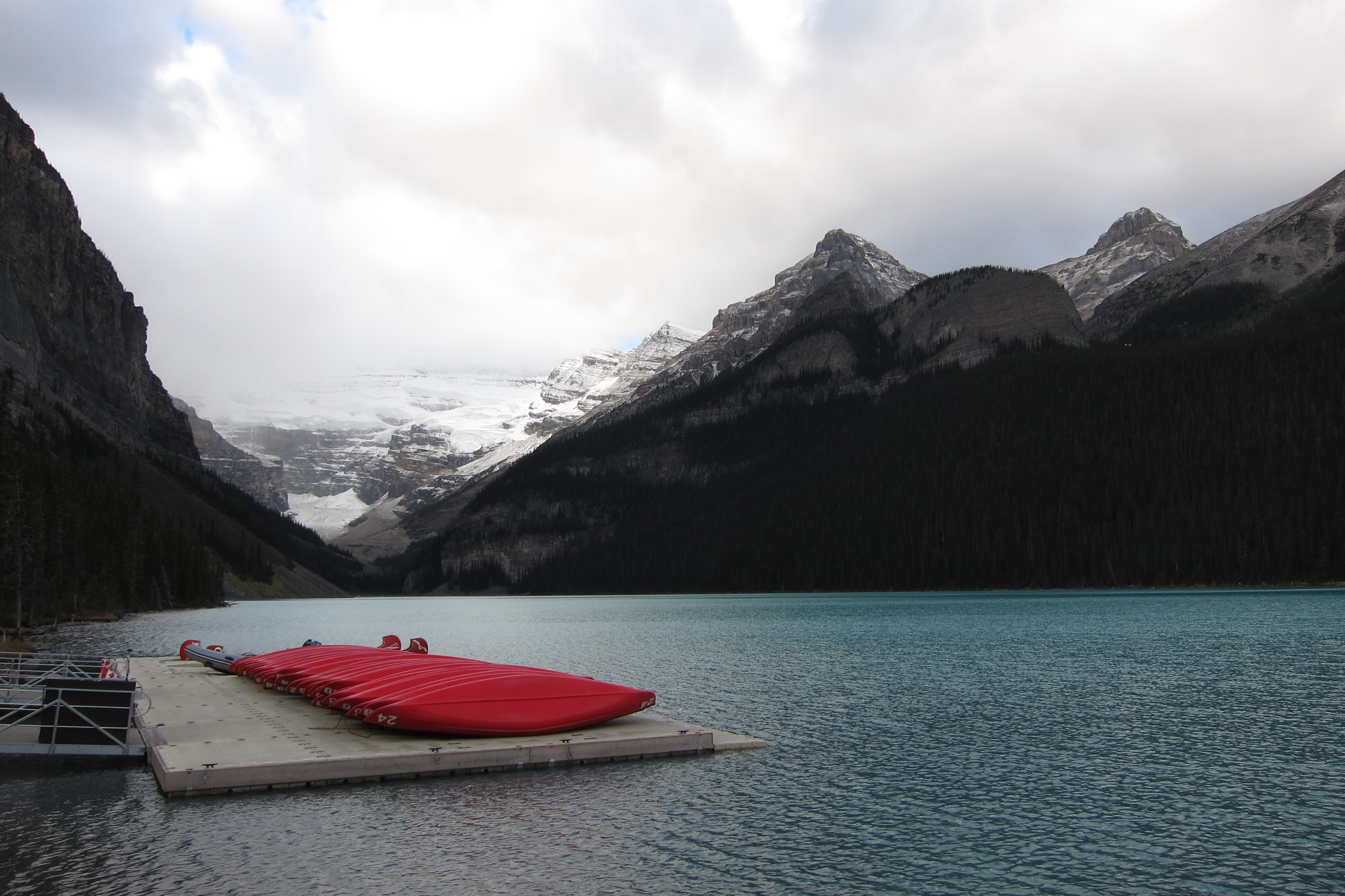
We followed the Columbia River Valley on our way from Yakima to Portland. This meant heading west across the Cascade Mountains. So we had a big revelation: East of the Cascades = dry. West of the Cascades = wet, very wet!

IMG_4533

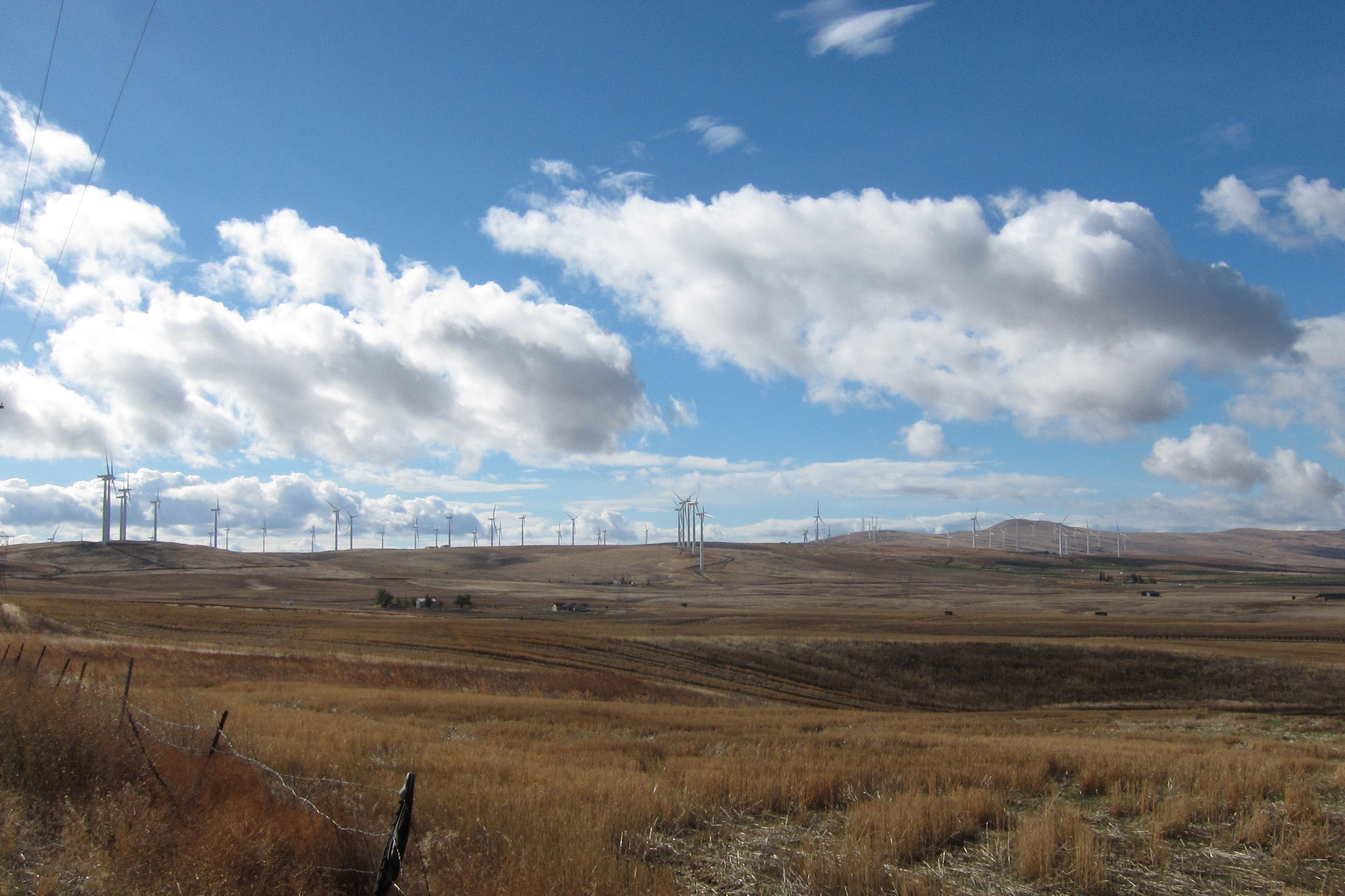
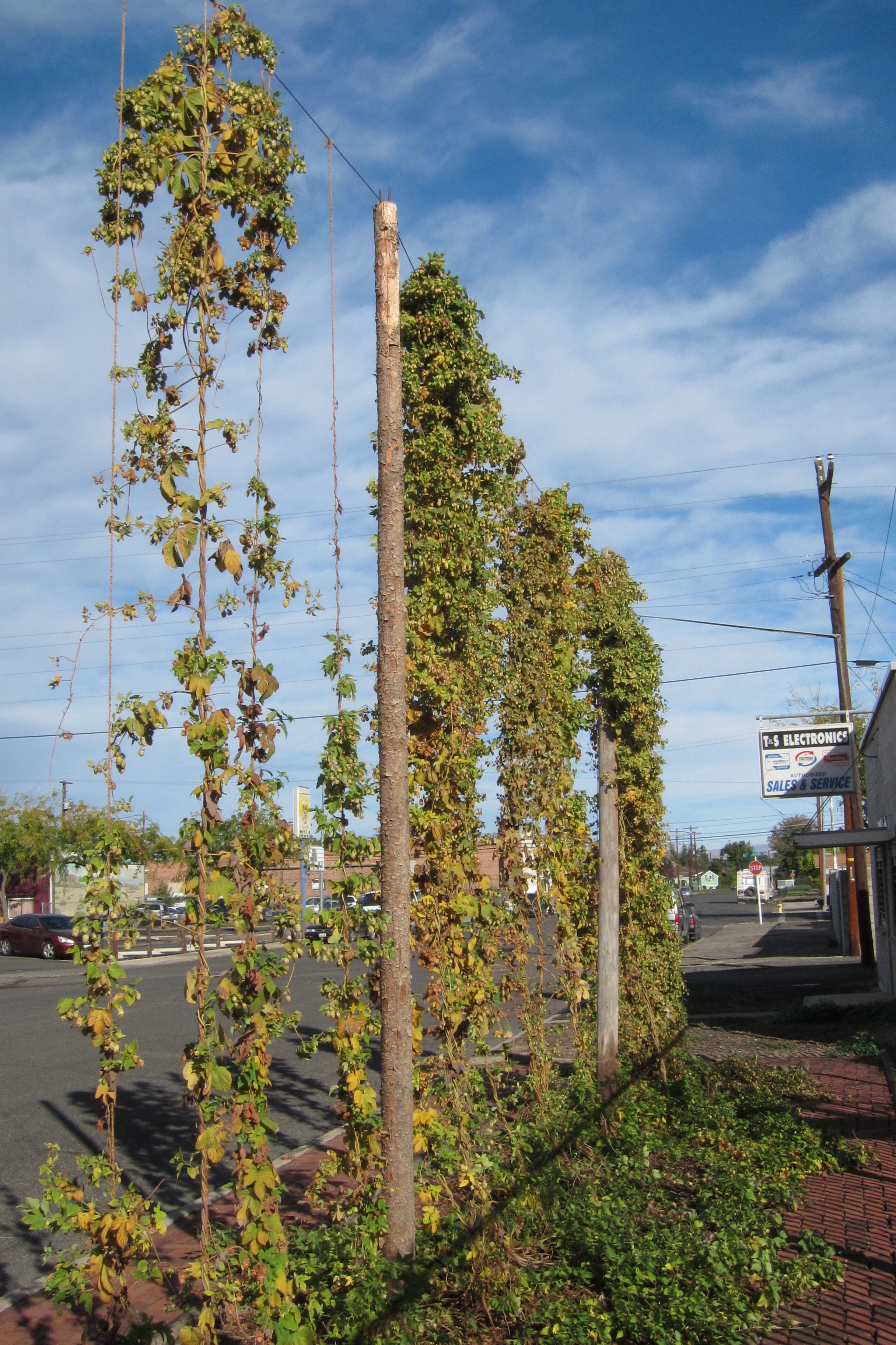
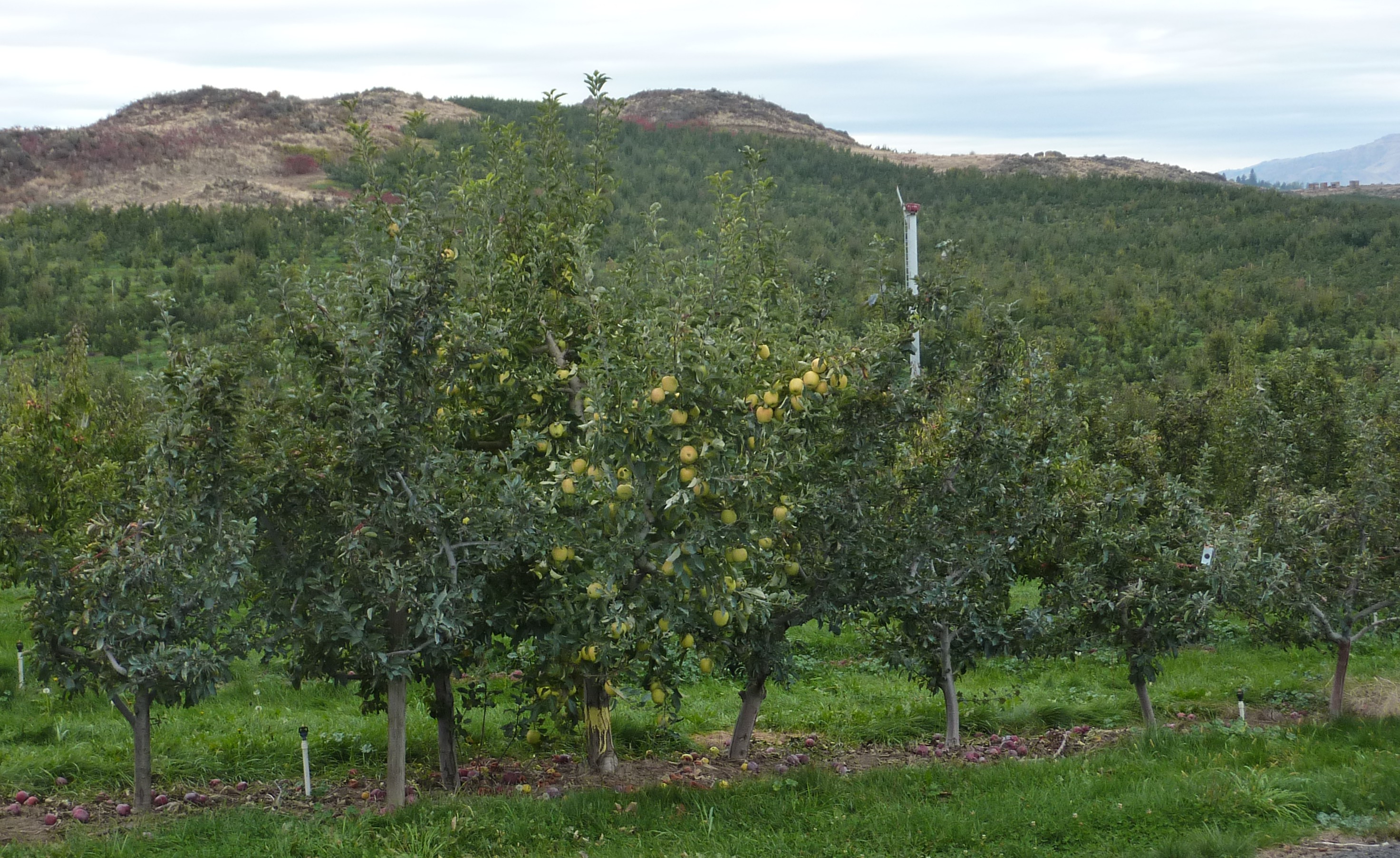
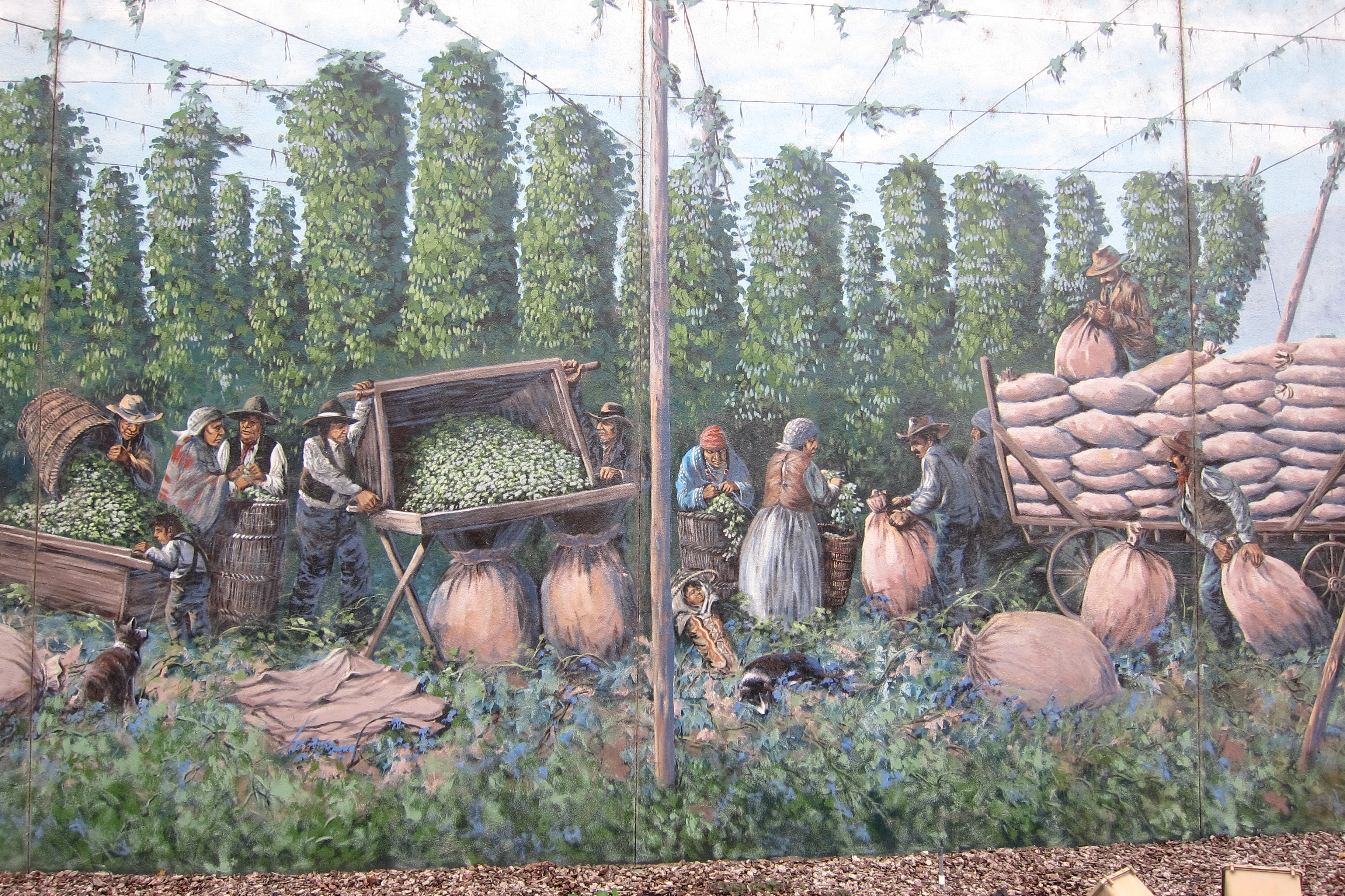
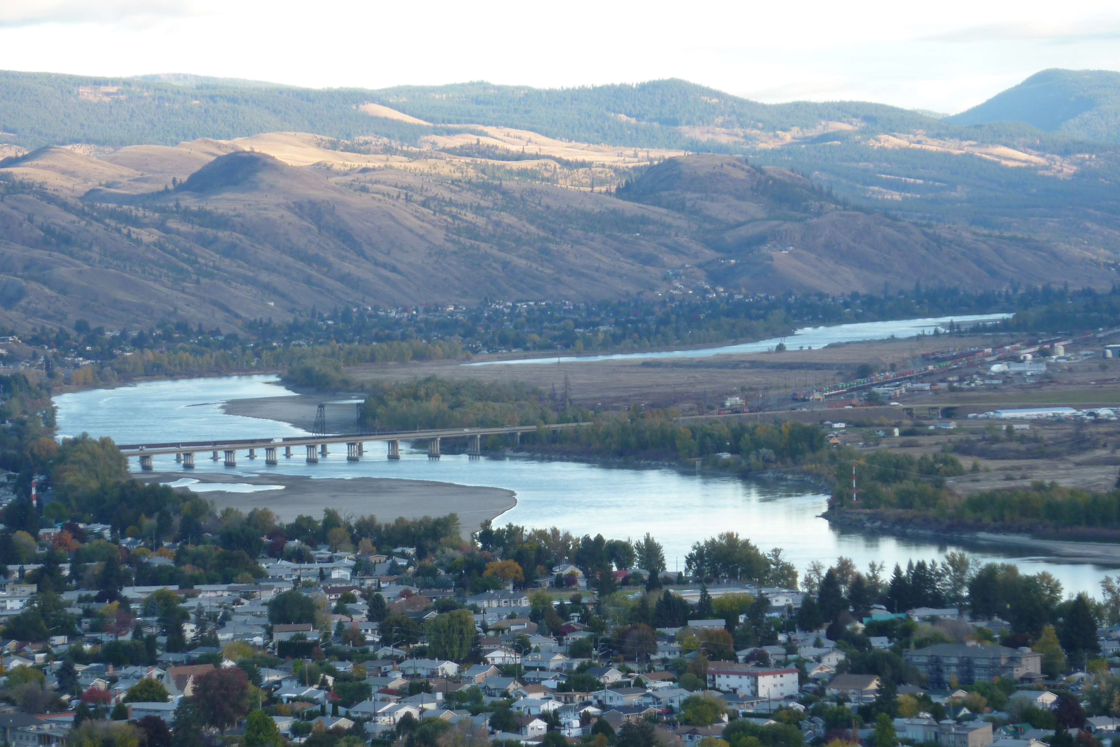
Leaving the fruited plains just north in Yakima, we saw rolling very brown hills as we headed south.

This area seemed to have even fewer people than the wide open plains of Canada, but the windmill per square mile population was large. Did you know that each of these creates around 2 megawatts (when the wind is blowing) vs. 300 megawatts from a coal or gas generator? You need lots of wind turbines to equal a “traditional” power plant. And we saw lots!

IMG_4537

Very big when seen from close view.

The only vegetation we saw was sagebrush, but as we approached the Columbia River, we started to see bits of green.

P1060862

Our first views of the Columbia River. Note the blue skies.

This had to be a welcome site for early explorers and settlers who had braved mountains and deserts. This part of the “Trail” was often traveled on log raft.

IMG_4540

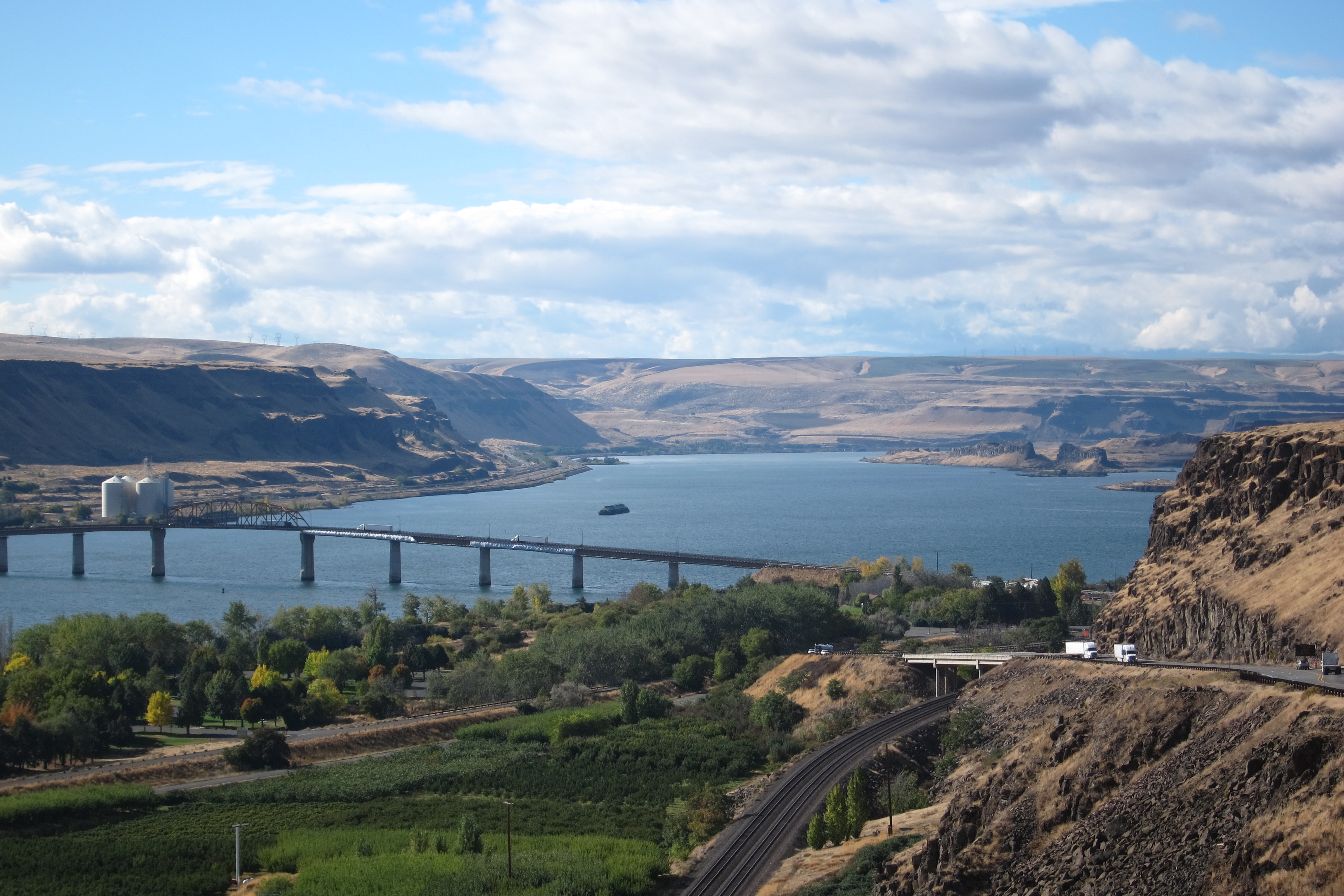
Next to the Columbia River now are vineyards and other crops.

The Columbia River has nearly a dozen dams, including the Grand Coulee, providing hydroelectric power to serve the Northeast.
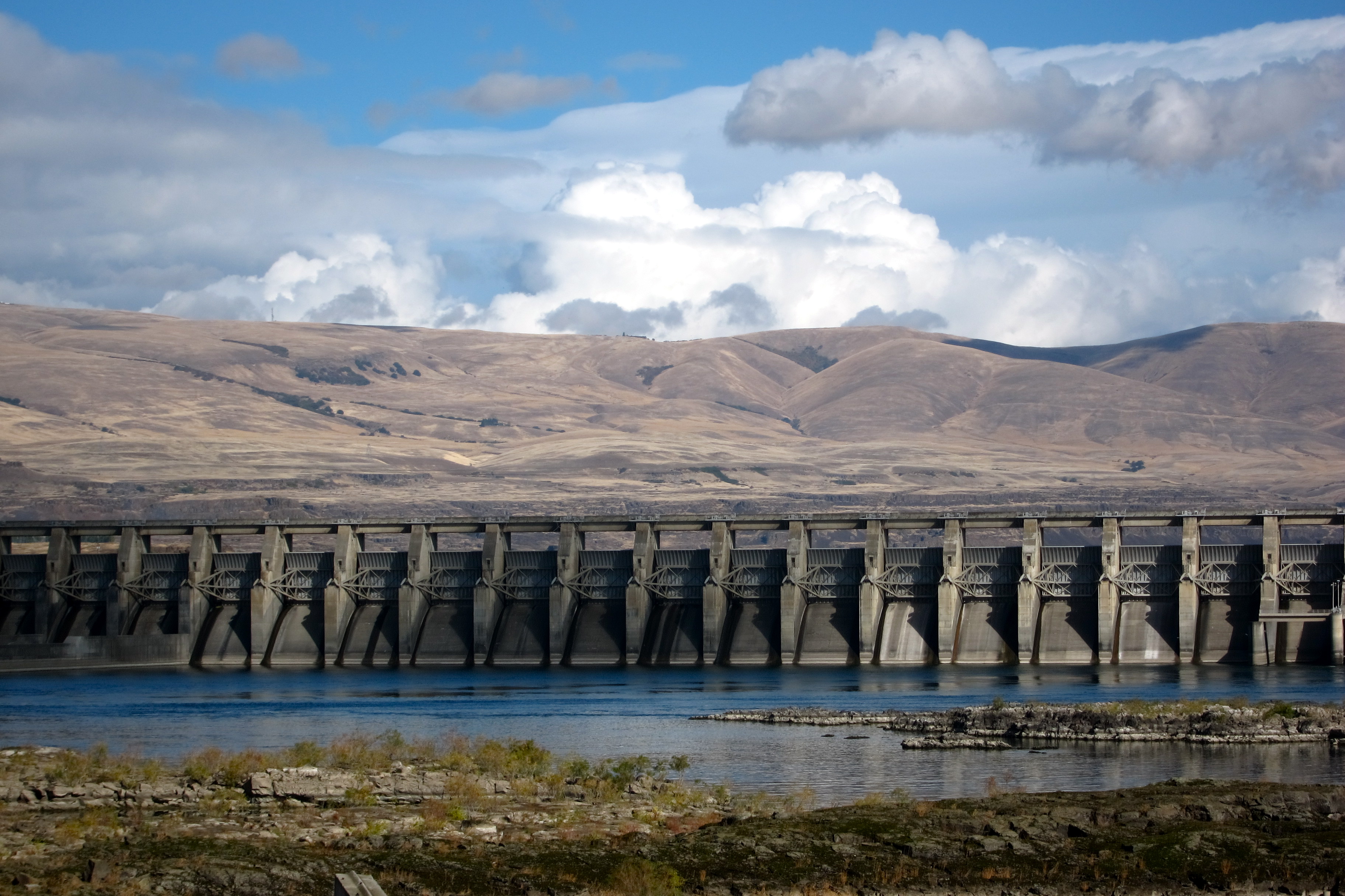
IMG_4542

The Dalles Dam

We crossed from Washington into Oregon and saw the sign for Bonneville Lock and Dam, an Army Corps of Engineering project. That looked interesting.

IMG_4556

The name Bonneville comes from Benjamin Bonneville, who charted much of the Oregon Trail in early exploration days. It was also very interesting that we were able to drive right up to the dam. All we had to do was answer the question of whether or not we had any guns. (We didn’t.) The dam was majorly impressive!

IMG_4548

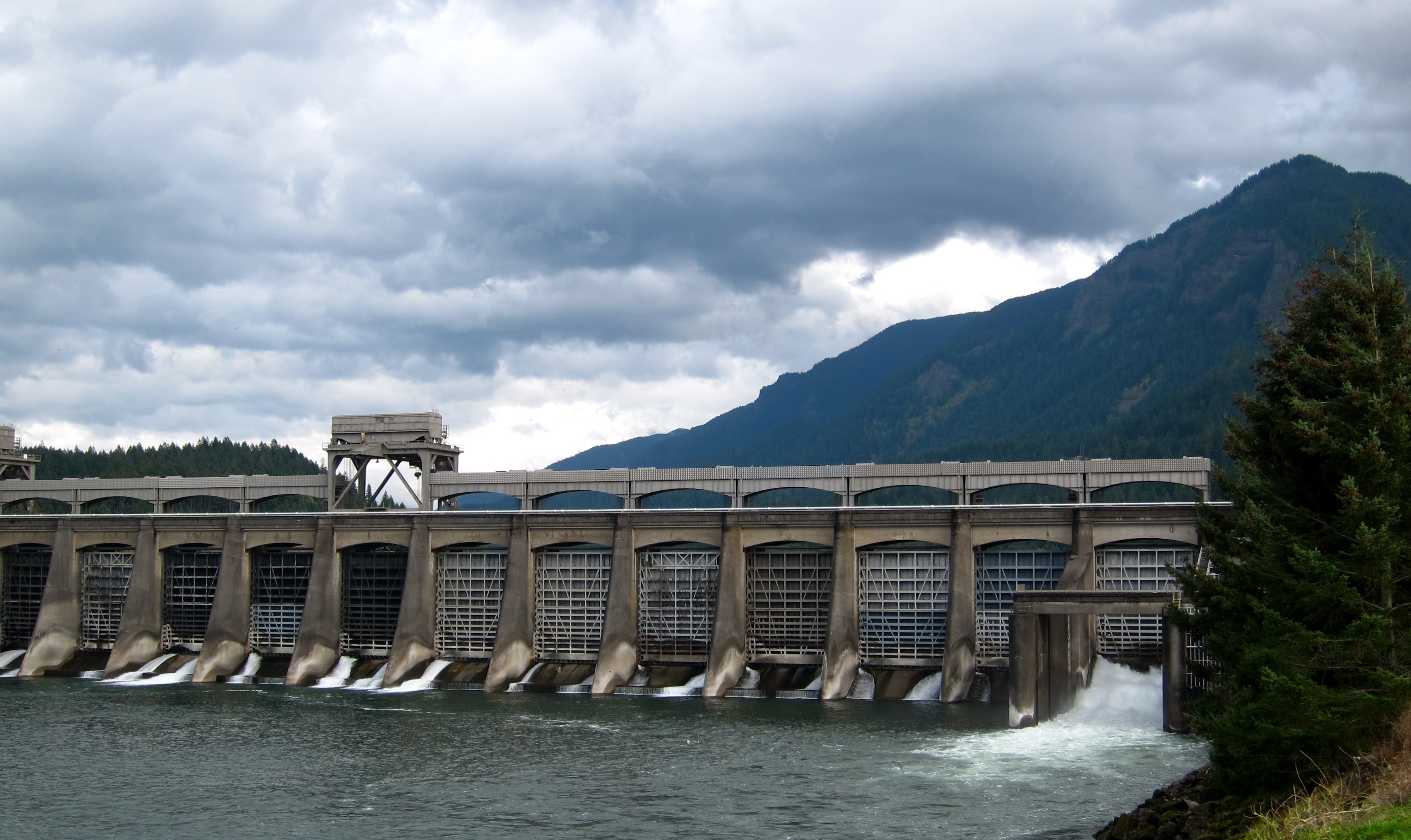
A 1938 New Deal project. The dam today can generate over 1,100 MW.

Michael remembered the number 1 issue of Life magazine had another New Deal dam project, not this one, but pretty close.

post_1936lc-1123

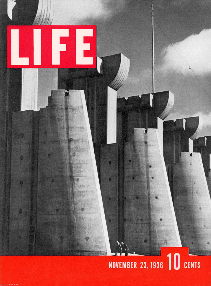
Building the Fort Peck Dam on the Missouri River in Montana, 1936 (Margaret Bourke-White photograph)

IMG_4550

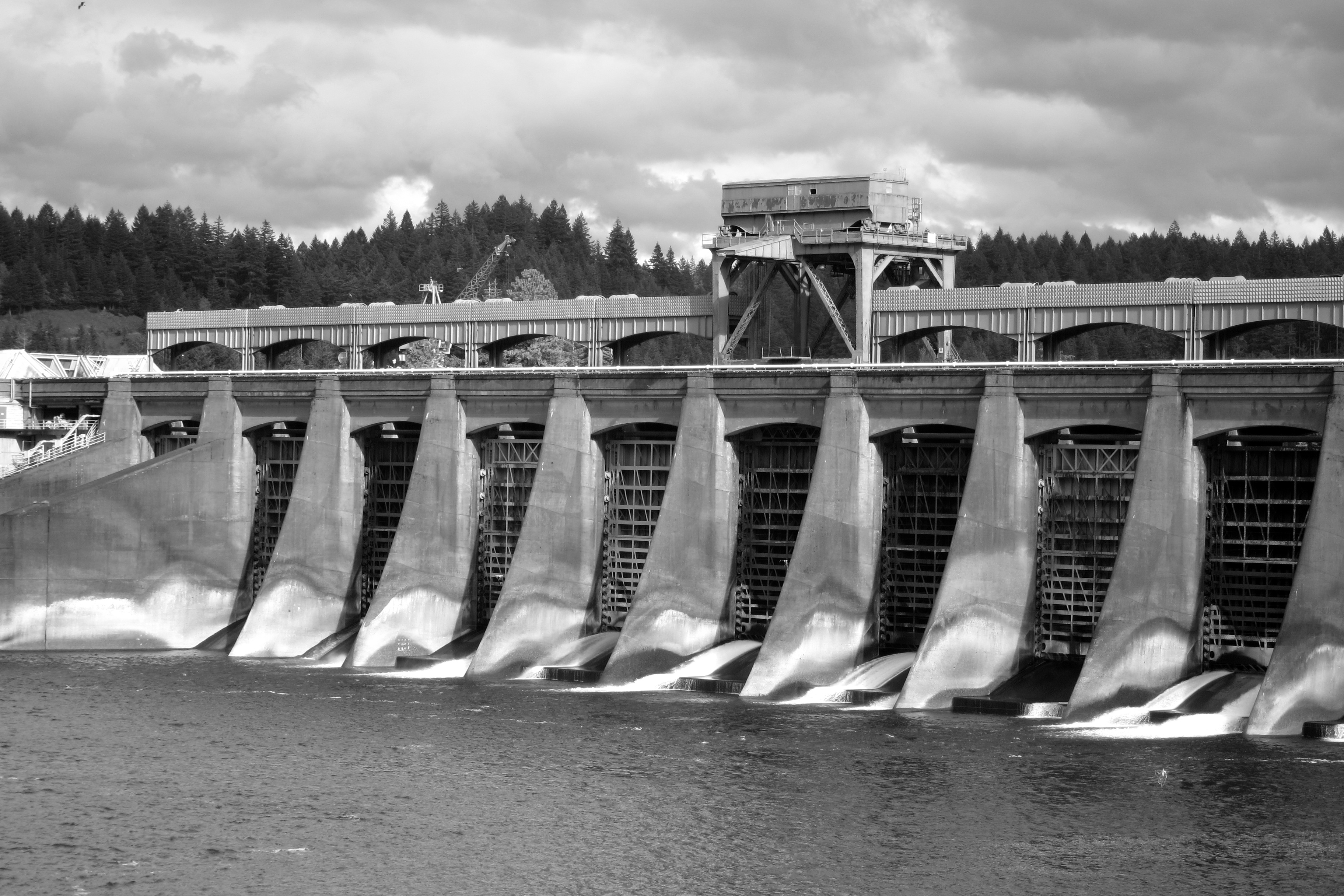
A Margaret Bourke-White style photo of the Bonneville Dam today. We’d submit it to Life magazine if it were still around. (photo by Michael O’Connell)

So if the river is dammed, what happens to spawning fish? Little ones go right through the turbines (hopefully without being chopped into ceviche). Larger fish follow a ladder maze that is a bit like a natural river rapids.

IMG_4551

The big fish swim upstream on this “ladder” against a very strong current.

At the top of the ladder, the fish are funneled into a narrower opening so that they can go past the fish counters…human fish counters. Specially trained observers sit before a window looking into the backlit funnel area, watching for each and every fish. They identify them from 30+ types and gauge their sizes. While we were there we saw a number of big coho salmon and some itty-bitty sardines who were really struggling.

IMG_4554

A big coho. (We think. We’re not well trained.)

You can see them too on the live Fish Cam (highest frequency during spawning season, of course). This year’s fish count is phenomenal, already the highest since counting was started 75 years ago. This was cause for BIG excitement among the guides at the facility!

It really was hard to break away from watching the fish, but we finally did… and we followed the Scenic Byway along the Oregon side of the Columbia River. There are half a dozen waterfalls dropping from great heights. This one, Multnomah, is the second-largest year-round waterfall in the US, according to the US Forest Service. It’s 620 feet in a two-part drop.

IMG_4559

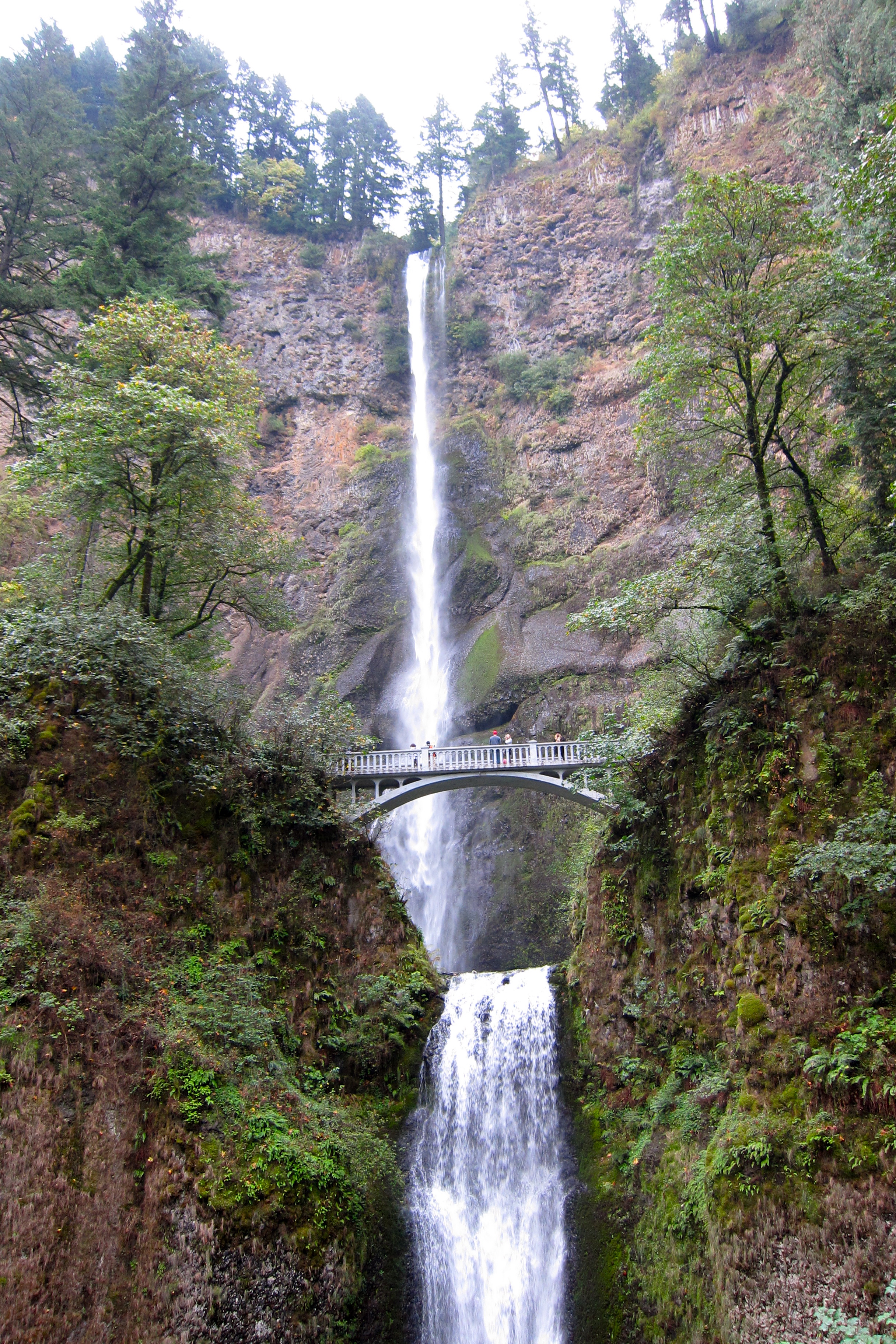
Multnomah Falls. The bridge is 100 years old this year.

A pretty place for wedding photos, don’t you think? In 1995, a 400-ton rock fell into the upper pool and made a 70-foot splash, drenching a wedding party on the bridge. No deaths fortunately, but 20 people were injured from the gravel that was thrown up.

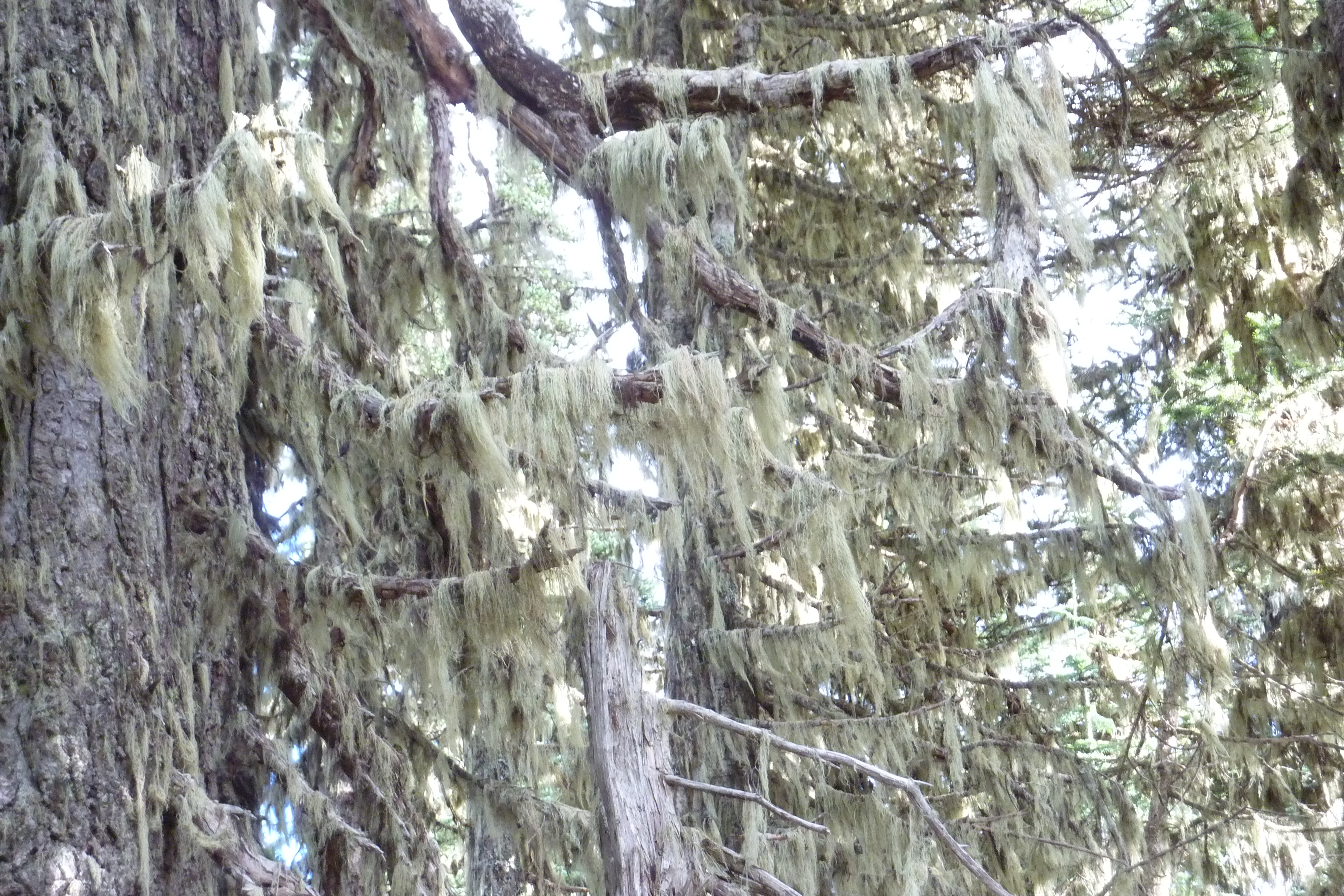
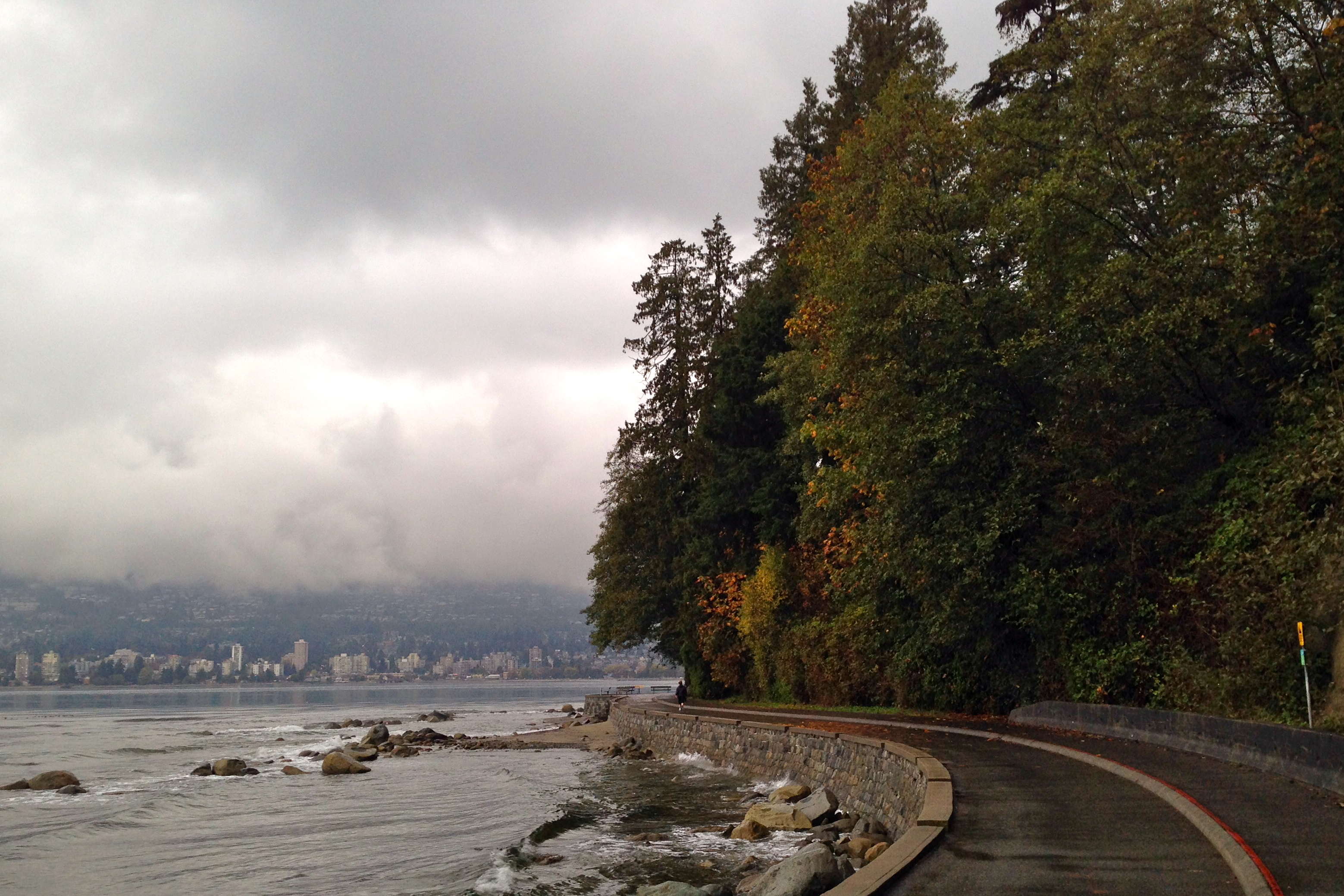
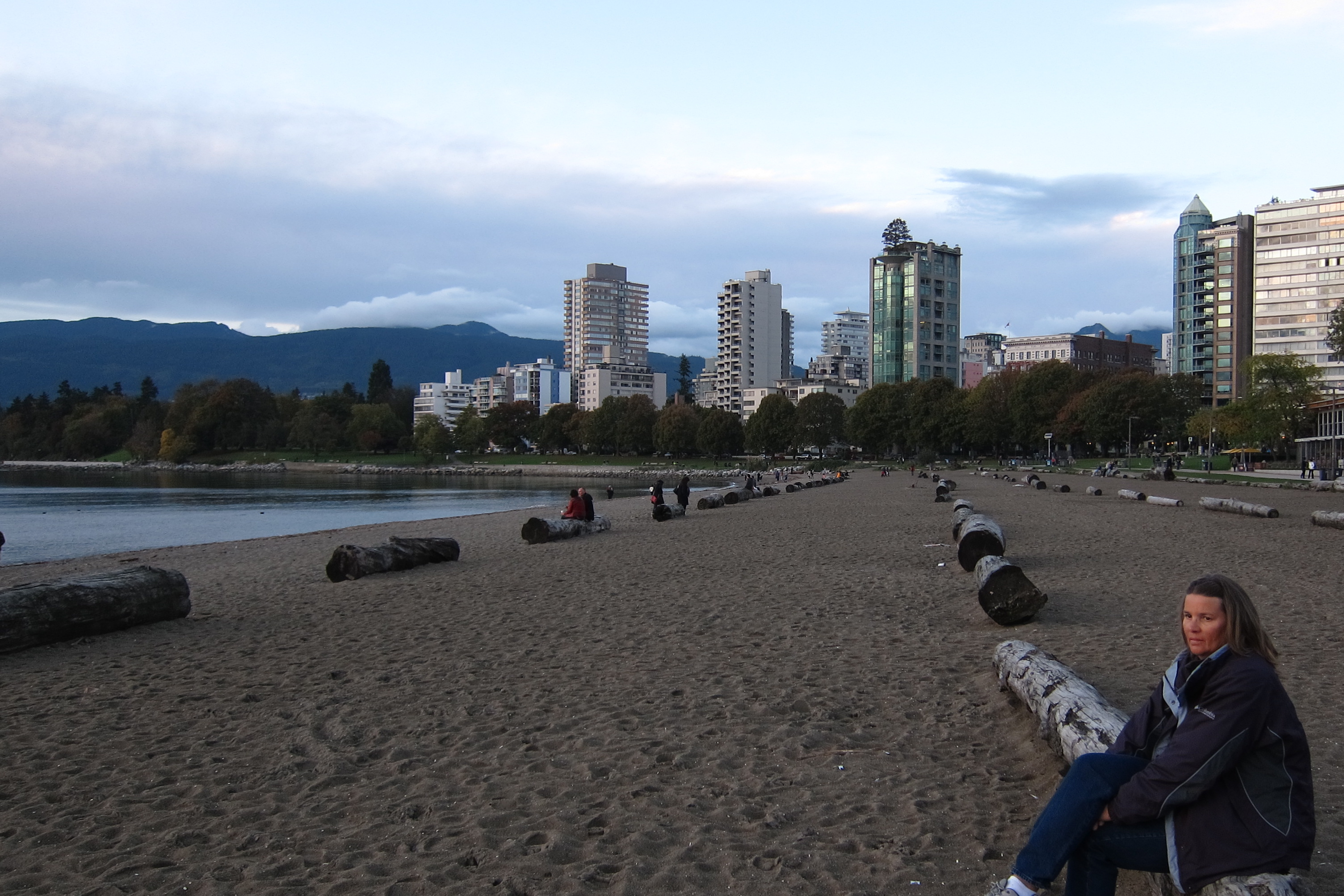
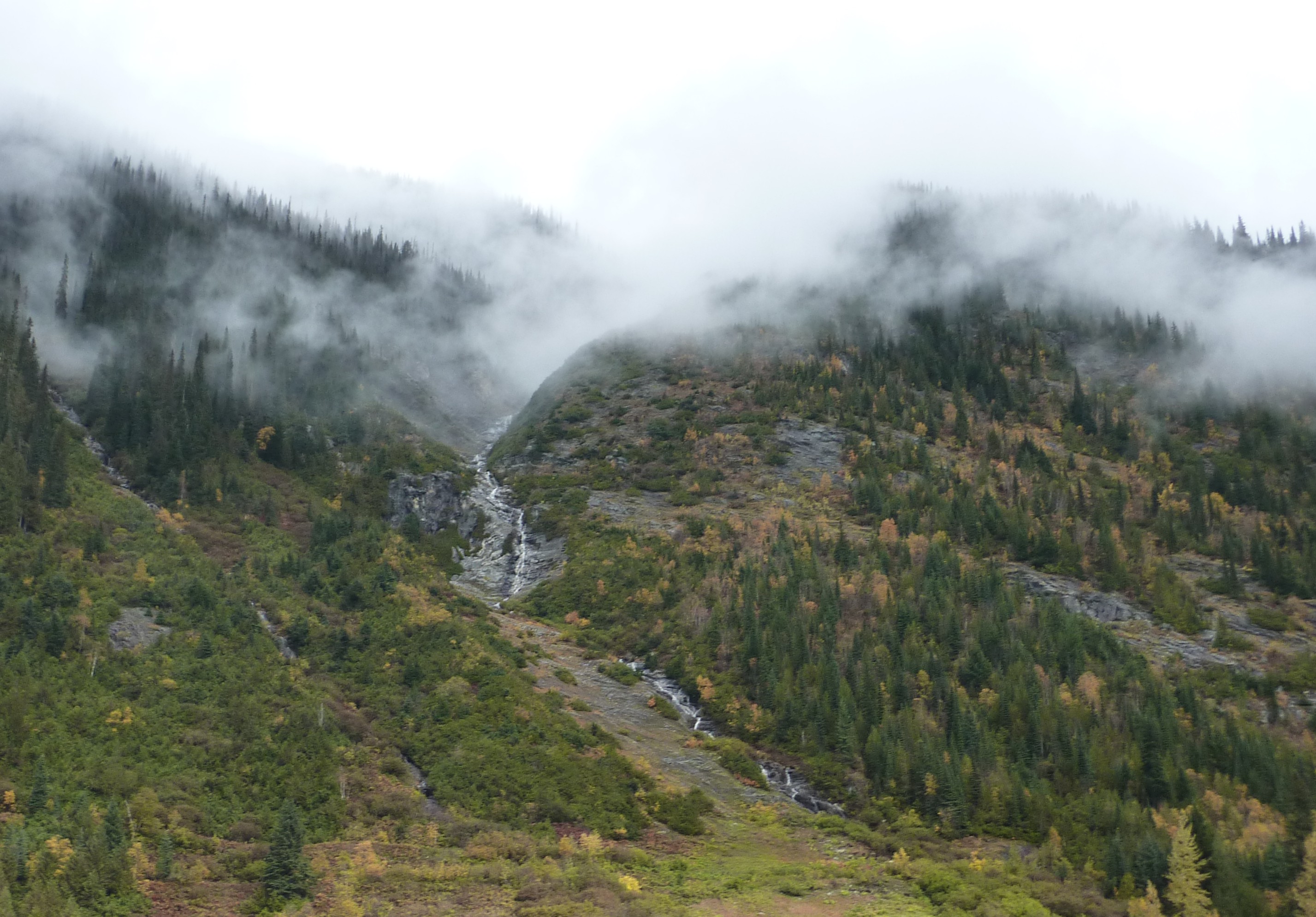
As we continued our path along the river, it was becoming clear that we were now on the wet side of the Cascades.

2014-10-21 048

Can’t apply the Boy Scout rule of moss growing on the north side. It’s so wet here, the moss is EVERYWHERE!

We had a few moments of sunshine before we got rained out.

IMG_4569

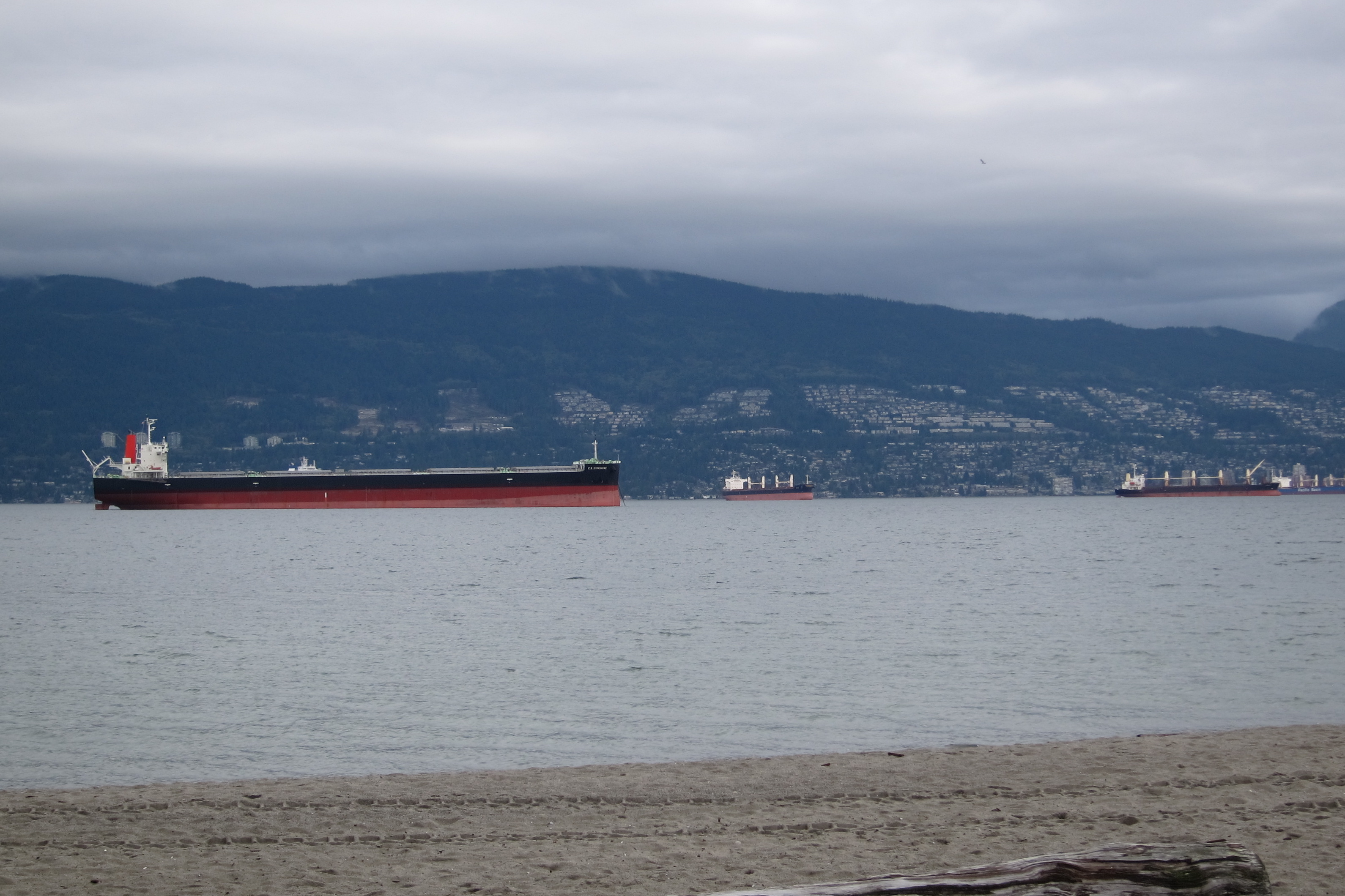
A soggy view east up the Columbia River. Note the lack of blue skies!

We’re heading to Portland and our forecast is for more rain, not just any rain, but a Pineapple Express, otherwise known as an “atmospheric river.” And it’s forecast to last for a week. It looks like we may not need to go to the coast to see the Oregon coast; it’s heading toward us!


Posted in Smell the Roses | Tagged , , , , , , , , , | Leave a comment

Y To Z in Washington (and Toppenish too) October 20 (Day 49)

Yakima was a familiar name, since Michael’s brother has a big Yakima ski rack on the roof of his car. (The original Yakimas did come from Yakima.) Zillah was a new name for us and Toppenish was an unexpected treat.

We didn’t know that Yakima was a fairly large city, very important in our lives in several ways. Why?

The Yakima Valley produces roughly 70% of the hops grown in the US, on over 19,000 acres. Hops, of course, is the key ingredient in all those craft beers we love.

IMG_4528

The valuable part of the hops plant, the female fruit, with “essences of tangerine, bergamot, and citrus.”

Baarth-Haas, the big hops company here, finished its harvest a few weeks ago and the product is now drying in giant warehouses or pelletized and on its way to a local craft brewery near you. We were two weeks late for the Fresh Hop Ale Festival, one of the top 10 beer festivals in the country. Here’s the last bit of hops on the vine.

IMG_4532

Hops just for display outside the Hops Museum in Toppenish. Harvest was a few weeks ago.

Hops is not the only crop grown here in Yakima Valley. We saw acres and acres of apple orchards. Many of the apples had been harvested already, with culled red apples on the ground. Sometimes we’d see a lone tree filled with yellow apples in the middle of other defruited trees. Michael figured out that this was in place to enhance pollination. Most likely those apples will never be picked.

2014-10-20 002

Notice the apples on the ground and these yellow non-varietals left in the tree. We need some foragers here.

We noticed the “new” method of apple growing that has been put in place with the help of Washington State University agricultural advice from TFREC (Tree Fruit Research and Extension Center). The trees are trellised almost like grape vines, supporting the branches and giving the fruit plenty of exposure to sunlight. Lots easier to pick too vs. climbing 30 feet in the air.

IMG_4525

Not the apple trees we’re used to.

So when you see Washington Apples in your local grocery story, they may have come from one of the orchards we passed.  We visited a couple wineries here too: Maison de Padgett and Severino, both very nice small family-owned vineyards with excellent wine! (We picked up some bottles to bring to Sonoma.)

Toppenish is the City of Murals and Museums, “where the West still lives.” These are great big names for a little town (only 9,000 people). But it makes a fascinating visit.

P1060853

Don’t blink or you’d miss it and you DON’T want to miss Toppenish.

There are 73 (and counting) murals here! These are larger than life and quite high-quality murals on the sides of buildings throughout the small town. The very first mural was a 40-foot painting created in a single day by 15 western artists on June 3, 1989.

2014-10-20 004

“Clearing the Land,” mural number 1. Little did they know in 1989 what they were starting.

The town has a Hops Museum, already closed since the season is over! But there are several murals dedicated to hops, given the importance in the region’s history.

IMG_4523

“When Hops Were Picked by Hand” sponsored by the hop industry, which created a pretty little park called Old Timers Plaza nearby.

The town commissions an artist or artists to create that year’s mural every June. Some of the murals are nicely suited for their locations: “Presumed Innocent” on the city jail building, “NP Railroad” on the train depot, “Halloween Pranks” showing kids tipping over an outhouse on the public restrooms. Very clever.

2014-10-20 010

“Halloween Pranks” Probably the modern restroom is less easy to push over than the outhouse was.

IMG_4521

Many murals feature Yakama Nation images.

IMG_4520

“Wildlife” shows wildlife native to the valley before settlement. (It reminds us of our visits to the Tetons and Yellowstone.)

IMG_4519

“Irish Dick” (for our O’Connell clan) tells the story of a hard-drinking shepherd scrapping with a grown-up bear he had known as a cub. Dick did not fare well.

Walking around the town offers one surprise after another. And the aroma from the paneteria on the main street is heavenly. The pastries taste great too.

2014-10-20 015

“Rodeo” Not an artist at work but a painting of an artist at work.

Finally, we stopped at Zillah, on a Mark Real style quest (presidential birthplaces and more). This is the location of the Teapot Dome Gas Station. During Warren G. Harding’s administration, naval oil reserves at Teapot Dome, Wyoming were leased to private operators without competitive bidding. Once this was known to the public, it was a HUGE scandal, which in 1922 inspired local Zillah businessman, Jack Ainsworth, to create a commemorative service station.

IMG_4526

Teapot Dome Gas Station: an unusual homage to a scandal.

The gas station is no longer in service, but we did have a pleasant surprise in nearby Toppenish. Gas was only $2.75/gallon (vs. $3.35 a couple miles away). Why? We were inside the Yakama Nation, where gas tax is only 25% of the amount elsewhere in the state.

Heading to Oregon tomorrow.

Posted in Smell the Roses | Tagged , , , , , , , , , , | 1 Comment

It’s a lot less rainier in Rainier October 19 (Day 48)

Now that that pun is out of the way, we had a glorious day to explore Mount Rainier National Park.

Like entering a lush rainforest

Like entering a lush rainforest.

We’re in the middle of the Cascade Mountain range that runs through Washington and Oregon, actually all the way from northern California to British Columbia, Canada. We’re next to a line of mountains formed by volcanic activity. Mount St. Helens, 35 miles away, erupted in 1980. Rainier most recently erupted at least a dozen times between 1820 through 1894; geologists are waiting for “the big one” which could create deadly mudslides or “lahars” that might stretch all the way to Puget Sound and Seattle.

For now it’s bright and sunny and the ground seems very stable. There is no seismic activity as we look up to the top of Mount Rainier at 14,410 feet above sea level, a very impressive site.

IMG_4480

From Skyline Trail above Paradise Visitor Center, about 5,800 feet.

The mountaintop peeked out and went back into hiding frequently during our visit. The peak is shrouded in clouds many days of the year. Officially rain (or snow) can occur any day. Park rangers describe Mount Rainier as a magnet for snow. At Paradise, the visitor center at an elevation of 5,400 feet, the average snowfall is over 600 inches (50 feet) and the highest recorded snowfall was over 1,100 inches (93 feet!) in 1971-1972.

IMG_4494

This area is usually covered by snow until July.

With the heavy layer of snow already on the mountain, it’s attractive for ambitious skiers and snowboarders. This requires a hike from 5,400 feet to about 10,000 feet to reach skiable snow, then a 2,500-foot run, just once for the skiing couple we talked to. No chairlift to bring them back up to the top.

From 5,500 feet, a long, steep hike ahead. We saw them as tiny specs still climbing up the snow mass later in the day.

From 5,500 feet, a long, steep hike ahead. We saw them as tiny specs still climbing up the snow mass later in the day.

We climbed about 700 feet on beautiful National Park Service trails with a Skyline view of the mountain range.

kkk

Each year over 10,000 people attempt the climb, about half of them reaching the summit.

And we followed Alta Vista down for another perspective. Another hiker told us this would give us the best view of fall foliage, so we expected yellow aspen, red oak, and more. Instead the hills were alive with the colors of shrubs. Green lupine plants are everywhere; their lavender blossoms peaked in July and August. Other plants have turned red, orange, and yellow.

IMG_4491

The hills are alive!

IMG_4461

Quite the color palette!

We noticed something that looked like Spanish Moss hanging from many of the trees in certain sections of the park. We wondered if it was a new invasive species that is killing off the evergreens. It’s not. In fact it is Usnea, a gray-green lichen that has been around for ages.

P1060775

The trees looked as if they were already bedecked for Halloween spookiness.

From nature guide P. M. Fogg (1925): “By reason of the fact that the growth is found on dead or dying trees, as well as on those that are alive, many casual observers wrongly assume that it alone is responsible for the death of the trees. The lichen does not however derive nourishment from the timber, and will flourish as well on a stick. It is an air plant, and perhaps prefers dead wood, or trees that have been attacked by insects, because on such there is less foliage to hinder its spread.”

In the foreground of our shots of Mount Rainier is Nisqually Glacier. This shows the geologic evolution of a glacier. At the top is the hardpacked ice and snow that lasts from year to year (unless global warming has a more drastic impact). A bit lower in the glacial valley, the ice is still there, but it’s brown because of the bits of rock that has been ground off the mountain and blown onto the ice. As any of this ice, or the fresh snow on top of it, melts, it trickles over the glacier and collects under it, carrying glacial flour to create a rush of gray water cascading over rocks to create a small stream which joins others to create a major river. Note the valley in front of the glacier was carved wide and deep when the glacier extended farther into the valley. It is constantly in motion. In May and June of 1970, the front advanced at a rate of two feet a day!

IMG_4498

The brown triangle and everything behind it  is dirt-covered ice.

Nisqually is one of 26 glaciers surrounding Mt. Rainier. It would take more climbing than we were prepared to do (ever!) to see most of the others, which are on other areas inaccessible by car. At about 10,000 feet Camp Muir is a base camp shelter built of rock. This is named after the naturalist John Muir, who climbed Mt. Rainier in 1888 when he was 50.

Descending (by car), we once more appreciated the work by the National Park Service in making these sights accessible. The 83-mile Road to Paradise offers views of the mountains, waterfalls, canyons, and beautiful foliage.

IMG_4510

Note the rockslide areas above…and below the road cutting across the mountainside.

We ended the day with one more view of the cloud magnet, Mt. Rainier.

On many days you don't even know the mountain is there.

On many days you don’t even know the mountain is there.

Did you know? Mount Rainier has had other names. Native Americans are campaigning to return to a version of the original, Tacoma. While that issue prompts big debate, for Super Bowl weekend 2014, Mount Rainier was officially renamed Mount Seattle Seahawks in Washington State Senate Resolution 8676 (very entertaining!), making the whole park a powerful 12th man for the team. It worked. Seattle won. Watch to see if this happens again next time Russell Wilson takes the team through the playoffs.

Posted in Travel Journal | Tagged , , , , , | Leave a comment

We’re off to see Seattle October 17 to 19 (Days 46 – 48)

Throwing Fish and Eating Chocolate in Seattle…

The first stop in Seattle is always the Public Market along Puget Sound…

IMG_4437

The market the bottom of Pike Street

specifically the Pike Place Fish Market. Whenever a customer orders a fish, workers shout to each other and fling the fish through the air. Actually the guy in front keeps a spare fish on the side specifically for this; it gets mangled quite quickly. It’s not just a fun thing to watch, but a management methodology. Read about it in When Fish Fly: Lessons for Creating a Vital and Energized Workplace from the World Famous Pike Place Fish Market.

Fish are grounded at the moment.

Fish are grounded at the moment, but the guy in orange pants is ready to fling on demand.

The public market is the spot to see the notorious multi-story gum wall (yes, people put their used gum on the wall), but that’s too disgusting for a photo. The original Starbucks (ca. 1971!) is here, with a line going around the block. We didn’t stop there, but did have scrumptious Piroshkys a few shops away. These are Russian filled pastries (not Russian-filled).

Piroshky!

Piroshky!

Pike’s offers a view of Mt. Rainier over the Seattle Seahawks stadium.

IMG_4406

Note the traffic too!

In the early ‘70s, two Seattle teenagers (Bill Gates and Paul Allen) became obsessed with computers, which led to the creation of Microsoft and ultimately billions in wealth for each of them. Today on opposite Seattle street corners the two boyhood friends provide unique visions of what can be done with great wealth.

IMG_4423

Bill and Melinda Gates Foundation

IMG_4433

EMP Museum, designed by Frank Gehry to look like a melted guitar.

IMG_4417

The choice: Build a foundation to tackle large problems…

IMG_4426

or buy the local football team and win the Super Bowl.

IMG_4418

Develop ways to prevent and treat disease…

IMG_4432

or acquire Superman’s costume.

IMG_4420

Invest to shape the future…

IMG_4427

or have your guitar collection turned into a 30-foot sculpture, complete with computer-controlled, self-playing instruments.

Across the bridge to Seattle’s northern districts: The last time Nancy was in Seattle was with Liz in her Green America Fair Trade role for a Green Festival. We’re retracing the steps of that visit. That meant going to Theo’s Chocolate manufacturing facility…and sampling product, of course.

P1060671

Plain vanilla on the outside. Pure chocolate on the inside.

Theo is in Fremont, near the Fremont Troll, an art (?) project under the Aurora Avenue Overpass. Built in 1989 it’s the same age as our niece Meghan, but Meghan is holding up a lot better! (Happy Birthday, Meghan!)

IMG_4408

For size reference: That’s an actual Volkswagen in his hand.

Just north of Fremont is Ballard, a hipster kind of neighborhood. We went to our favorite little breakfast spot, Café Besalu.

Best

Cafe Besalu: best latte ever, and pastries to die for

Who would ever imagine a rusting gas works could become a major city park? But it has. Gas Works Park offers views of the city across Union Lake.

park

Gas Works is a very popular park!

Grey’s Anatomy doesn’t give a clear picture of the city of Seattle. This place is hilly! Kerry Park, on a tall hill in the Queen Anne district, provides a view of the city. On a clear day, you can see to Mount Rainier. Our days were not quite clear enough. Look for Seattle Grace Mercy West Hospital to the right. (Just kidding. GA is a TV show!)

P1060694

Seattle and the Space Needle. It was built for the 1962 World’s Fair.

The Fremont Brewery in Fremont, Earth.

Because beer matters

Because beer matters

On our last night we walked to Chinatown, which happens to be next to the stadium for the Seattle Seahawks, who happen to be owned by Paul Allen. We had Peking Duck, almost as good as in Beijing.

IMG_2431

Feels like home.

A lovely couple days in Seattle. We do want to thank Shosh, Carrie, Liz, and especially Kathy for their advice and kindness. Mwah!

Posted in Travel Journal | Tagged , , , , , , , , , , , , | Leave a comment

Vancouver makes us smile :) October 15 and 16 (Days 44 and 45)

We may have seen our last roadside wildlife for a while. These goats seemed to be bidding us farewell from the mountains on our drive to Vancouver.

P1060587

Between the road and the railway, yet he’s still alive.

The land west of the Rockies was brown and dry until we came to glacial reservoirs in British Columbia.

IMG_4343

Peaceful view

This is fittingly called the Sea to Sky Drive, only we’re going in reverse, and we have fantastic views of the inland bays of the Pacific.

IMG_4366

Approaching Vancouver

Finally we arrived in the city and found that Vancouverites are very nice. How nice are they?

  • We hoped to use a credit card to board a bus since we didn’t have any Canadian money. Nope, they don’t take credit. BUT the bus driver said, “Get on.” Then he gave us advice about things to see in Vancouver. And then he punched out transfer passes so that we could get around the city. Where else does that happen? Thank you! What a pleasant welcome.
  • There is a pleasant welcome for nudists too. The world-famous clothing-optional Wreck Beach is a mere 502 steps below the parking lot. The elevation keeps the riff-raff away; only serious nudists or peepers make the effort. This beach is next to the Museum of Anthropology on the UBC campus. Maybe it’s a field study location for budding anthropologists.
IMG_2397

The Wreck Beach organization says the beach generates over $60 million in tourist revenue annually from visitors from over 150 countries.

IMG_4398

No nudists today, although a local told us there were many just two days ago.

  • Vancouver has some high rises, but developers want to “soutenir un avenir vert” (keep the future green) so they put trees on top of their buildings to add a bit of chlorophyll to the sky.
P1060637

Who rakes the leaves up here?

  • The oceanside has been preserved for public use in beautiful Stanley Park with 13.7 miles of walkway, with separate paths for walkers/strollers and bikers/roller bladers.
IMG_2392

Stanley Park is named after Lord Stanley of Derby,  who gave Canada the original Stanley Cup in 1892.

  • The sunset over English Bay is just beautiful. The city has laid out large logs as benches with room for hundreds of people to watch as the sun sets. And it’s mirrored on the other side of the sound for watching the sunrise.
IMG_4381

Waiting for the sun to set.

  • At intersections, the green light starts to blink before the yellow comes on, giving an extra warning that it’s time to slow down…please.
  • Tour maps tell you to go north, east, etc. Then they remind you that if you have the mountains at your back, you’re facing south…and west is on your right, east on your left. Just in case you have to do some old-time navigating.
  • A public bathroom required a code for entry. Just so no one is inconvenienced, the code is taped to the door.
ll

We’re locking you out…but we don’t want you to feel locked out.

  • When the city installed sidewalks, the busy work crew put imprints of leaves in the wet cement. But these are only around the trees next to the sidewalk. And the leaves are matched to the type of tree. How neat is that!
  • Vancouverites have so much national pride that they supersize their maple trees.
IMG_4389

Are these maple leaves?

  • The city hosted the 2010 winter Olympics. You might remember the Inukshuk, the welcoming mascot.
IMG_4378

Ilanaaq was the Inukshuk mascot at Whistler Mountain for the Olympics. This one was in Stanley Park.

We were told by one shopkeeper that it is now winter, which means four months of rain. Not very cold, but not sunny. (He remarked that they did have a record 40-day period of sun this past summer. Probably lots of people at Wreck Beach then.)

So in the rain we went to Granville Island with a fantastic public market.

Reminds us of the lusc

A bit like the Wan Chai wet market.

Michael found a few dry moments to run along the Seawall Trail.

IMG_2390

Lions Gate Bridge

IMG_2367

A nice way to see the sights on a rainy day.

English Bay is also a major container port. Ships leave from here with raw materials and return from China with inexpensive imports.

IMG_4403

About a dozen of these moving in and out.

And that’s our view of Vancouver, very short, not doing justice to its beauty and cultural offerings. We’ll have to come back someday.

IMG_4387

The 2010 Olympic torch. If we had asked, the friendly folks of Vancouver might have lit it for us.

For now, we’re back in the USA!

IMG_4404

Nice to be home again.

Posted in Travel Journal | Tagged , , , , , , , | Leave a comment

Canmore to Kamloops, Canada October 13 (Day 42)

We had a big day ahead, a 500-kilometer drive from Canmore to Kamloops. How could we not get up early with a sunrise like this?

The view from the door of our lodge...

The view from the door of our lodge in Canmore.

We drove through the Rockies with roads cut through the mountains…

Up, over, around, and through

Up, over, around, or through

and into the mountains.

This is an avalanche roof.

This is an avalanche roof, likely to protect cars from pebbles and rocks, but probably not boulders or clumsy mountain goats.

It was overcast for our drive through the western Rockies so our scenery was shrouded in clouds.

Were literally driving through the clouds.

We were literally driving through the clouds.

We had another wildlife sighting. Near Sicamous at least 30 cars lined up along the major highway and people were spread along the roadside gazing down for a length of more than 50 meters (do the math). So it wasn’t just one animal, maybe a whole herd of moose?

As soon as we opened the car door, the smell gave it away. Unless moose smell like dead fish, it wasn’t moose. It’s spawning season for sockeye salmon. These hardy swimmers apparently have come from the Pacific, 480 kilometers away, to spawn…and then die. Every fourth year (2014 is one), the number of spawners is especially huge, as many as 3.6 million coming to these inland rivers.

Swim hundreds of miles, lay or fertilize an egg, and die. What some parents will do for their kids!

Swim hundreds of miles, lay or fertilize an egg, and die. What some parents will do for their kids! Think about that next time you eat salmon.

That night was a stopover in Kamloops, roughly halfway between Banff and Vancouver.

10 Things You May Not Have Known about Kamloops

1 That it exists. Maybe we’re just ugly Americans. Kamloops, in British Columbia, is a city of 100,000 that is known across Canada, but we had never heard of it. Sorry. We didn’t even know it by its Secwepemc (Shuswap) name, Tk’emlúps, which means “where the rivers meet.”

One of the Thompson Rivers. This area flooded in 1999.

One of the Thompson Rivers. This area flooded in 2012.

2 We’ve found the strangest fruit here. Anyone know what it is?

Is this something I could use for jam?

Is this something I could use for jam?

3 Kamloops was established by US interests. John Jacob Astor (whose grandson sank with the Titanic) was a fur magnate here and set up Fort Astoria. After the War of 1812, he ceded his interests to the British. Later the 49th parallel was decided as the US/Canada boundary and the future Kamloops fell to the north. So it’s farewell from US, bienvenue to Canada.

4 The actual city of Kamloops was formed at the confluence of the North and South Thompson Rivers by “Overlanders” who had left Winnipeg (near Detroit) in the spring of 1862 and arrived here in October 1863. The very next day, Catherine (wife of Augustus) Schubert gave birth to their fourth child. I bet her trip across country was a bit more difficult than ours. The last bit was on rough-hewn log rafts on the North Thompson River.

Childbirth a bit more natural than I'd want.

She deserves a break.

5 Kamloops is Canada’s Tournament Capital! It has facilities for everything from aquatics to gymnastics to baseball to motocross. Hockey fans can watch as the world’s best US ladies compete here on November 4 to 8 in the Four Nations Cup: Canada, US, Sweden, and Finland.

Another friendly Canadian city!

Another friendly Canadian city!

6 It’s warm here, at least compared to the Rockies. In mid-October roses are abloom in the beautiful park along the Thompson River. Morning temperature of 50 degrees (F).

Really, really lovely park!

Really, really lovely park!

7 Thompson Rivers University is growing by leaps and bounds. It’s popular with international students and has majors from arts and science to engineering.

8 Kamloops is fairly dry, with sagebrush on the hillsides. We even saw a tumbleweed blowing through town. Just outside the city are irrigated farmlands.

Alfalfa?

Sagebrush in the foreground. In the background maybe alfalfa? And then the Thompson River.

9 The spectacular Tobiano public golf course overlooks Kamloops Lake. Everyone is welcome! (It’s Canada!) Such a temptation…

Tobiano public course

Tobiano public course next to lake and mountains.

10 Kamloops is known as BC’s Friendliest City. Can’t argue with that! Happy Thanksgiving to one and all.

The strange fruit is not so strange after all. It’s a chestnut wearing its winter jacket. Now it looks a little more like the chestnuts roasting over Sterno in New York City in winter.

Chestnuts roasting on an open fire

Chestnuts roasting on an open fire. No Jack Frost here, very pleasant.

Wish we had more time to explore the city, but we have to move on to Vancouver before the Cascade Mountain pass closes and we have to hunker down for the winter.

Posted in Travel Journal | Tagged , , , , , , , | Leave a comment

Banff, the First F Is Silent, October 11 to 12, Days 40 to 41

We are in Banff, the ffamous ski destination in the fforests and mountains of western Canada. The people are so ffriendly, they offffer a ffree breakffast!

Every sign here seems to repeat the mountain geometry. Look how friendly: free breakfast!

Every sign here seems to mirror the shape of the Rocky Mountain peaks. Look how friendly: free breakfast!

So the key to pronunciation of Banff is to ignore the spelling; it is pronounced Bam(p)f. Unless, of course, you’re talking about Ze Burgler of Banff-ff-ff.

Banff is a city inside Banff National Park. You actually have to pay a national park fee to visit the town. It’s worth it, a cute little mountain town filled with interesting shops, good food, and many visitors on this unseasonably warm holiday weekend. Yes, it will be Thanksgiving on Monday. Happy Turkey Day, Canada.

How would you like this in your backyard?

Banff. How would you like this in your backyard?

The town of Banff was formed in the late 1800s when Canada’s transcontinental railway was being built. With the natural beauty year-round and some lovely hot springs nearby for cold weather, the setting was and is perfect for luxury vacations. In 1888, a night at the Banff Springs Hotel was $3.50. It’s considerably more now. We looked at the impressive lobby inside and the heated pool outside…but didn’t stay!

The Fairmont Banff Springs Hotel

The Fairmont Banff Springs Hotel. Marilyn Monroe slept here.

Just north of Banff, the town, is Lake Louise, the blue lake, tiny hamlet, and very big ski hill.

Maybe more bears than people in Lake Louise?

Maybe more bears than people in Lake Louise?

Peaceful Lake Louise

Peaceful Lake Louise

The ski hill is pretty green now, but the snowmakers (people, not machines) are being trained this week. Snowmaking starts next week. Skiing begins on November 7. World cup men’s events will be held here at the end of November and women’s at the beginning of December. Watch and see if you recognize the runs.

IMG_4307

Purchase your season ticket by Wednesday for only $949, slightly over half of Jackson Hole. Kids under 5 are $20 all season. And it’s Canadian dollars!

Interestingly, for the last week or so we’ve been seeing LOTS of Chinese tourists. We thought we were in Harbin instead of the North American Rockies. In China, October 1 to 7  is this year’s Golden Week, a big time for vacations, so that may explain the high numbers.

People the world over make crazy poses.

People the world over make crazy poses.

The next lake was known to every Canadian citizen in the 1970s, since it appeared on the $20 bill.

Canadian $20 bill

Canadian $20 bill, 1969

A sign tells you to climb the “Rock Pile” to see the famous view of Lake Moraine.

Lake Moraine, form the "Rock Pile"

Lake Moraine today. The $20 bill has been retired, but the lake lives on.

Lake Moraine is a beautiful iridescent teal blue, thanks to the rock flour suspended in the water. This fine powder is created as the glacier grinds against the rock walls. Then meltwater brings the particulate down into the lake where it delightfully reflects blue light.

Rock flour = blue-green lake

Rock flour = blue-green lake

A great spot for a stroll along the shore.

IMG_4280

Arabesque? Sort of.

IMG_4279

About to fall off a log? For sure!

We couldn’t hike far afield from the lake since every trailhead posted this sign, not just warning about bears but mandating that groups of two just won’t do. Not enough nourishment for the bears, apparently.

By law, hike in foursomes.

By law, hike in foursomes.

Actually, Parks Canada has been working valiantly to restore grizzlies to Banff after they were nearly wiped out when the railroad and farmers ruled the area.

Next is Lake Bow, in front of Bow Glacier. Many of the glaciers we’ve seen in the northwest have been melting so that they appear to be snowdrifts or more accurately, piles of dirty snow. The crystal blue ice of Bow Glacier is mesmerizing.

This is what we expected for glaciers!

This is what we expected for glaciers!

We took the scenic Trans-Canada Highway through all this beauty and enjoyed the mountain views. Then we found “the scenic route” of the Bow Valley Parkway.

The scenic route

The scenic route

Turn a corner and this was our majestic view…

Aptly named Castle Mountain

Aptly named Castle Mountain

Just as in the American national parks, Parks Canada practices conservation, including controlled fires to allow the forests to regenerate.

This was a controlled fire.

This was a controlled fire, still smoldering.

Between fire and the passing of time, the aspens leaves are finally falling to the ground.

Aspen leaves on the scorched earth.

Aspen leaves on the scorched earth.

As we were driving along, we couldn’t help but sing “O Canada, da da da da da da…” The country deserves our knowing the lyrics. Sing along next time you go to a hockey game.

O Canada!

O Canada!

O Canada!
Our home and native land!
True patriot love in all thy sons command.
With glowing hearts we see thee rise,
The True North strong and free!
From far and wide,
O Canada, we stand on guard for thee.
God keep our land glorious and free!
O Canada, we stand on guard for thee.

We’re heading west tomorrow, toward Kamloops, a place we hadn’t heard of before today, but we’re sure to love.

Posted in Travel Journal | Tagged , , , , , , , , , | 2 Comments

Elk-rick Woods at the Banff Springs Golf Course – October 11

We watched some interesting action at the Banff Springs Golf Course, one of the world’s best courses in one of the world’s most beautiful settings.

One of the premiere courses in the world!

Banff Springs, Canada, one of the world’s premier golf courses!

Beautiful first tee. Elk-rick tries to hit it to the Rockies.

Beautiful first tee of the Banff Springs course with the Canadian Rockies in the distance on October 11.

Grounds crew working on the back nine.

Ooh! Here’s Elk-rick striding across the course. The fans go wild.

8 or 9 to get out of this trap?

Hmm, should I use an 8 or 9 to get out of this trap?

Cleaning up the fringe.

Oh-oh. Hope Elk-rick isn’t improving his lie!

Come on, guys, would ya help me find my ball?

Come on, guys, would ya help me look for my ball?

P1060463

Elk-rick seems to have a bit of a ‘tude today.

P1060464

Oh, no! He’s running off the course in a huff! But we still love him.

Yah, now I have to repair all his divets!

Right. Elk-rick gets all the glory and now I have to repair all his divots!

(Any similarity to the great golfer, Eldrick Woods, aka Tiger, is totally unintentional.)

Posted in Smell the Roses | Tagged , , , , , , | Leave a comment

Calgary, Alberta, Canada October 11 (Day 40)

Crossing the border to Canada was a bit tricky. We had to stop and change our cell phone plan to avoid horrendous roaming charges. Then we met with Canadian customs. Once they took a look at our matching QKA shirts they probably saw us as low terrorist risks. And we were in without much ado.

Canada is so friendly!

We thought we’d be seeing snow. Love the blue skies.

As we headed north, the territory was all vast farm lands with mountains in the distance, the Canadian Rockies.

P1060441

Acres and acres or hectares and hectares of this.

We passed a few small towns, oil rigs, and lots of high-voltage power lines. The speed limit is 110! But that’s kilometers/hour. Gas is 122.9. That’s Canadian cents per liter,  a little over $4 US/gallon. Not too many people between towns, but we were made very welcome.

P1060424

Canada is so friendly!

Calgary is known for the 10-day Stampede in July, full of rodeo events and concerts. Although there are statues of horses everywhere, it’s far more than a cow town…or horse town.

P1060426

This Mechanical Horse is made of junk parts.

We had very good authentic Chinese food in Chinatown. The sprawling city has over a million people and a beautiful downtown with a pedestrianized walkway outside and enclosed overhead walkways to connect buildings in the cold winters. From our hotel, we could walk inside to 60 buildings (one of the selling points on its Expedia listing).

P1060428

Really pleasant today, but the walkways will be much appreciated in a few weeks.

Just as we found ourselves looking up to the mountains over the last two weeks, we looked up here in Calgary, seeing majestic buildings in the skyline.

IMG_4202

Tetonic!

P1060437

See the tiny specs halfway up “The Bow”?

We found more animals climbing the heights, right in the city. This time they were the two-legged variety.

P1060438

Anyone want to apply for this job? No experience required!

This job is not for anyone uncomfortable with heights. (Right, Gail?) The window washer on the right was having difficulty. His support line was caught on a ledge 20 stories above and he couldn’t reach his assigned windows without swinging back and forth. It looked like he was having a great time, with a little extra fun during his workday.

Calgary hosted the 1988 winter Olympics.

The Olympic Torch lit up the sky atop this tower.

The Olympic Torch lit up the sky atop the Calgary Tower, 627 feet tall.

Civius, Altius, Fortius...Faster, Higher, Stronger

Citius, Altius, Fortius…Faster, Higher, Stronger…at the fountain in Olympic Plaza

The downtown Olympic Plaza includes a monument showing the “Famous Five” Canadian women who led Canada’s women’s suffragette movement, with women finally being recognized as persons in 1929.

Les femmes sont des personnes!

Les femmes sont des personnes!

Olympic sites line the road from Calgary to Banff, about a 1.5-hour drive. One of the first indoor speed skating tracks is here, probably not just to guarantee consistent ice, but also to make sure spectators could stay warm. Just north of town, it was on this ski jump that Eddie “the Eagle” Edwards from the UK became famous for his consistent losing, barely making the safe steep part of the downhill landing area. Bravery or madness?

IMG_4217

We don’t want any of the young O’Connell boys getting ideas about trying this.

We drove west, through more farmlands, coming ever closer to the Canadian Rockies.

We dont see this in Charlotte.

Note the sharp peaks on these “young” mountains and the clearly demarcated tree line. No snow yet.

Banff tomorrow…

Posted in Travel Journal | Tagged , , , , , | Leave a comment

The World’s Best Donut – Bozeman Montana

I cringe to write “donut” rather than doughnut, but I’ll make allowance for the world’s best. They’re from Granny’s Gourmet Donuts in Bozeman Montana, just off the campus of Montana State University.

2014-10-08 009

The doughnuts are squarish-round without holes, lighter than air, with a light glaze and then a filling on the top. Maybe more like grazed craters with a topping.

The owner makes his customers’ favorite flavors and then dreams up new ones on a regular basis. Today’s flavor was mocha, very, very delicious, but not nearly as wild as past offerings of Robin’s Nest or Broccoli Cream.

Robert McWilliams is the owner and donut artist. Having worked in food services for decades, he started learning about donuts and established the shop 11 years ago.

Robert and his assistant Tom both wear berets and aprons. The shop is decorated with aprons sent from people around the world. In front of the cash register, the counter overflows with large piles of foreign coins, a small stash of foreign bills, and origami dollars, all donated by customers to enhance the decor.

Bob (the owner) and Tom, the bereted duo

Robert (the owner) and Tom, the bereted duo

We wondered why Robert made this unusual pose. Up to two thousand times a day he uses his right hand to lift tongs to pick up a donut and then drops it into a bag held with his left hand. Muscle memory?

The shop has been in operation for 11 years and is #1 on TripAdvisor’s list of restaurants for Bozeman. We happened to see it while driving past MSU on our way out of Bozeman and had to stop. Glad we did!

When I asked Robert what he did before doughnuts, he said he had a business with his brother making inflatable sheep…and selling 400,000 a year. Was he kidding? I guess not. Billy McWilliams of Erotique applied for a trademark for “Luv Ewe” in 1989. Not sure about the 400,000, however.

As interesting as an inflatable sheep sounds, I’d rather have the donut.


Posted in Smell the Roses | Tagged , , , , , | 1 Comment