The Headlands – end of October and start of November

On Marcia’s last day with us on the West Coast, we dipped down toward San Francisco in the Marin County area just north of the Golden Gate Bridge. This area includes Sausalito and Tiburon on the water and Mt. Tamalpais and the Marin Headlands, way above the water. First stop: the Headlands.

OLYMPUS DIGITAL CAMERA

Part of the Golden Gate National Recreation Area

The top of the headlands had a military installation during World War II, with men stationed to watch for naval threats on the Pacific or aerial threats approaching San Francisco. Remnants of the battlements are still there, but the hilltop is now primarily a bird-watching spot for hawks, a viewing spot for the Golden Gate Bridge, and a destination for hill-climbing bicyclists.

OLYMPUS DIGITAL CAMERA

On a clear day… Note the Sutra Tower’s large antennae in the background.

The bridge is spectacular from every vantage point. Some stats: It was built in 1933 at a cost of $35 million. Eleven men died during construction, but 19 other survived after being caught in safety nets set up under the area of construction. (They became members of the Half Way to Hell Club.)

OLYMPUS DIGITAL CAMERA

Despite periodic public outcries to make the bridge suicide-proof, it remains highly accessible and jumpable.

More stats: The bridge is 245 feet above the bay. So tempting to cross over, but we waited…for now.

OLYMPUS DIGITAL CAMERA

Marcia, just before she left her heart near San Franciso

Great views from the Spinnaker restaurant in Sausalito.

OLYMPUS DIGITAL CAMERA

The Bay Bridge and San Francisco in the background.

There are yachts here.

OLYMPUS DIGITAL CAMERA

Great day for a sail, but lots of boats in harbor

…and houseboats.

OLYMPUS DIGITAL CAMERA

People started occupying “floating homes” in Sausalito in 1945. Now they’re connected to water and sewer systems and quite livable.

A few days later we headed on the same route. We passed Tomales Bay and saw oystering similar to Tim Henry’s Great Bay Oysters in New Hampshire.

OLYMPUS DIGITAL CAMERA

A dedicated oysterman sorting his crop

It’s a very different logo.

OLYMPUS DIGITAL CAMERA

She does not look like the oysterman we just saw.

We climbed to the Marin Headlands for views of the bridge again. What a difference a day makes!

OLYMPUS DIGITAL CAMERA

This is the Sutra Tower, but where is the Golden Gate? (Unbelievable, but it’s totally under the fog.)


Posted in Smell the Roses | Tagged , , , , , , | 1 Comment

Sonoma – the other wine valley. Starting November 1 and still going

Two years ago we celebrated another Christmas with California O’Connells and decided that it would be great to move to Sonoma when we retired. So here we are, moved to Sonoma…for one month.

IMG_2617

Sonoma, Valley of the Moon, Valley of Wineries!

We’ve found our new favorite winery, Buena Vista.

IMG_2640

Buena Vista, Good View, established 1857

This is actually the oldest premium winery in Sonoma, self-proclaimed “The Pioneers of the California Wine Industry.”

We happened to hit the annual cellar sale at Buena Vista as guests of Stephen and Kathy who are members. You pick up a glass and then go from table to table to sample $5, $10, $15, and $20 wines, with no tasting fee, a rarity here. We bought a few and Kathy bought a lot, so I guess they recovered their non-fees. After that, we did a for-real tasting and bought another couple, not just because we were tipsy, but because the wines are so good. Our favorite: the Pinot Noir and Zinfandel (too hard to choose just one).

We went back to Buena Vista on our bikes (about 3 miles)  a couple days later to see everything we missed on the tasting tour and take more photos.

IMG_2677

Bach-us and Di-o-connell, gods of wine (and biking)

The path into the winery is lined with the history of wine according to BV, with life-size cutouts of the main players. It all starts, of course, with Bacchus and Dionysus, the Roman and Greek gods of wine. (Interesting that both cultures created wine gods. I wonder if there would be a god of marijuana if the myth-makers were around now.)

IMG_4629

Bacchus and Dionysus, other gods of wine

Along the path, our friend, John Jacob Astor, showed up. He had a big influence on places we visited earlier on this roadtrip: Fort Astor/Kamloops and Astoria Oregon. It isn’t clear why he belongs at the winery, however. (Or Leif Ericson either, but he’s here.) Astor is credited as being the first multi-millionaire in the US; maybe drinking wine every day helped him live long. He died at age 85.

IMG_4635

JJ Astor, fur-traitor and hero of Western expansion

The founder of the winery, and pioneer of wine in the region, was Count Agoston Haraszthy de Mokesa (Hungary).  Interestingly, his first home in the US was in Wisconsin, where he established hops growing, eventually supporting the start of beer production. The area was too cold for wine grapes (think: frozen tundra), so he headed west on a 9-month wagon train ride to find a friendlier terrain/terroir.  He established his Sonoma winery in 1857, making Buena Vista (Good View) the first premium winery in California.

IMG_4625

Agoston Haraszthy, with his beloved grapes

Along with his hops farming and wine making, Count Agoston was also a metal assayer during the gold rush (and accused of embezzlement), a sheriff in San Diego, and a member of the State Assembly. A true Renaissance man. His biggest legacy, though, is his buen vino (good wine).

We found one more “What is he doing here?” piece of art.

IMG_2631

Lion in the BV tasting room? Anyone know why? We’ll just have to go back to find out.


GLBS_icon

Just two miles farther, we found Gundlach-Bundschu (pronunciation rebus guide: gun-lock-bun-shoe), which is the oldest continuously family-owned winery in California, now in its sixth generation. Note the fine print: slightly different claim from BV’s, but another long and interesting history.

IMG_2652

Gundlach-Bundschu, established 1858 (a bit before this truck was manufactured)

Jacob Gundlach bought the land on March 12, 1858, named it Rhinefarm, boated off to Bavaria to get married, and brought back vines acquired on their honeymoon.

IMG_2667

The name comes from Bundschus marrying into the Gundlach family. The other entry post is labeled Rhinefarm.

The estate lost over a million gallons of wine in the 1906 earthquake, closed the winery during Prohibition, had to sell grapes to another winery for several decades, and finally came back to the family brand of Gundlach-Bundschu in 1973. That’s perseverance. One of their unique offerings (at least different from what we find in the Finger Lakes) is a dry Gewürztraminer. We really liked their Zinfandel.

Michael was curious about the differences between the vines as they take on fall colors. He got his answer.

IMG_2661

Pinot Noir (red) grapes have red leaves.

IMG_2681

Chardonnay (white) grapes have yellow leaves.

Biking is not a great way to do a wine tasting (safely) but it’s fine for a scouting mission. Michael did a big loop ride around the region and spotted another candidate for a later stop on four wheels. Ledson Winery has a gothic, Harry Potterish appearance that has earned a nickname as “California’s own little Hogwarts.” The story is that the Ledsons built it as a house, but because of its impressive appearance, it was so often mistaken as a winery, that they decided to turn it into one. How are the wines? We’ll find out…

IMG_4643

Hogwarts Ledson Winery

We spotted this sign here in the region: Sonoma is for wine. NAPA is for auto parts. (Get it?) There doesn’t really seem to be a snarky rivalry between the two regions, but someone just had to do the creative wordplay. How would Napa counter? Maybe a little Spanish: So-no-mas (so, no more)?

We can’t yet say that one region is better than the other. We’ll just have to keep sampling and enjoying the views.

IMG_2712

Wine country, California style


Posted in Smell the Roses | Tagged , , , , , | 8 Comments

A Salute to Our Troops November 11

On our travels we are realizing how privileged we are to live in the United States and be able to make this kind of trip. We recognize the sacrifices that have been made by so many troops to protect our freedom and American way of life.

2014-09-18 027

Plattsburgh NY

Most towns we’ve passed through have some monument for military personnel from the area. On our drive around Lake Champlain we learned stories of military heroes from the mid-1700s, mid-1800s, and mid-1900s.

Between Vermont and New York, the entire island of North Hero (Vermont) in Lake Champlain gives recognition to Ethan Allen and 364 other Vermont heroes, many of them members of the Green Mountain Boys. Among other notable achievements, in 1775 they captured Fort Ticonderoga, a small but important battle of the Revolutionary War. After the war they were granted three islands as gratitude for their services.

Battery Park in Burlington, Vermont, was a military camp in the early 1800s. This cannon commemorates the successful fending off of the British at this location in the War of 1812.

IMG_0832

The Burlington Battery cannon

A few yards away, a plaque lists the names of those killed, wounded, and taken prisoner during the Civil War from this area so far removed from the Confederate secession, both in geography and way of life. Yet 1,858 men from Burlington and other towns of Vermont served in the 2nd Vermont Volunteer Infantry. Out of these men, 399 died, 692 were wounded, and 129 were captured. How does a town go through this kind of loss? Not just one or two of their young men fell on the battlefield, but many of the sons and brothers and husbands who returned from the war were harshly impacted.

Burlington sign

Vermont’s Civil War heroes

Plattsburgh Air Force Base in New York is on the opposite side of Lake Champlain from Burlington. In the 20th century, it was one of the oldest military bases in the country, providing support from the Revolutionary War through Operation Desert Storm. Now the base has a park displaying a small collection of planes retired from that period of service.

2014-09-18 018

The FB111-A strategic bomber

The site was a Strategic Air Command base during the Cold War, with Air Force personnel stationed here from 1955 to 1995 when it was finally closed.

2014-09-18 022

Many of the base facilities have been repurposed, but some are still available.

South Portland Maine tells the stories of the men and women, mostly women, who became manufacturing workers during World War II to build over 2,700 Liberty Ships that delivered war materials.

IMG_1664

Displays inside this “ship” speak of the contributions of troops and civilians to the war effort.

Nancy’s mom was one of the “Rosie the Riveters” who worked on the war efforts. She was uprooted from a small farm in rural northern Wisconsin to travel to New England with her sister so they could do their part for the country working on Corsair planes. Nancy’s dad, meanwhile, was in the thick of fighting in Italy.

IMG_1670

Rosie the Riveter and others at home provided essential support.

Some veterans are reluctant to talk about their military lives. Others share their experiences with pride. In the Chatham MA post office I asked a man about his USS naval hat. He recited the 11 theaters he visited during World War II from Iwo Jima to Okinawa. His service and bravery, along with the efforts of his fellow soldiers in arms, enabled the US victory in the Pacific. If the outcome had been reversed, our visits to Hawaii and Hong Kong in January might have a very different perspective.

Short ‘n’ Sweet ice cream shop in Chatham has one piece of Vietnamese propaganda art high on a wall amid other quaint old ads and clippings. The proprietor wears a USMC shirt. His tour of duty was one year in Anwan province during the Viet Nam War. He gave me the exact dates after all these years. Every day of rain and jungle mud, land mines and snipers, uncertainty and terror is indelibly etched in the memories of so many men who served our country during that war in a far-off land. Baby boomers now, some of us served—and many died, some of us protested and some of us just watched as that controversial war dragged on.

On the other side of the country in California, we rode our bikes through the small town of Glen Ellen, north of Sonoma. The Wolf House Restaurant at Jack London Lodge hosted a flag-raising ceremony and recognition celebration for local veterans on Sunday. One of the attendees we spoke to works with a group to help match returning veterans with job needs in the private sector.

IMG_4610

“Amazing Grace” on bagpipes to honor veterans. The bagpipe player was from Belfast Ireland.

Today is the one day of the year that we officially recognize the contributions of our veterans. But each and every day we realize and recognize the great service and sacrifice of our troops, veterans, families, and civilian supporters who keep our country the great United States of America.

Thank you for your service.


Posted in Smell the Roses | Tagged , , , , , , , | 2 Comments

Winery Hopping in Napa November 3 (Day 63)

We’ve reached the promised land, the promised land of vineyards at least.  We’ve been told that there are 1,000 wineries in Napa and Sonoma…and we’re going to try them all! (even if it kills us)

OLYMPUS DIGITAL CAMERA

Napa, where the wine is bottled poetry. We have to agree.

Yesterday was a total veg day watching football and relaxing after the 1,900 miles driving along the Oregon coast and in and out of the state’s interior. Today we had to get busy on our wine goal, so we visited three wineries in Napa. The first was Beaulieu Vineyard, the name meaning “beautiful place.” It was founded in the early 1900s by the Frenchman Georges de Latour (not to be confused with the French Baroque painter, Georges de la Tour). Our visit was to the tasting room, not the vineyard, so we didn’t see just how beautiful these specific vineyards were, but the wine was quite nice.

(A heads-up if anyone is a wine connoisseur: We will not be providing discriminating reviews. Everything is tasting pretty good to us.)

OLYMPUS DIGITAL CAMERA

This might have been a Beaulieu vineyard. It’s rather hard to tell since every square inch of space in the valley seems to be covered with grapes for one winery or another.

OLYMPUS DIGITAL CAMERA

Or this might have been Beaulieu. How do you tell them apart?

Then we went to Sterling. The wines don’t have quite the reputation as some others in Napa and Sonoma, but the tour experience is unique. The long driveway into the place is inviting.

OLYMPUS DIGITAL CAMERA

Setting the stage for a delightful experience.

Every winery has to have something unique to stand out from the crowd. Sterling stands up on a tall hill.

OLYMPUS DIGITAL CAMERA

The production facility is up on this hill so they haul the grapes up here for processing. (There is a road too, not just cable car.)

To get to Sterling’s tasting you have to take a cable car ride. It’s only four minutes long, but it goes 90 feet in the air to a large Greek-design winery on a hill. Like a ski lift without snow.

OLYMPUS DIGITAL CAMERA

The view from Sterling’s cable car on the way to the fortress 300 feet above the valley.

The tasting is actually a self-guided walking tour with bottle stations and a few bits of information as you walk past the processing areas.

OLYMPUS DIGITAL CAMERA

Lots of wine being “oaked” in barrels. Aromatic with a bit of oak and slightly musty wine smells.

Finally, we ended up on Sterling’s large terrace where we looked out over vineyards up and down the valley as far as the eye could see, which was not necessarily all that far given all the wine we were drinking.

OLYMPUS DIGITAL CAMERA

Lovely day for a bit of wine on the terrace. (Where was this sunshine in Oregon?)

We learned that Sterling actually provides some of the wine for the Beaulieu Vineyards. (We also learned that you can get $10 off the cable car ride simply by mentioning their website. Too late for us, but anyone reading this who is going to rush to visit Sterling can save some money! )

As we left the winery, we made our mark on the “Before I Die” board. Read Marcia’s goal: Visit the Oregon Coast. DONE!

OLYMPUS DIGITAL CAMERA

The biggie on our visit today was Robert Mondavi, a name that we recognized from wines readily available on the shelves of Harris Teeter (grocery) back in Charlotte. While we sat on their spacious patio sipping our Pinot Noir, a large corporate group came in to do the full tour and tasting. Thirty cell phones snapping selfies with the statue in the courtyard.

OLYMPUS DIGITAL CAMERA

Mondavi’s HUGE lawn for tasting and entertaining. A great spot for a wedding.

Speaking of weddings, our daughter and her boyfriend have just gotten engaged on their trip to Greece. Very exciting! The wedding is likely to be back at Keuka Lake in New York’s Finger Lakes wine country next summer.

Back to our mission: Three tastings in one day was enough but we made one last stop as a scouting trip to Hall Winery. We couldn’t resist a photo of the “big animal” at the entrance to the vineyard. This bunny is 35-feet tall, better than a billboard to attract the attention of drivers on the highway for some “winery hopping.” (The sculptor is Lawrence Argent.)

OLYMPUS DIGITAL CAMERA

The gigantic Hall hopping Bunny Foo Foo. They even provide an “X marks the spot” instruction for where to stand to get the best photo.

At the end of the day we have three wineries down and only ~997 to go. We’ll have to come back to Napa again, but it’s on to Sonoma next…

Posted in Travel Journal | Tagged , , , , , , , | 4 Comments

From a very deep hole to very tall trees October 28 to 30 (Days 57 to 59)

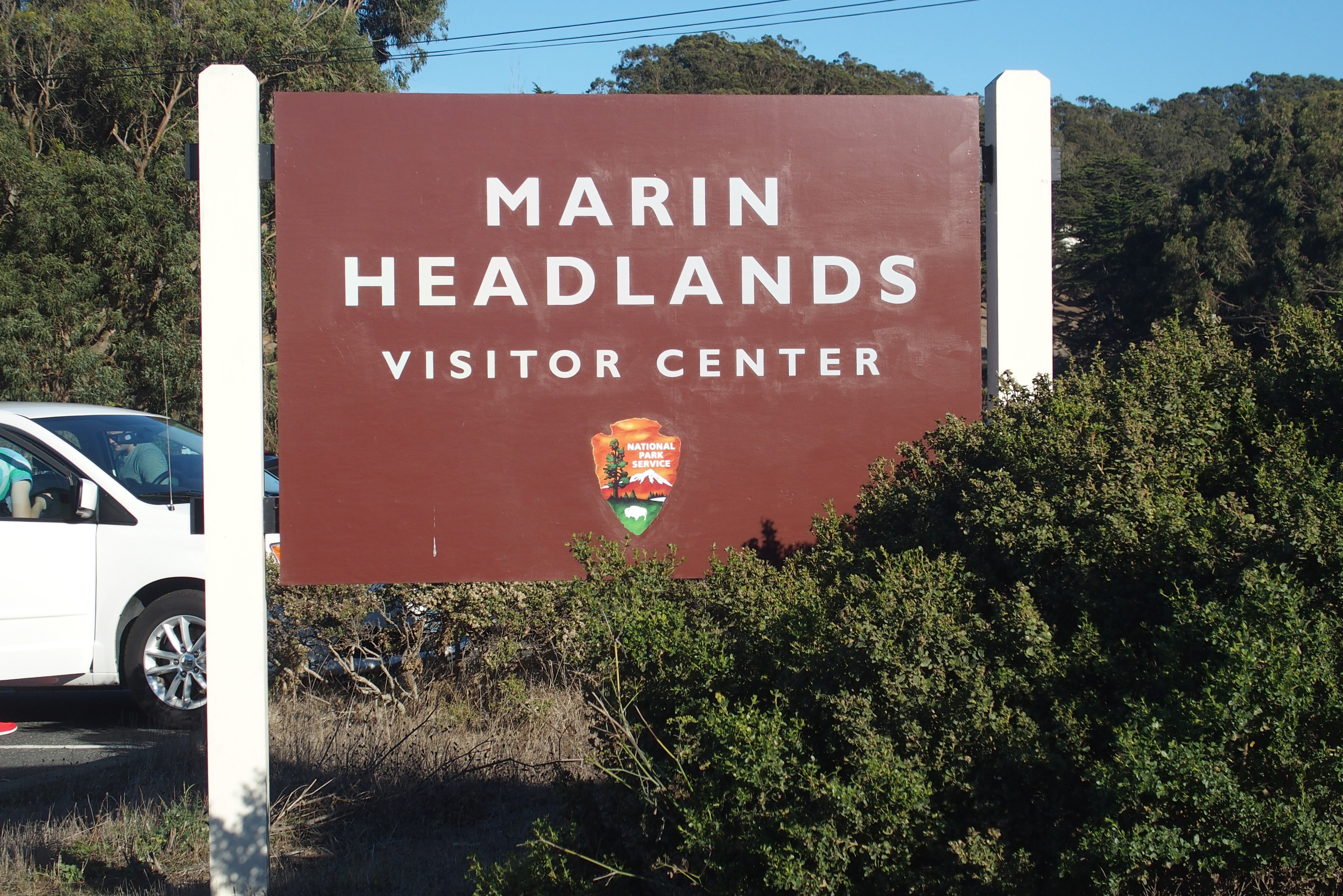
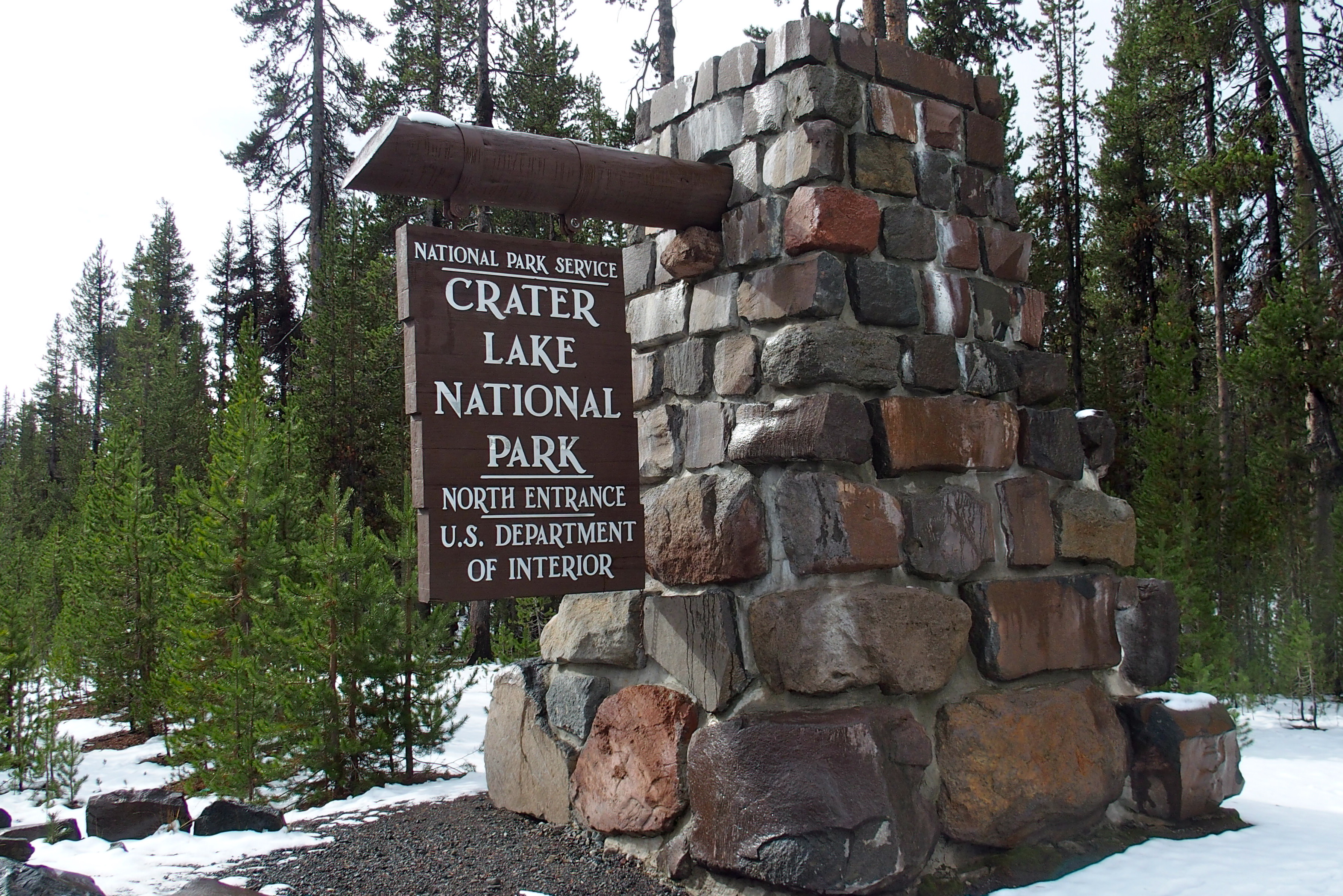
Another day, another national park. (But nothing ho-hum about it.)

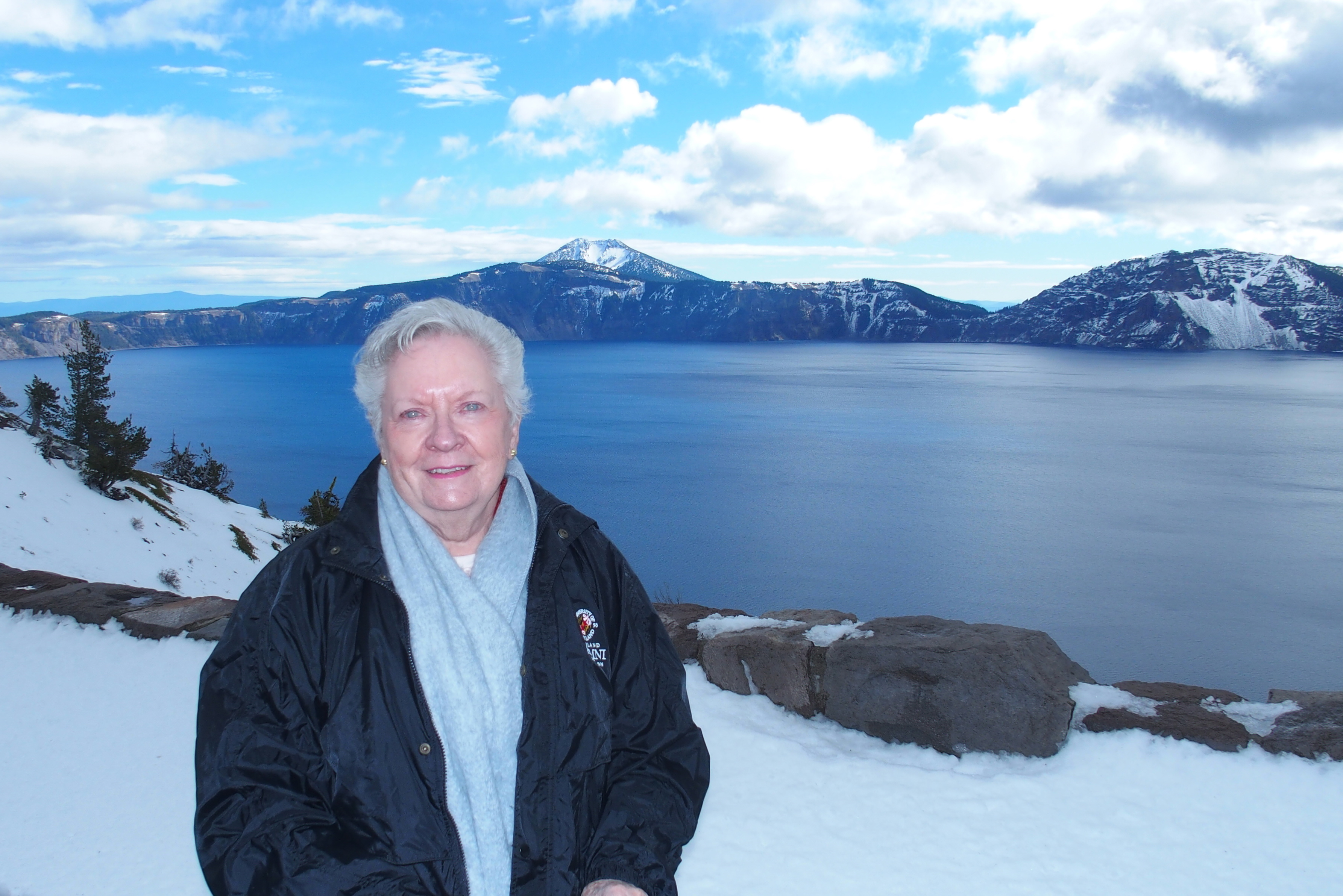
Here we are at Crater Lake in Oregon.

OLYMPUS DIGITAL CAMERA

Notice the snow on the ground. It’s cold!

Snow and volcanoes don’t seem to go together, but this park has both. There are more than 40 volcanic cones here! The one that erupted most recently (4,800 years ago) is hidden under the lake. The area remains thermally active, but you’d never know it with the cold and snow we’re experiencing.

OLYMPUS DIGITAL CAMERA

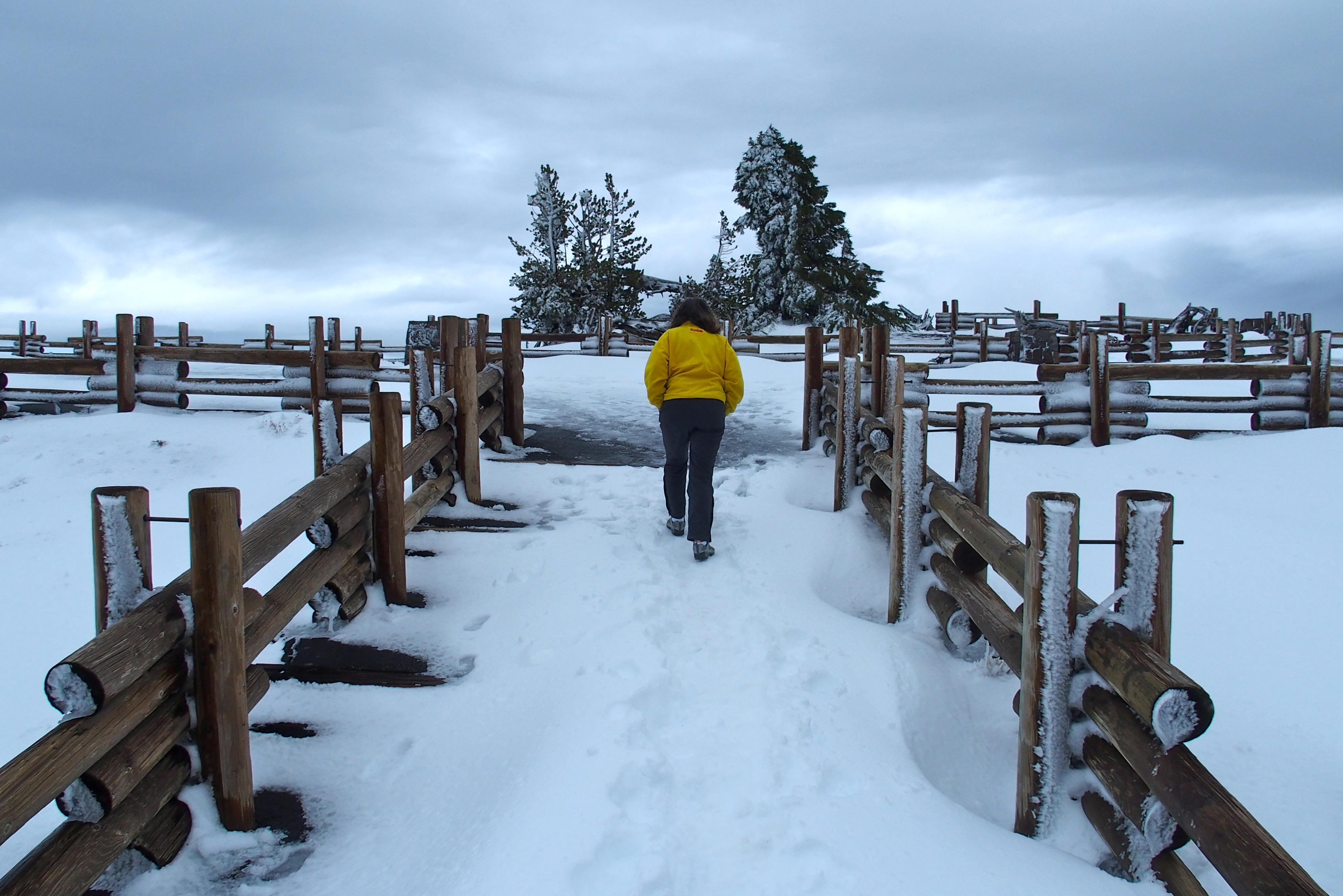
Wondering if there is a view beyond the snow drift.

OLYMPUS DIGITAL CAMERA

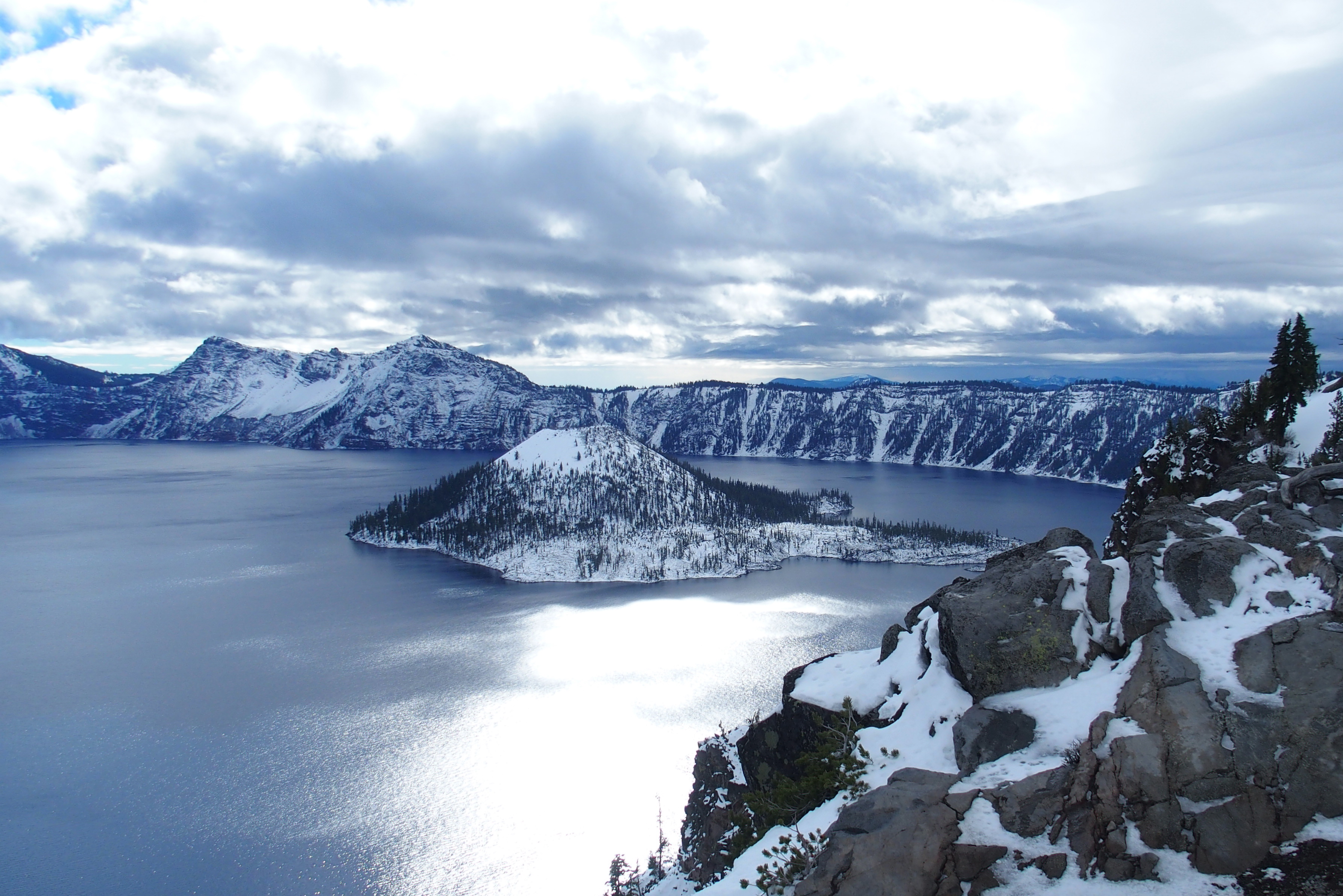
There is! We have found Crater Lake.

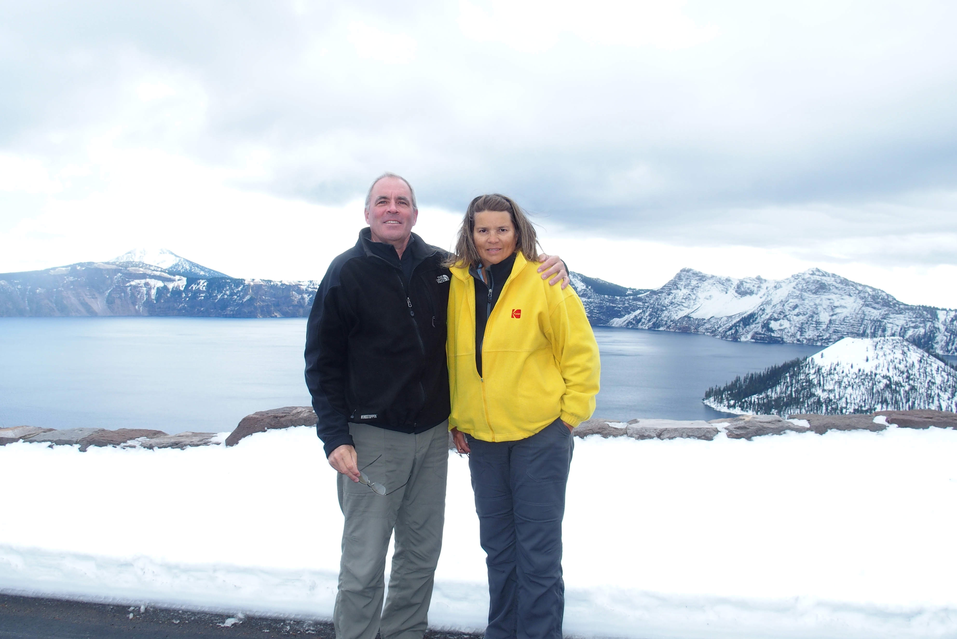
Mount Mazama was a volcano here not quite 8,000 years ago. After the volcano erupted (quite violently!) it collapsed, forming an almost perfectly round caldera or crater. This filled in with snow and rain to create Crater Lake, nearly 2,000 feet deep.

On a blue-sky day, the lake deserves its frequent nickname of Blue Lake, but today we saw its alter ego, Shiny Gray Lake in the Clouds.

OLYMPUS DIGITAL CAMERA

Wizard Island in Crater Lake

We did have a few moments of clear skies to begin to appreciate the blueness of this vast lake. It’s almost 2,000 feet deep and about 6 miles wide.

OLYMPUS DIGITAL CAMERA

Crystal clear, very deep water means blue light is not absorbed, so we get the very blue lake.

The island at the edge of the lake is Wizard Island, a volcanic cone that formed after the major eruption and collapse. Twenty-five years ago, scientists explored the depths in a manned submarine (brought to the location by helicopter) and found blue pools in the crusty underwater surface and elevated temperatures in certain spots. It is another area, like Yellowstone, that could become active again on the surface during our lifetimes…but not on this trip.

OLYMPUS DIGITAL CAMERA

Worth the trip? Marcia says yes!

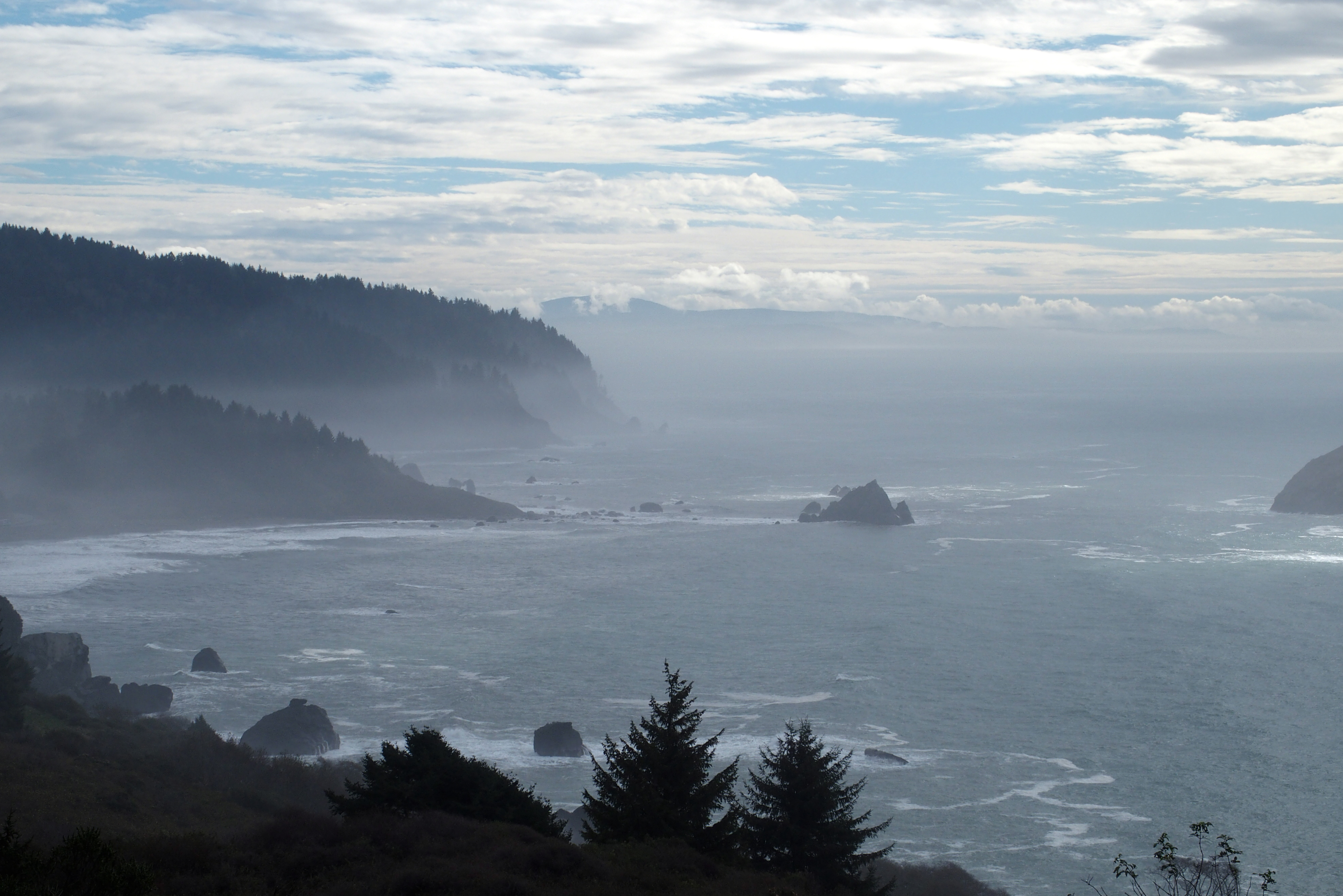
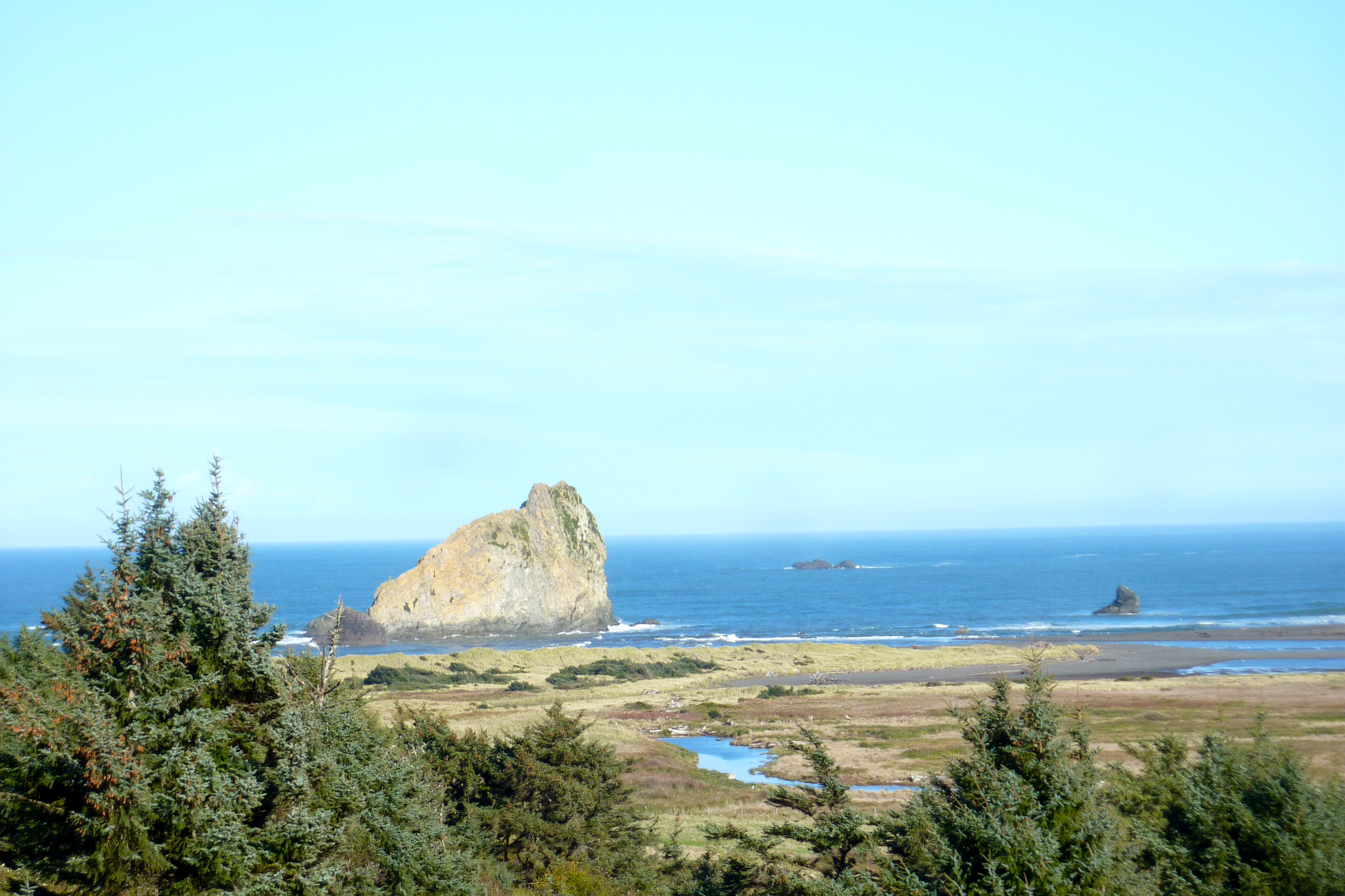
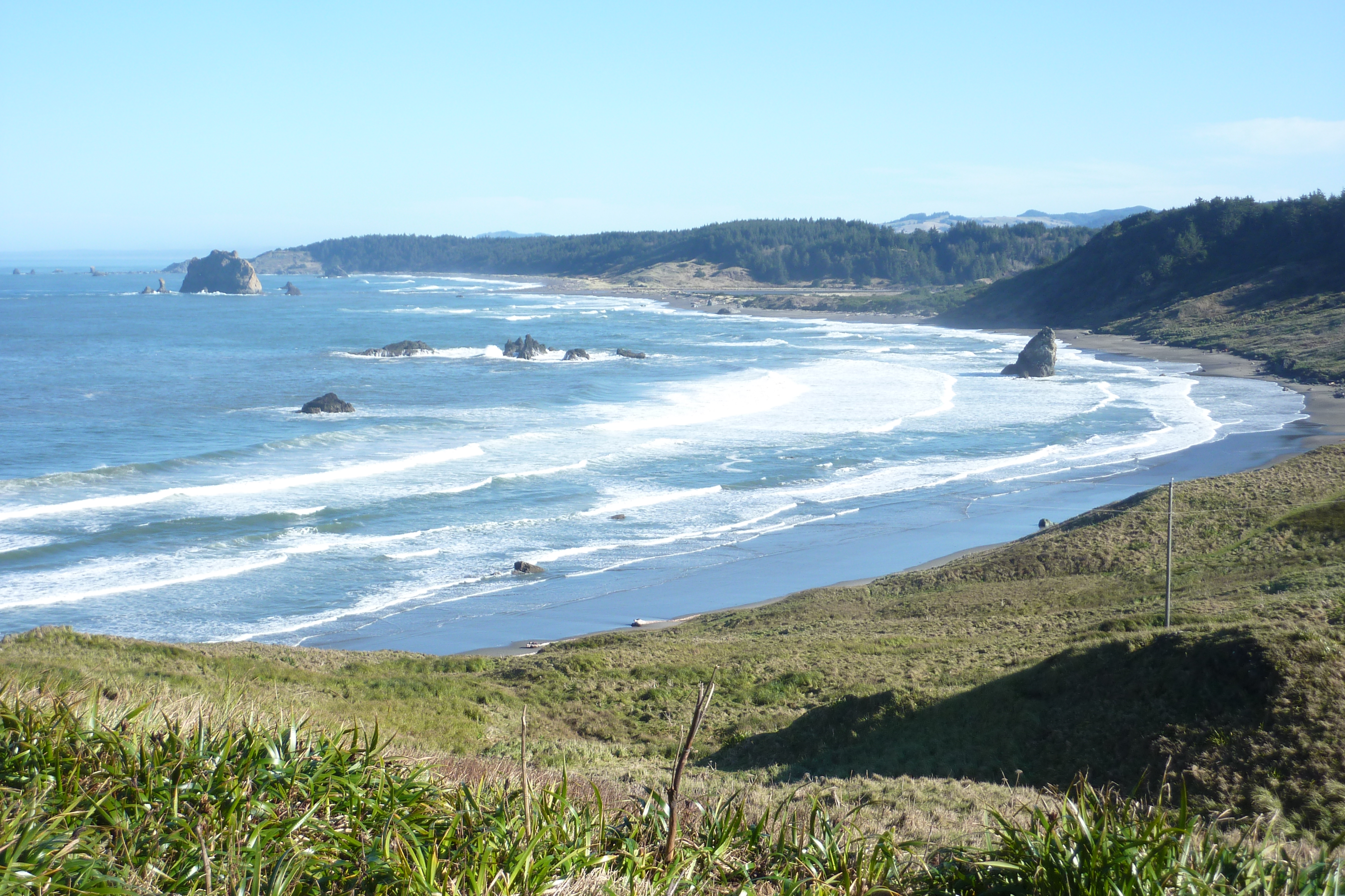
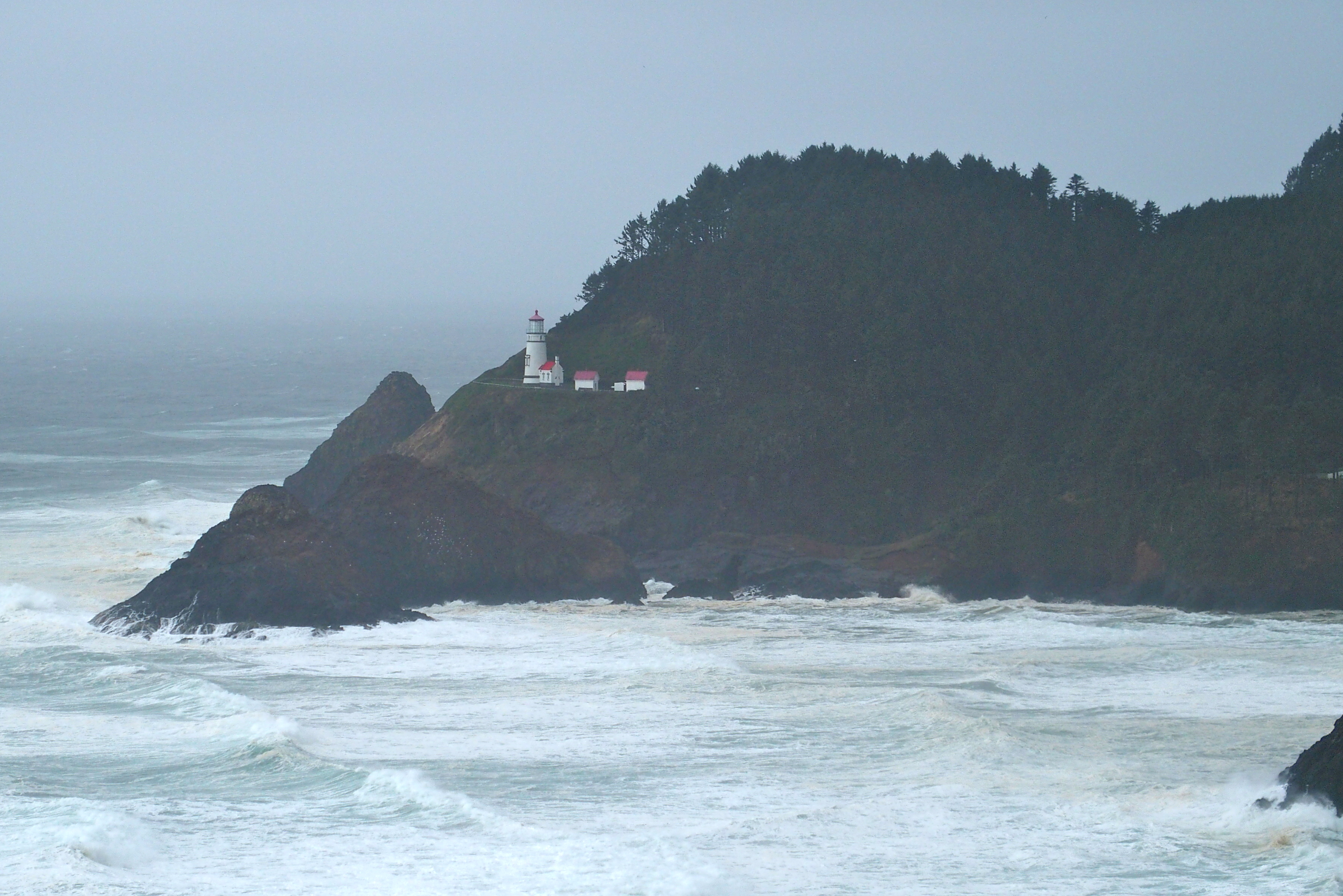
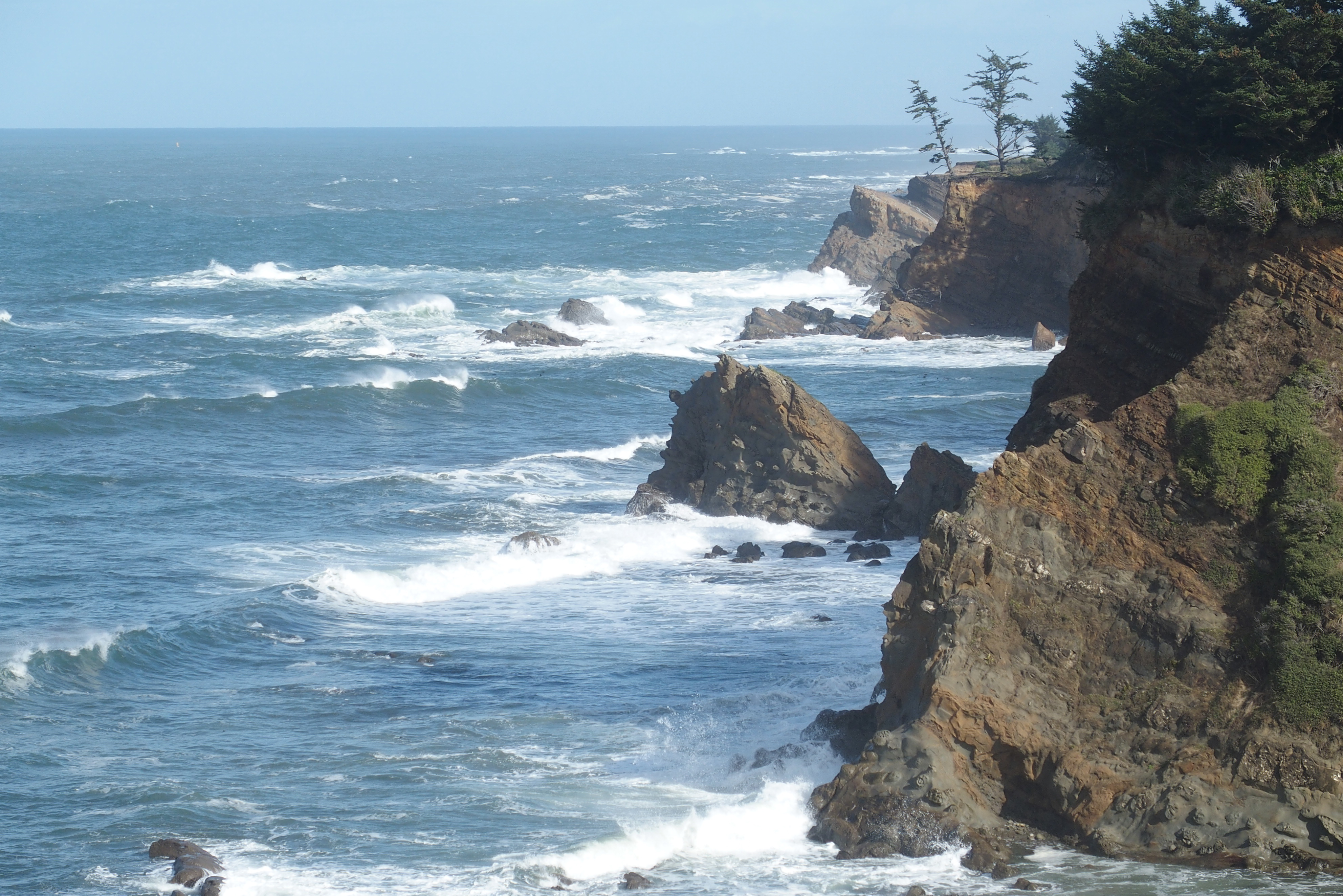
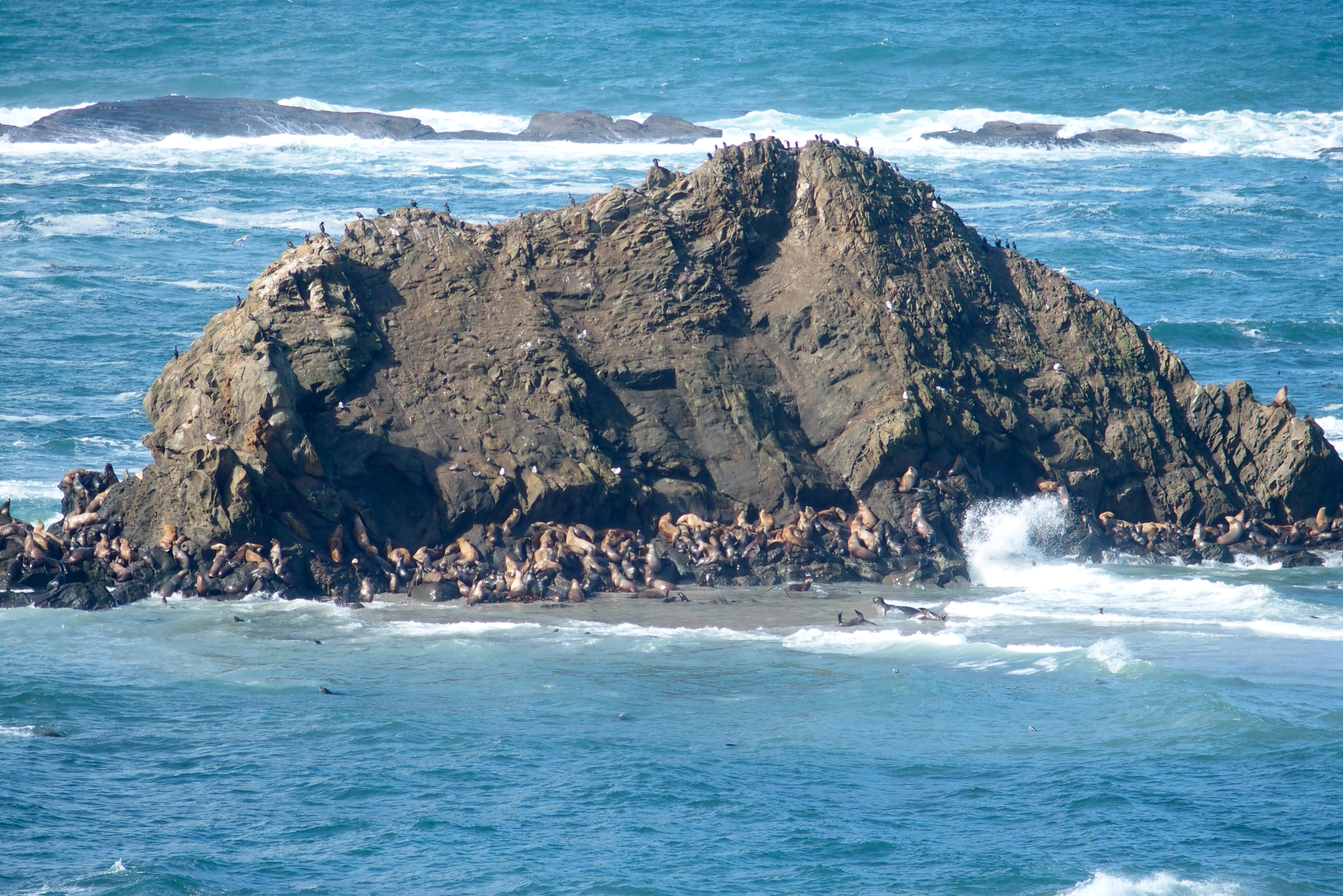
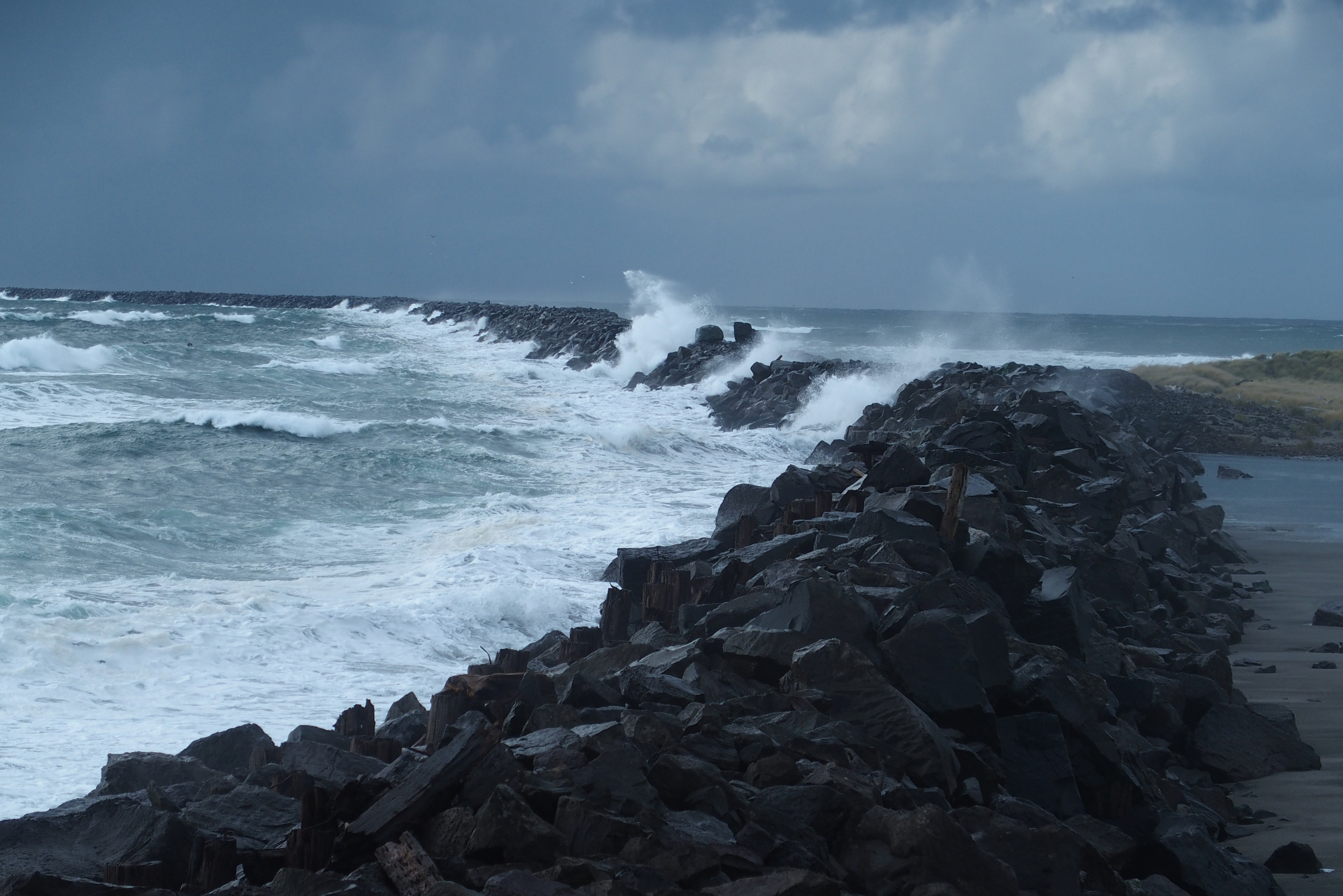
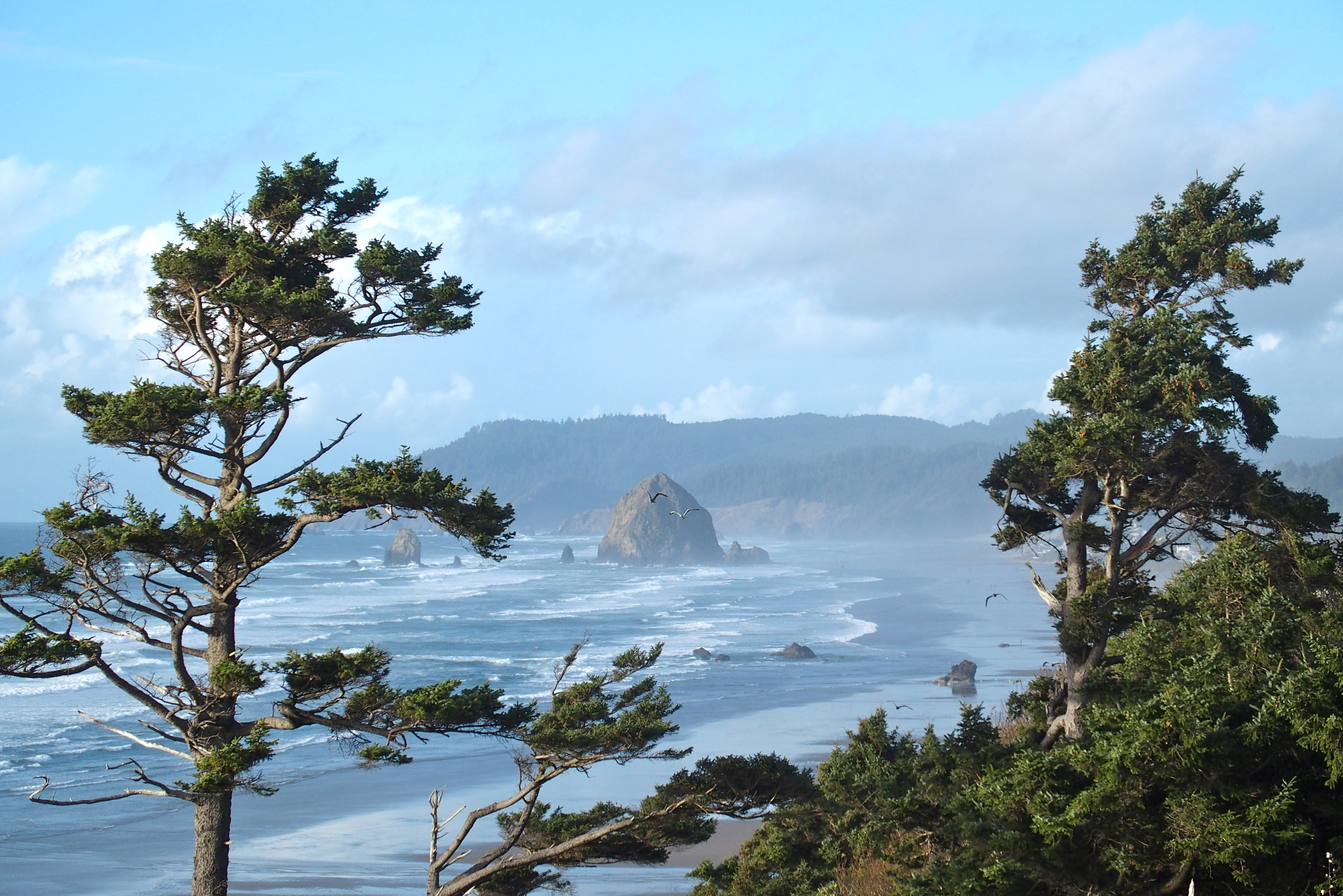
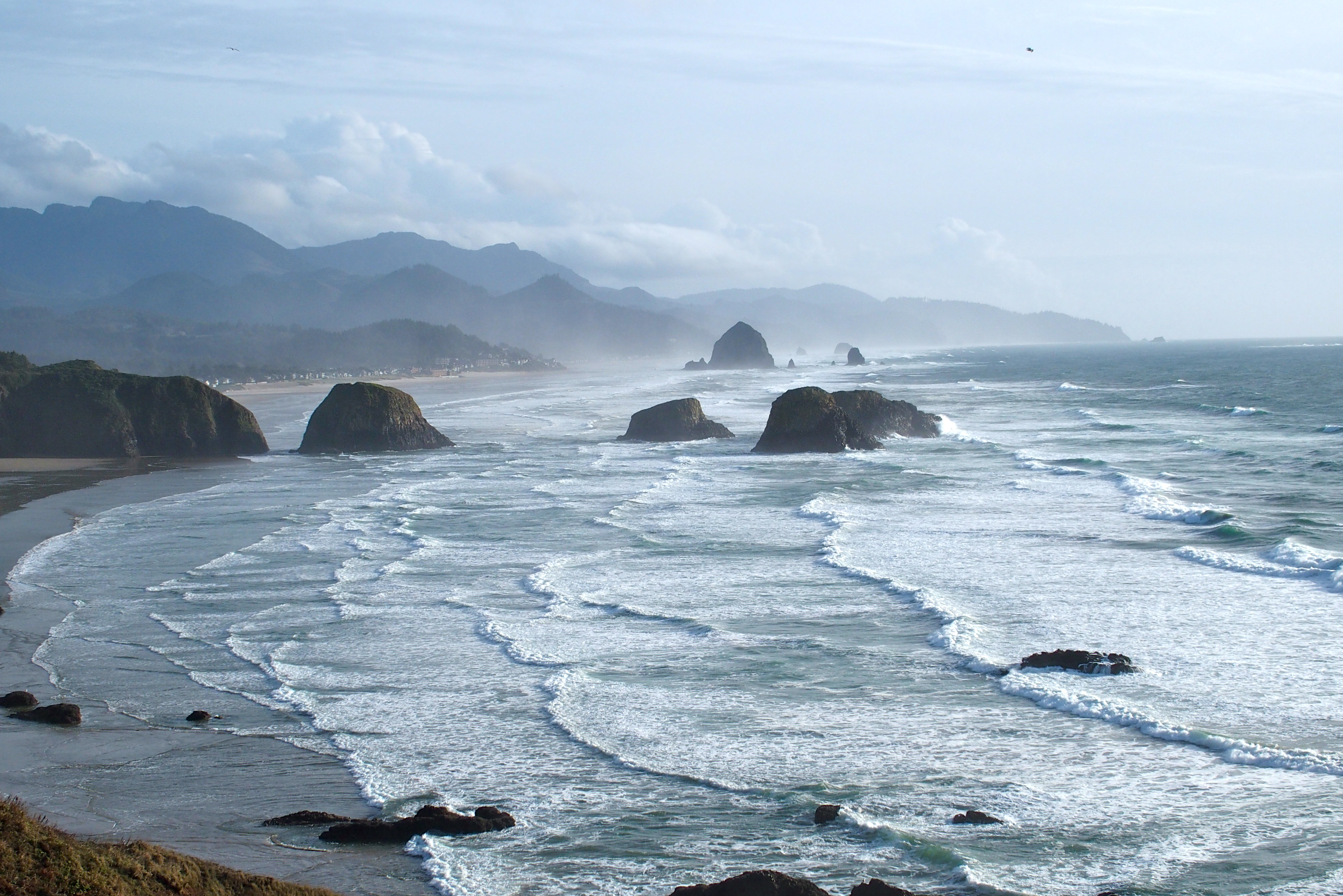
We drove south and found more wild coastline, this time in California. Saturday’s storm really ravaged this area.

OLYMPUS DIGITAL CAMERA

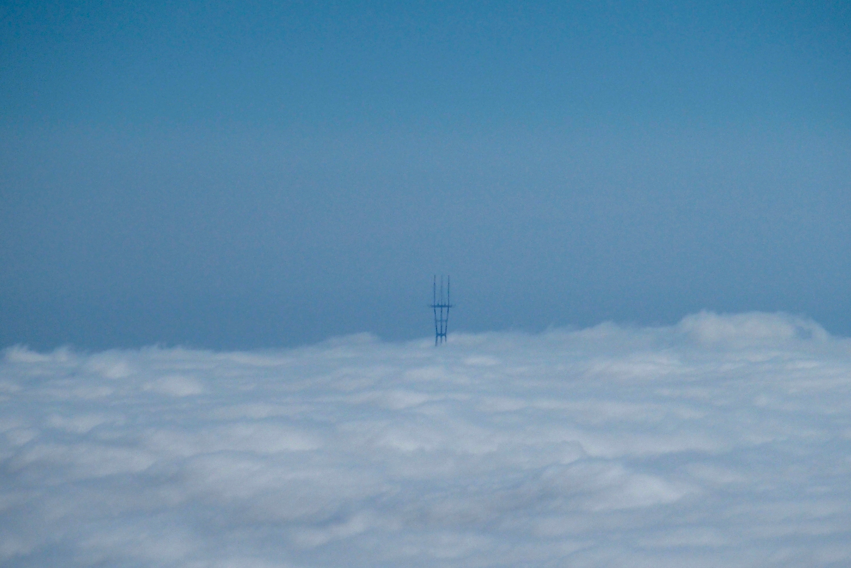
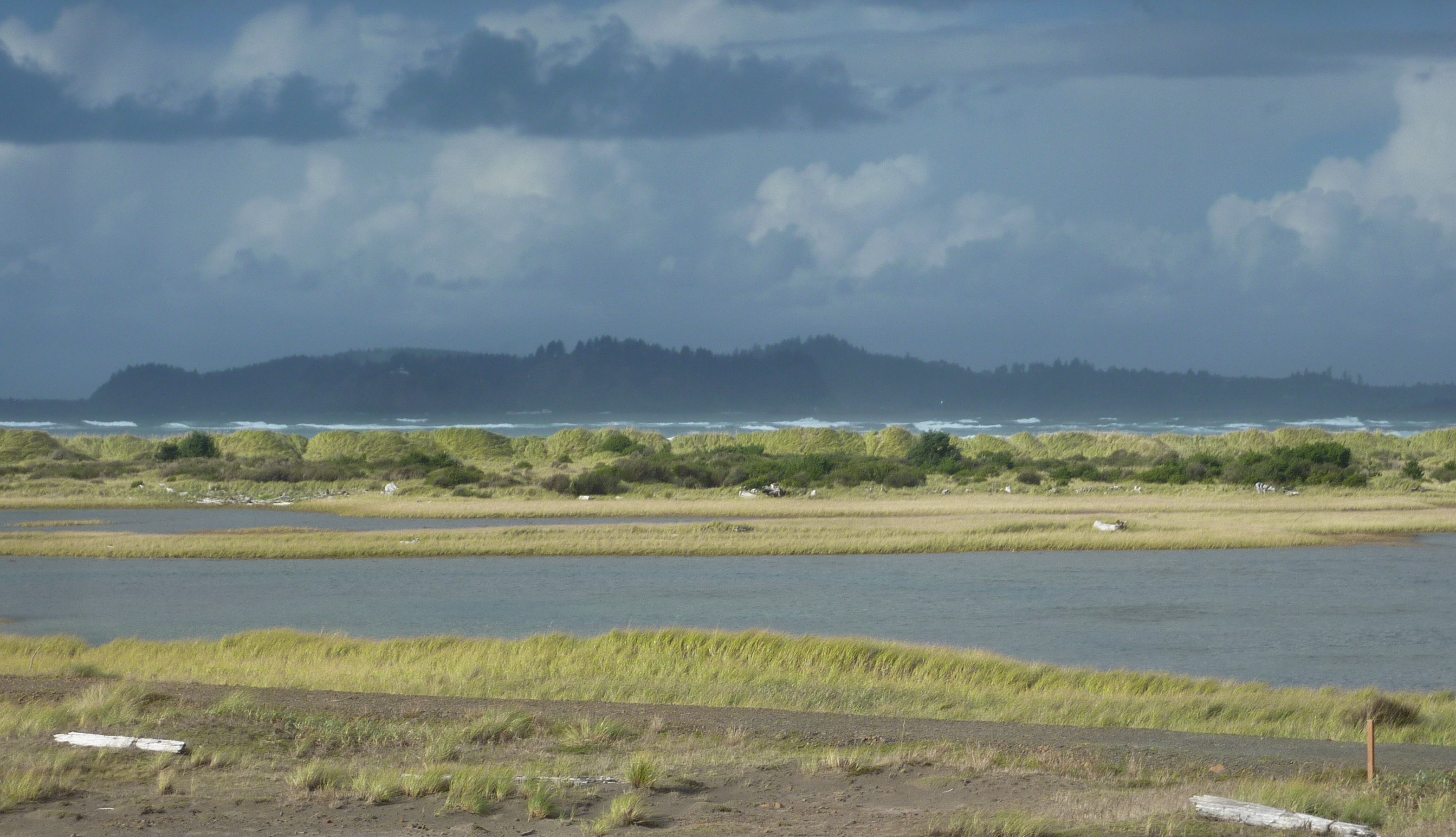
We drove above a cloudy mist for much of the day.

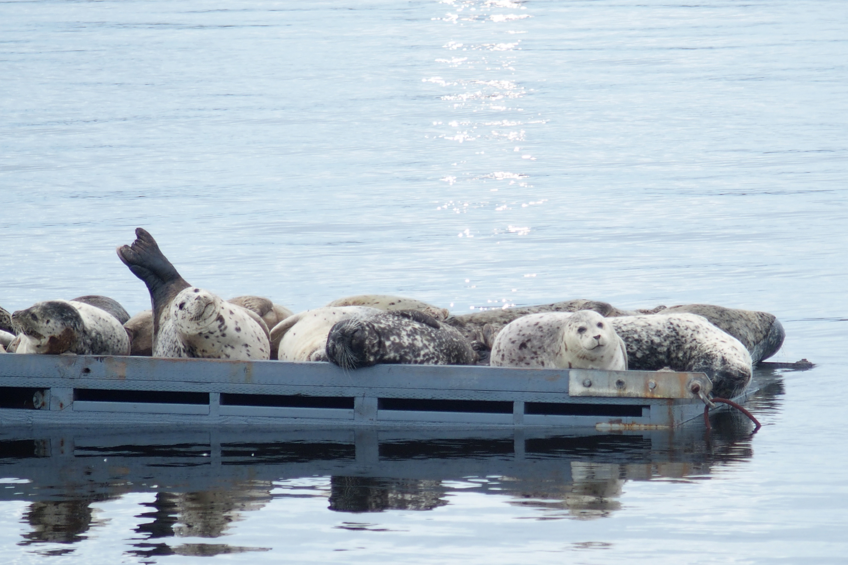
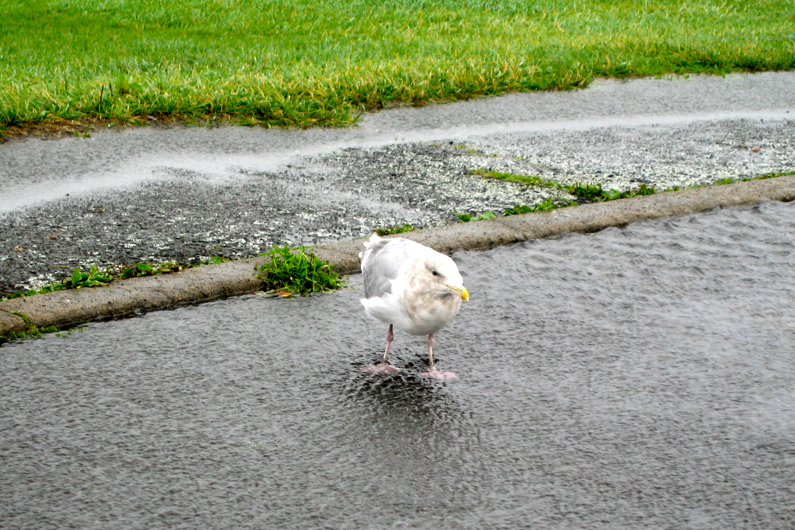
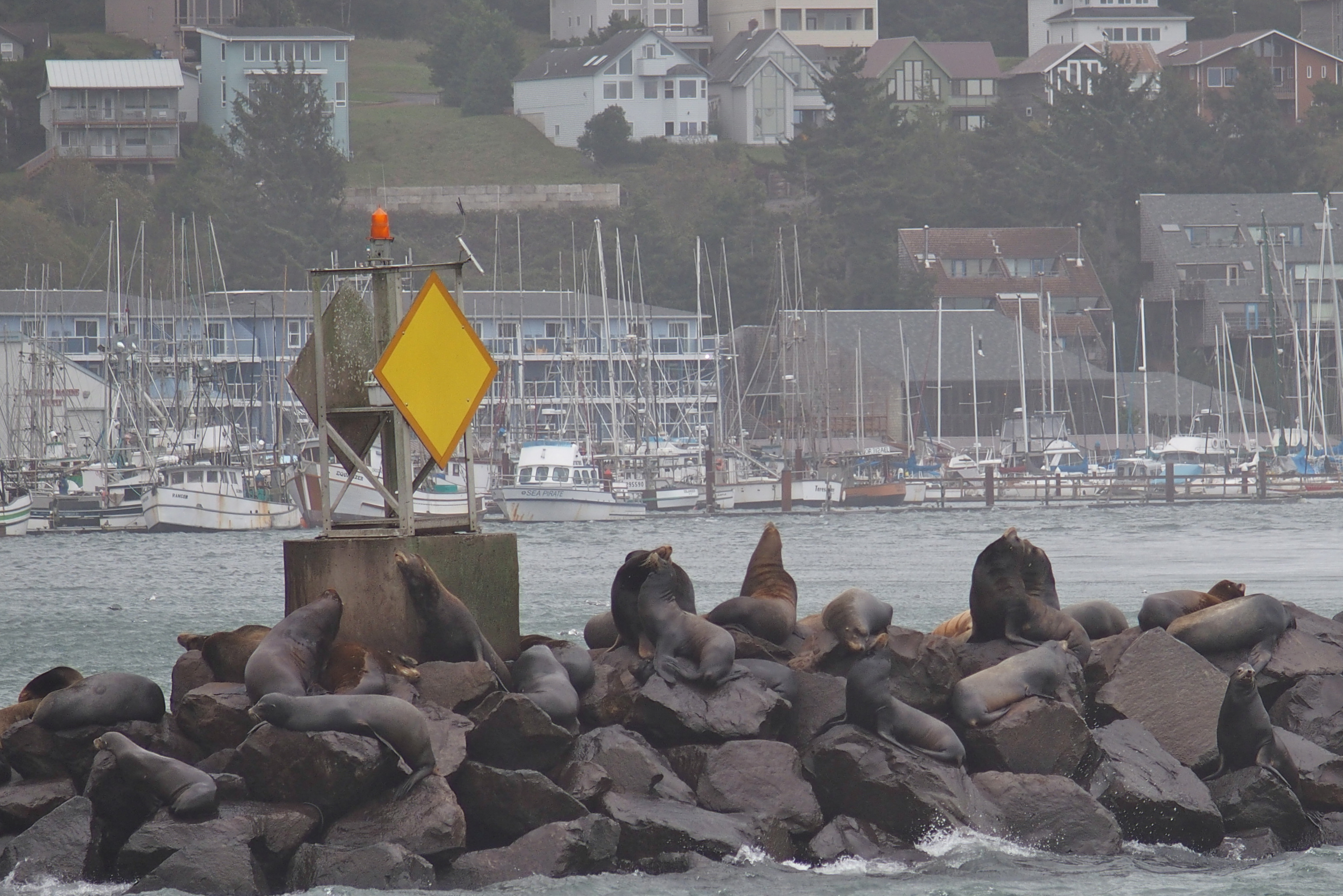
In Cresent City, we found new wildlife: spotted seals. Unlike the sea lions with long foreflippers, these swimmers have very short flippers that don’t look like they’d be functional out of the water. But they are…

OLYMPUS DIGITAL CAMERA

The one on the right looks like the poster boy on the public service ad with the caption “Don’t club baby seals.” He survived, thankfully.

Getting onto this float is not an easy task. First, the seal bobs several times in the water looking for an open spot to squeeze in. (His buddies don’t say “Come on up” and slide over to make room.) Then he pushes his head over the edge of the raft, tucks his chin down for leverage, reaches the tiny flippers onto the wood surface, and pulls the remainder of his 200 pounds out of the water. With a lot of shimmying and tail-flapping, he’s aboard. And he probably stays there all day.

OLYMPUS DIGITAL CAMERA

This shoreline at Crescent City looks a little like the bluff at Keuka Lake.

While we watched the seals at the harbor, workers were busy cleaning up the pier and parking lot. This was Thursday and they were still removing huge logs and dozing away large rocks, gravel and kelp. However, these after-effects were nothing compared to 50 years ago when the Alaskan earthquake triggered a tsunami with a 21-foot wave that overwhelmed Crescent City, killing at least 12 people. Tsunami preparedness signs are everywhere.

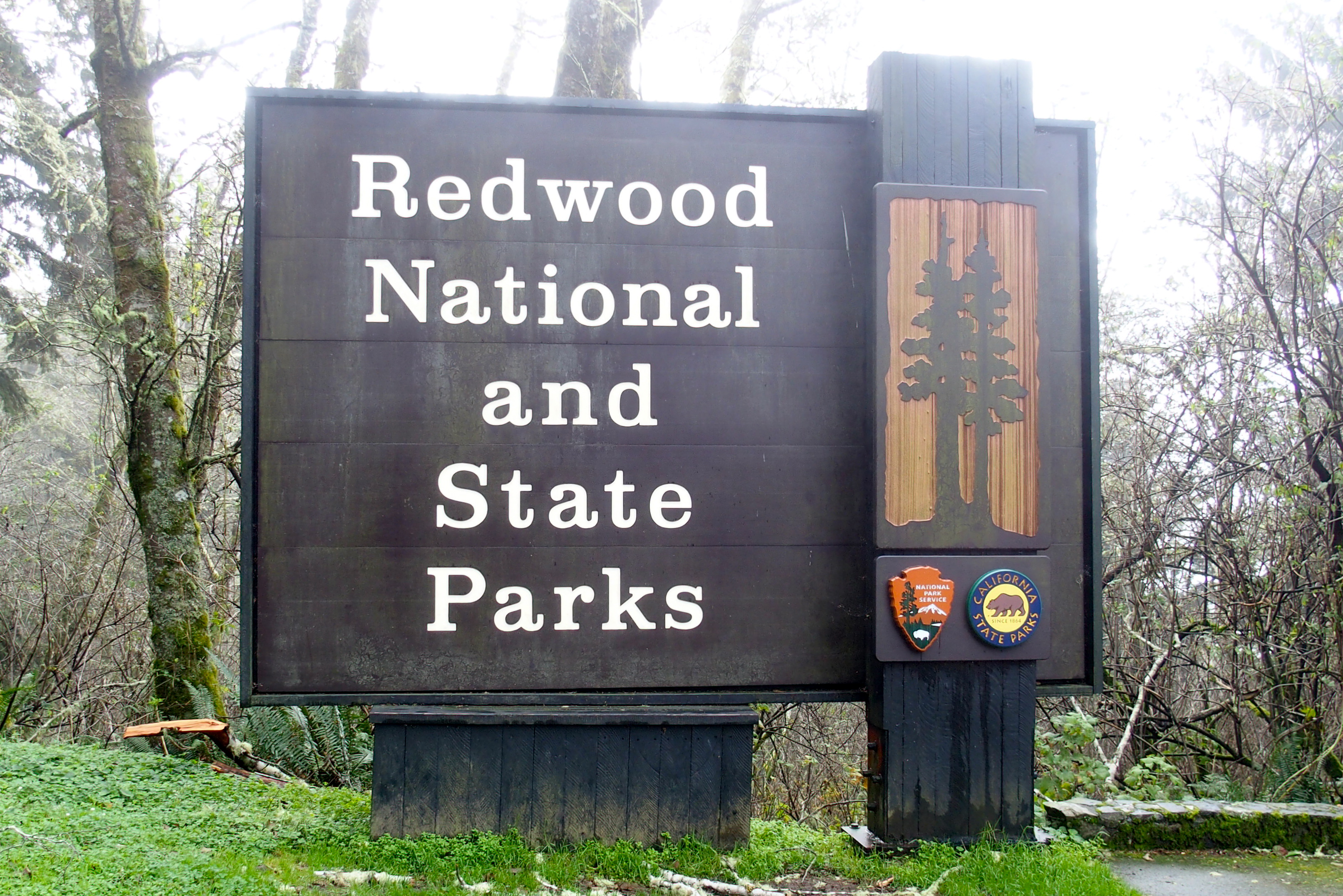
We kept driving south and found ourselves in another national park, Redwood. It actually stretches over 330,000 acres of land managed cooperatively by federal and state agencies. The shared goal is to preserve the towering redwoods. California State Parks celebrates 150 years of existence this year (a happier anniversary than the tsunami).

OLYMPUS DIGITAL CAMERA

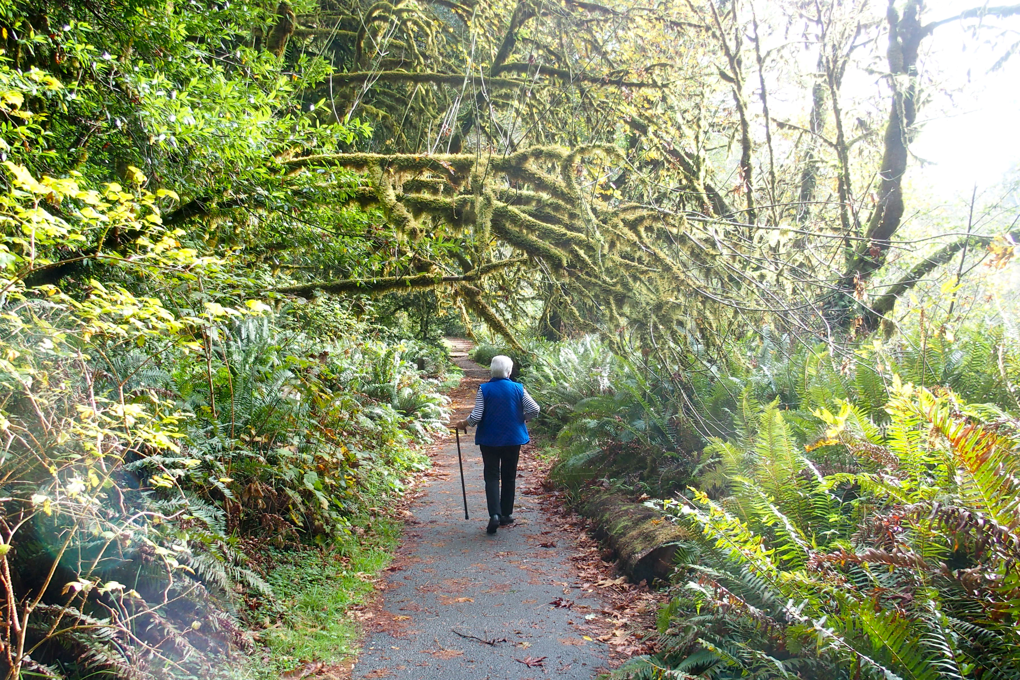
The park stretches for miles along the coast.

The trees are too big to photograph in one frame!

OLYMPUS DIGITAL CAMERA

Majestic redwoods, straight, tall, creating such a dense forest we can’t see the sky.

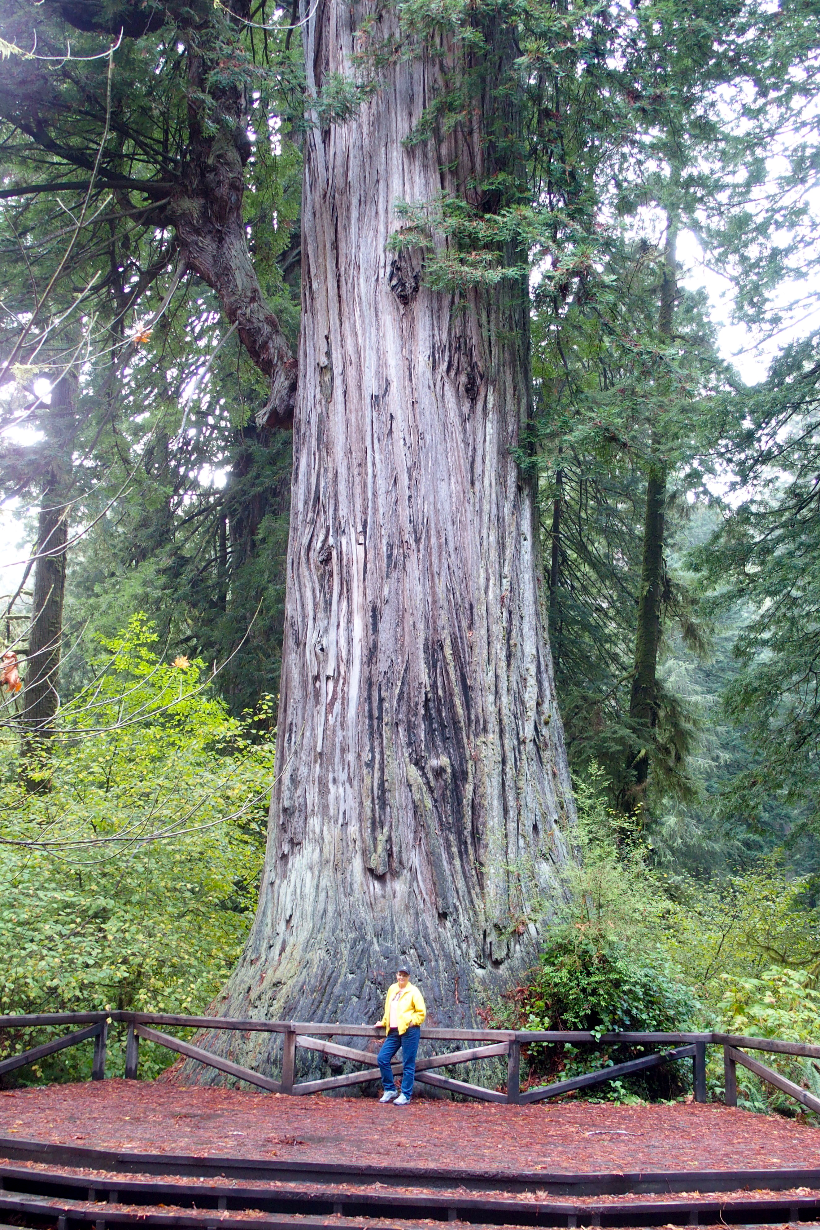
One specific redwood has a name: Big Tree. It’s 304 feet tall, 21 feet in diameter, 68 feet in circumference, and probably about 1,500 years old. At one time, an enterprising businessman in the area wanted to cut it down and make a dance floor on the stump. Fortunately he didn’t, so we have this sight to enjoy.

OLYMPUS DIGITAL CAMERA

Better a tree than a dance floor!

OLYMPUS DIGITAL CAMERA

Leaving the Big Tree, totally awed.

Many acres have been harvested in past years before conservationists succeeded in their preservation efforts. That means giant tree trunks are left behind.

OLYMPUS DIGITAL CAMERA

This might be the secret kitchen of the Keebler elves: a hollow tree trunk, big enough for a giant oven.

And the answer to the question, “If a tree fell in the forest and no one was there to hear it fall, would it still make a noise?” seems pretty obvious. This tree made a giant crash.

OLYMPUS DIGITAL CAMERA

The sheer mass of the tree and its roots is so great it’s hard to imagine a more powerful force that could cause it to fall.

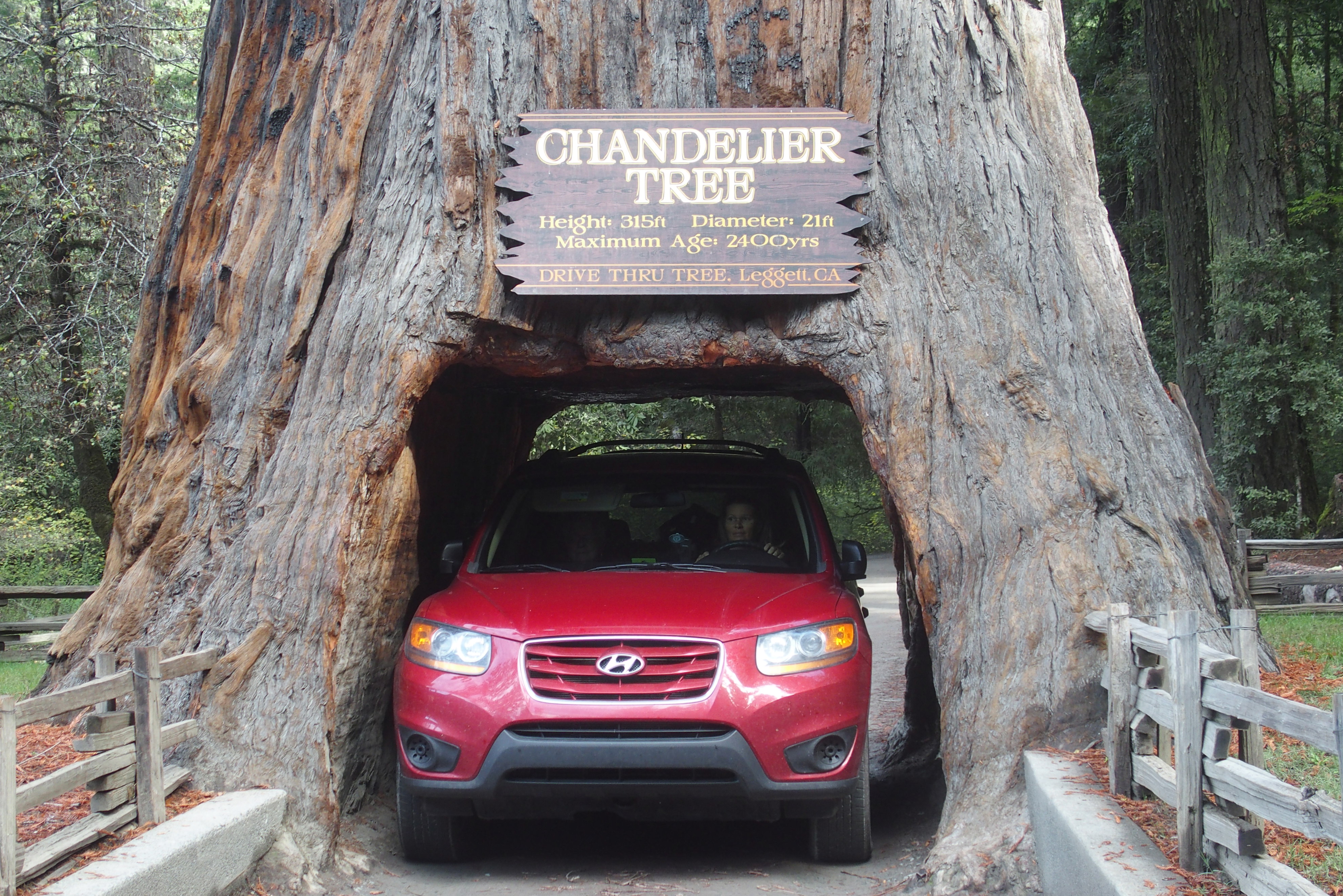
One obligatory sidetrip was to “the tree you can drive a car through.” This one is estimated at up to 2,400 years old. We tucked our side mirrors in and glided through with ease. A bigger SUV inched through behind us, barely avoiding scraping the sides or getting wedged in place. How would AAA react to an emergency call to be removed from a tree?

OLYMPUS DIGITAL CAMERA

How many thousands of cars have passed through this tree? Yet it still stands strong and tall, 300 feet tall.

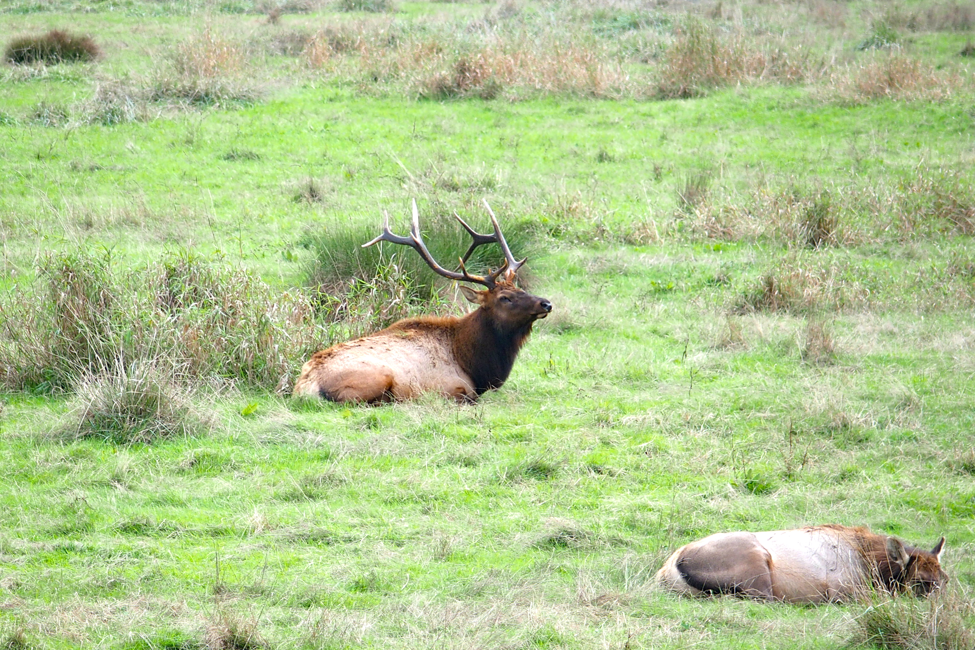
No national park visit would be complete without wildlife. We stumbled across a mighty elk and a harem of 30 or so lady elk.

OLYMPUS DIGITAL CAMERA

A lazy day today: They were all chewing their cud in synchronized motion.

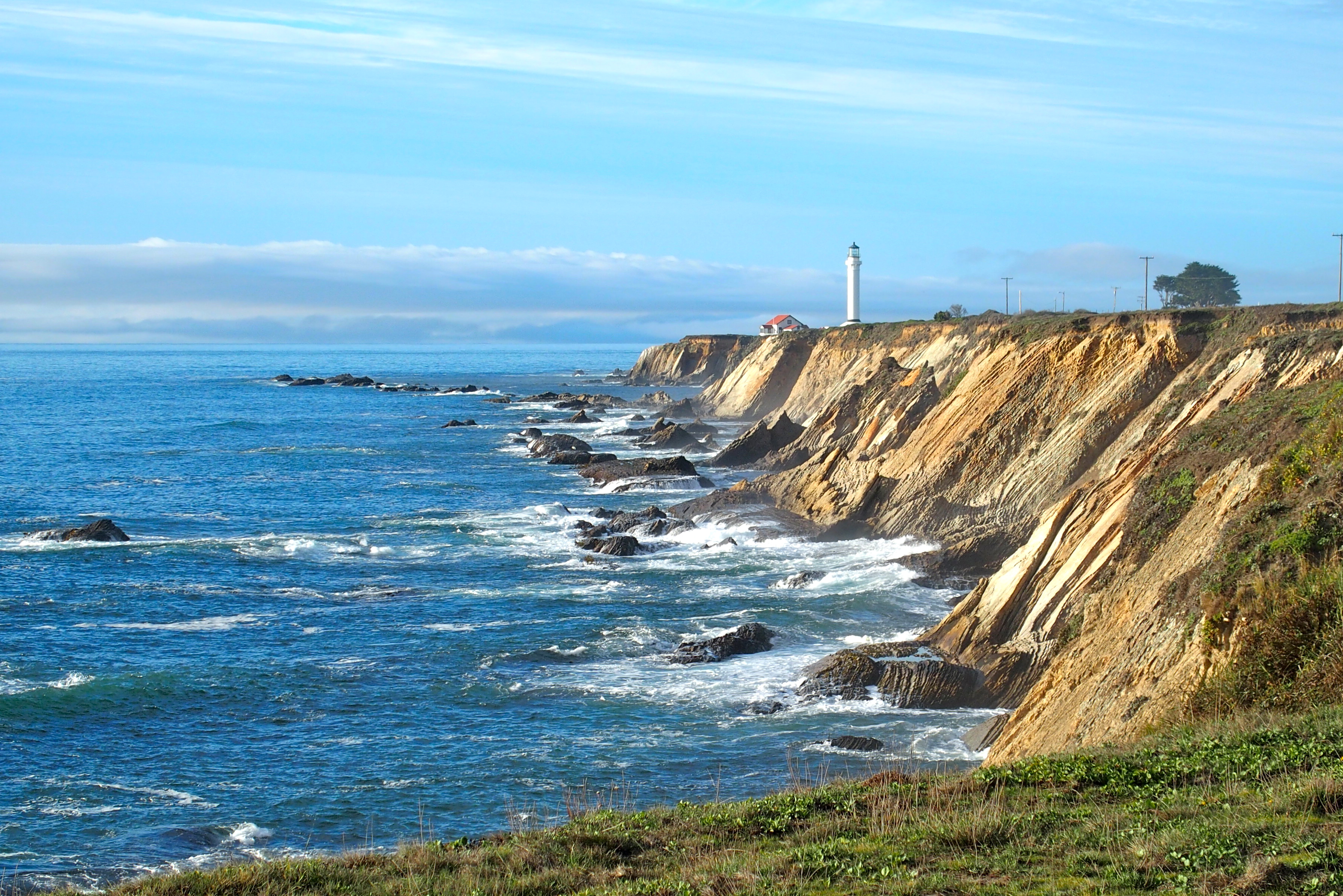
We ended the day as we started, driving along California shoreline.

OLYMPUS DIGITAL CAMERA

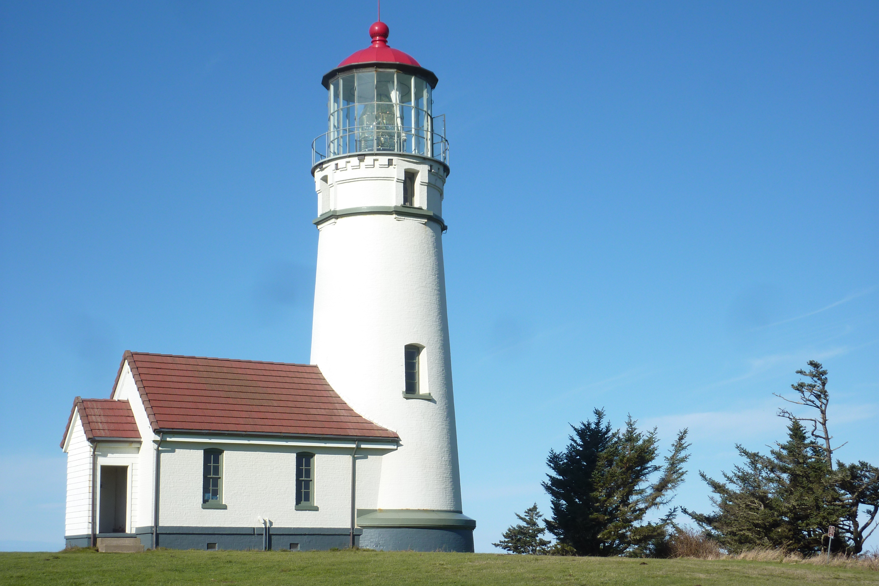
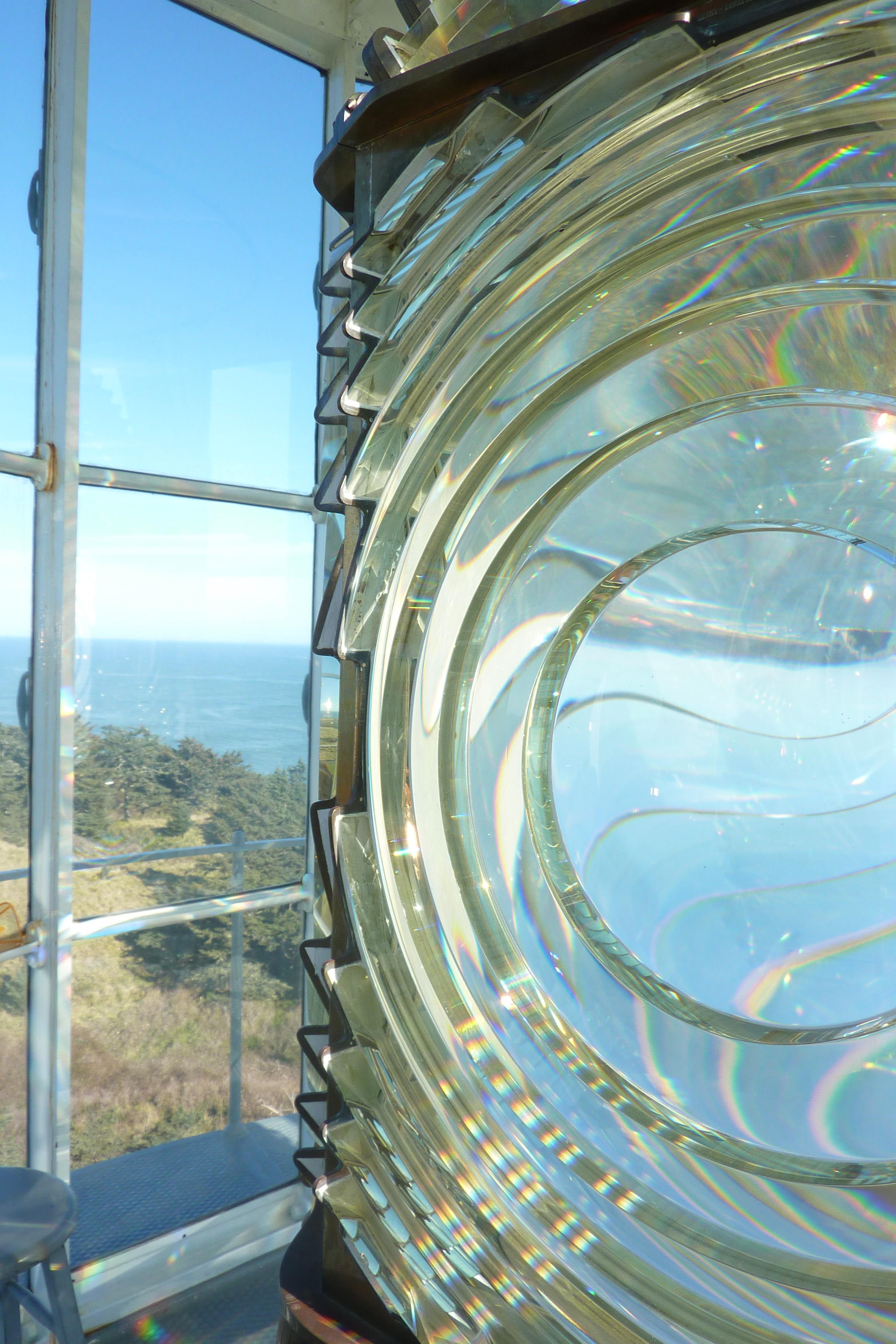
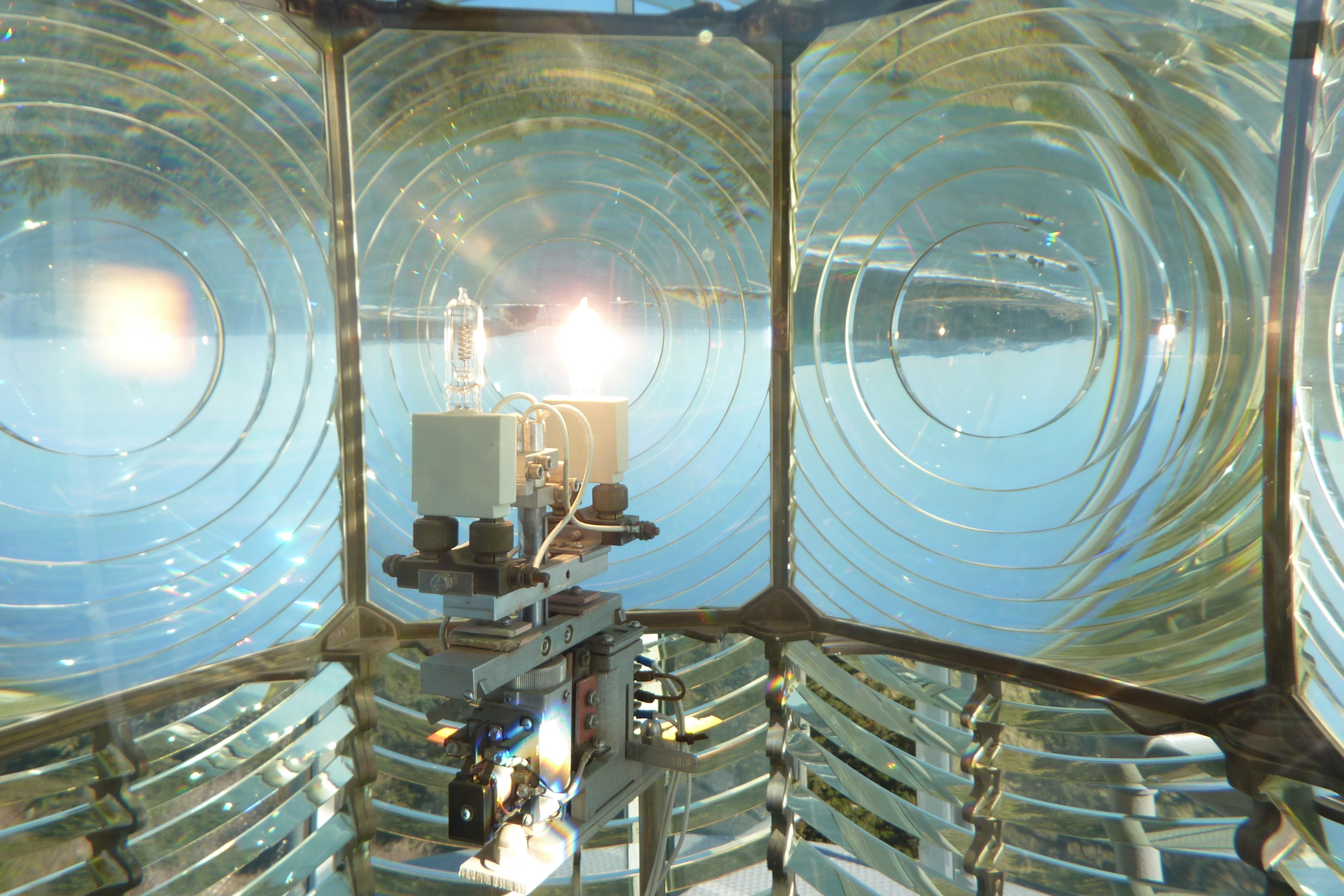
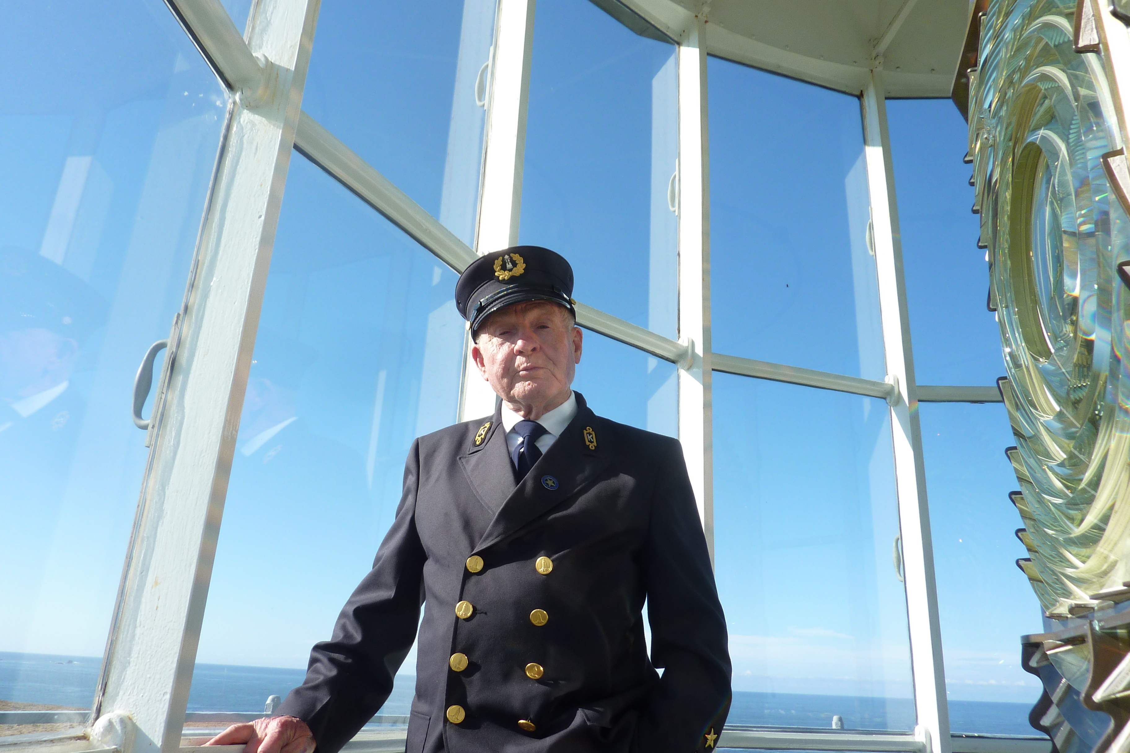
Point Arena Lighthouse and the rugged shoreline.


Posted in Travel Journal | Tagged , , , , , , , | 1 Comment

Cape Blanco Light (Oregon)

Near Port Orford, on the westernmost point of Oregon:

P1070080

The Sixes River meets the Pacific Ocean

The Hughes family, Patrick and Jane, built a very large (over 3,000 square feet) Victorian home near the river in 1898.

2014-10-27 004

Not your typical farm house

They raised seven kids (two others died early) and over 100 milking cows on their 2,000-acre farm.

2014-10-27 016

James, the lighthouse keeper, is in the center.

A short distance from the farm is the Cape Blanco Lighthouse, where one Hughes son, James, was one of the lightkeepers. On this particular coastline, the job was critical since ships could easily go aground on sand or rocks hiding less than 20 feet from the surface up to two miles away from the shore.

2014-10-27 026

Pretty, but pretty dangerous

The light was built in 1870 using bricks made locally, with the highest quality at the base, most critical for the integrity of the building’s structure. The point is sandy, so the lighthouse is anchored on a very thick and deep slab of concrete to withstand some shifting. That seems to have been a good plan, since the structure is still sound today.

2014-10-27 031

Still standing after all these years

Not enough of the local bricks were good enough, so others were brought from San Francisco by sea. However, a storm pushed the ship onto the treacherous rocks, losing some of the cargo…and demonstrating the importance of having a lighthouse to keep other boats away from these rocks!

2014-10-27 039

The brick and steel of the circular staircase are the original installation from 1870.

At the top of the spiral stairs is the light. James Hughes and two other attendants took shifts around the clock in the upper level tending the lighthouse. In the early days, the light was powered by hog fat (lard) and the lightkeepers needed to clean the soot from the glass every hour.

2014-10-27 037

Jack, a volunteer, shows the replica storage cans for “hog fat” and the carrying cans brought to the top of the light.

By 1936, the lens was an electric revolving lens, still in operation nearly 80 years later.

2014-10-27 067

This motor hasn’t stopped since it was installed in 1957.

2014-10-27 056

Today the lens needs cleaning, but not hourly. More like every couple months.

2014-10-27 051

This relatively small bulb is all that is needed for the light to be seen from 23 miles away.

2014-10-27 063

Bob takes his volunteer job giving tours seriously. He purchased a replica of James Hughes’ uniform and climbs the 63 steps multiple times a day on a knee he had replaced 25 years ago. Although he also has acrophobia (fear of heights), he loves sharing the lighthouse stories with visitors.

2014-10-27 069

Descending the nearly 150-year-old stairs.

Two days earlier while we were battling wind and rain a bit north, the volunteers closed the lighthouse for tours because of the windy conditions. Winds have been measured here at 100 mph, but the lighthouse stands tall and sturdy year after year.

The last tour of the season is the end of this week. It was one more serendipitous moment of making a very interesting visit “just in time” before things close.

Our thanks to Jack, Bob, Roald, and the other volunteers for their kind service.


Posted in Smell the Roses | Tagged , , , , | Leave a comment

Rain, rain go away. Our soggy Oregon saga. October 25 to 27 (days 54 to 56)

This weather is for the birds!

IMG_6629

Jonathan Livingston Seagull is grounded…Can’t pull his webbed feet out of the puddle.

And speaking of birds, one lady was trying to recreate Tippi Hedren’s role from The Birds.

OLYMPUS DIGITAL CAMERA

From The Birds: “Have you ever seen so many gulls? What do you suppose it is?”

Let’s get all our ducks in a row (or maybe gulls).

IMG_6634

The gulls need to brace themselves facing into the wind or they get blown off the cliffs.

When it rains it pours. Now what does that mean exactly? We’re besot and besodden by the rain as we head toward Lincoln City and Newport.

OLYMPUS DIGITAL CAMERA

We’re in front of the Oregon Capitol Building in Salem. That is not an Oscar Award on the top…

First stop is seeing the Oregon Pioneer on top of the Oregon Capitol building in Salem. He’s 76 years old, carrying an ax and symbolizing the pioneers who first settled in this area (after the Native Americans). He doesn’t appear to need an umbrella.

OLYMPUS DIGITAL CAMERA

He’s 22 feet tall, 8.5 tons, and finished in gold leaf

Along the same lines in Willamina (pronounced Will-AM-in-a?) is Rusty the Logger who symbolizes the logging contributions to the community. He’s carrying a crosscut saw. There’s an ax-head on his shoulder too.

2014-10-25 015

Not quite as shiny as the Golden Pioneer. Rusty looks a little like the mammoth at Domaine Serene in Willamette.

Rusty has been replaced by more mechanized equipment. We see patches of land that have been clear cut and trucks, trains, and boats carrying the logs and lumber products.

IMG_6623

A small sampling of logs and logging equipment in the area.

Normally you expect that after the rain comes a rainbow. Here we’ve found that after the rain…comes more rain!

OLYMPUS DIGITAL CAMERA

The sea lions in Newport don’t seem to mind the rain. They’re resting on the rocks after eating lunch.

IMG_6639

The crabs don’t fare as well. These Dungeness crabs were more than 2 pounds and fully cooked, ready to be eaten for lunch.

This whole section of the Oregon coast is dotted with state parks, each with a view of majestic cliffs and powerful waves. We caught glimpses between raindrops.

OLYMPUS DIGITAL CAMERA

The winds reached 50 MPH while traveling the Oregon coast road.

OLYMPUS DIGITAL CAMERA

When the sun comes out it is delightful 🙂

OLYMPUS DIGITAL CAMERA

North of Coos Bay are massive dunes. We were too late in the season to get a ride. 😦

2014-10-26 081

This gnarly mass looks like octopus tentacles but it’s some kind of sturdy seaweed. Maybe this is the tangled “hair” of Medusa that pulled sailors toward treacherous rocks.

OLYMPUS DIGITAL CAMERA

Is the rock covered with maggots? No, they’re California sea lions and Stellar sea lions (the lighter-colored ones)

Sea lions can grow to 7 feet and 1,000 pounds. Although these particular animals looked rather lazy, National Geographic says they can swim at 25 mph and dive over 1,700 feet. The proprietress of a great ice cream shop in Newport told us about “her” sea lions. The ladies spend all year along this northern coast. The guys go down to California for 11 months and just come back to mate. They’re quite noisy. Arf! Arf!

OLYMPUS DIGITAL CAMERA

Sea lions are very sociable. A herd in the water is called a raft. On land it’s called “let’s pile up on each other.”

Finally we were back into blue skies, so nice that Michael could enjoy a day of golf at Bandon Dunes for his birthday.

IMG_4599

The course

IMG_4595

The swing

Happy B’Day!

Posted in Travel Journal | Tagged , , , , , , , , , | Leave a comment

Willamette wine and coastal cheese (Oregon) October 24 (Day 53)

Cows don’t mind rain. In fact, they probably appreciate the green grass it produces. Rain in Tillamook is one of the big reasons they make the greatest cheese in the world. (At least it’s Chris’s favorite!) We learned that Tillamook is the name of  the Native Americans who lived in this area many years ago.

IMG_2538

Chris, we’ve hit the mother loaf!

We toured the super-clean factory and tasted samples from squeaky to 60-day aged. They weren’t sampling Chris’s favorite, Special Reserve, aged over 15 months. (It’s available in a 2-pound loaf at Costco in the west.) Then we discovered Tillamook ice cream, another tasty product of well-nourished cows.

IMG_2527

The packaging line is fascinating to watch.

Nearby is another cheese house, Blue Heron. This is a sampler’s heaven, with 50 or more delicious jams, mustards, and dips. Wine too. We picked up Brie with peppercorns and a sourdough baguette.

What goes with bread and cheese? Wine! Off to McMinnville at the northern end of the Willamette Valley, home of Oregon’s renowned Pinot Noirs. It’s pronounced Will-AM-ette (accent on the second syllable).

We visited three vineyards. Domaine Drouhin is run by a French family; the winemaker is a woman. This is one of the cleanest wine-making facilities we’ve ever seen. The wine was quite smooth.

2014-10-24 012

Domaine Drouhin. The wine is as crisp and clean as the factory.

At Domaine Serene, we had a small-world experience, with the server having been raised in Irondequoit NY, two blocks from a spot where Nancy once lived. More tasty wine!

IMG_6619

At Domaine Serene, this rusted metal woolly mammoth represents the impact the Ice Age had on the valley, making it perfect for wine production.

Finally at Stoller, we had not only excellent Pinot Noirs, but some very good Chardonnays as well. Our server was a man close to our age, who had been in the construction business and was now studying full-time for a degree in viticulture. Sounds like an appealing post-career career.

OLYMPUS DIGITAL CAMERA

The vineyards here are pruned to perfection!

Dinner that night was our Brie and baguette with Bing cherry jam. Delicious!

IMG_2546

Cheers!


Posted in Travel Journal | Tagged , , , , , , , , , | Leave a comment

Beautiful Day on the Oregon Coast October 23 (Day 52)

The massive Pineapple Express storm was predicted to ravage the area, but we ended up with beautiful sunny skies as we drove from Portland to Astoria, Oregon. Astoria was again named after that fur trader, John Jacob Astor. The family got around: from the Waldorf Astoria Hotel in New York City to the hinterlands of Oregon.

We criss-crossed the Columbia River, intrigued by all the logs and lumber products all along the banks.

2014-10-23 005

Lots and lots of these trucks hauling big logs

At one point we passed Longview Washington where wood products were being loaded onto large cargo ships.

Looking back toward Longview Oregon at 11AM.

Looking back toward Longview Washington at 11AM.

Two hours later, an EF-1 (86-110 mph)  tornado rolled through Longview, touching down for 1.3 miles in a 200-foot wide swath of destruction. No deaths or even injuries, thankfully.

We reached the Astoria-Megler Bridge. At four miles long, it’s the longest continuous truss bridge in the country, but only two lanes wide. This was down to one lane with stop-and-go traffic during the four-year repainting project that lasts through 2016. When the bridge was built in the early 1960s critics called it  a “bridge to nowhere,” connecting a small town to an empty shore, but now it transports over 7,000 people daily, with no toll (having been eliminated in 1993).

OLYMPUS DIGITAL CAMERA

The Astoria-Megler Bridge completes highway 101’s 1,540-mile stretch from LA to Olympia Washington.

Then on to the Oregon Coast, our home for the next eight days. Michael’s mother, Marcia, had met us in Portland for this portion of the trip, fulfilling a very strong desire to see this part of the country. We hoped for some visibility to make the trip worthwhile and we got it!

OLYMPUS DIGITAL CAMERA

Introducing Marcia to the Oregon Coast

Our first view of the coast was up and over a dune, a bit of a climb, but worth it. With wind whipping the surf and sea grasses fighting the gusts, this rugged shoreline is what we imagined for Oregon. Nature is powerful here.

IMG_6593

It’s a hold-onto-your-hat day!

To keep inquisitive sightseers from climbing on the rocks and ending up in the drink, the state has provided a great observation tower at the south jetty at Fort Stevens State Park.

OLYMPUS DIGITAL CAMERA

We could actually feel this massive structure shaking in the wind. (Nancy and Marcia waving)

From here we could see the coastline. One little sea lion bounced around in the swirling waters just off the rocky shore protection.

OLYMPUS DIGITAL CAMERA

Waves splashed 20 feet in the air, going over the jetty.

Our view also included the delta of the Columbia River, very wide here as it rushes into the ocean. We saw ships filled with containers, logs, and oil moving in and out. On this particular day it seemed like the boats going upstream were aided by a wind at their back that was stronger than the current.

2014-10-23 026

The waves in the distance are on the river, not the ocean.

Near Astoria is Fort Stevens, the only place in the continental US that was attacked by Japanese bombs during World War II. The battery on the shore shows the site of two American guns. US troops never fired back on the Japanese submarine for fear of revealing their site, but they were prepared if the attack continued.

This part of the coast is very difficult for navigation. In 1906 the 285-foot, four-masted cargo ship Peter Iredale was just reaching the mouth of the Columbia and had trouble maneuvering in the wind and fog. The ship was forced aground just off the coast and then driven right onto the coast by wind and waves. Over the years, the bulk of the ship’s carcass was stripped for salvage materials. This bit of the bow remains 100+ years later.

P1060931

Once a mighty ship! Thankfully all 27 crew members and 2 stowaways survived.

OLYMPUS DIGITAL CAMERA

Waves have been crashing here for 100 years, yet some of the hull remains.

OLYMPUS DIGITAL CAMERA

Monet could have added this to one of his famous series. It’s Haystack Rock in Cannon Beach Oregon.

This post doesn’t capture the sound and feel of the wind and the salty taste of the sea mist. We were very happy to have this day of sunshine to appreciate Oregon’s coast. With projections of pouring rain tomorrow we’re headed inland.

As far as our day yesterday in Portland…it was a wash, quite literally. We were able to visit Powell’s Bookstore (inside), have beer and dinner in Lompoc Tavern (inside), and taste the world’s best handmade ice cream at Salt & Straw (inside), but our view of the International Rose Test Garden and other outdoor sites was mostly rain. It didn’t get our spirits down.

P1060895

Marcia always has a smile as her umbrella…plus this large actual umbrella for Oregon’s extra wetness.

One final indoor spot for Patrick and Liz, Southland Whiskey Kitchen. When it rains outside, they pour inside.

2014-10-21 054

Pat can drool over the wall of whiskey. Liz can advise us on whether Prop 92 for food labeling is a good or bad thing.

Posted in Travel Journal | Tagged , , , , , , | 2 Comments

From Sea to Shining Sea!

After 52 days and more than 7,000 miles, we have reached the Pacific Ocean!

OLYMPUS DIGITAL CAMERA

Fort Stevens State Park in Oregon

Another writer has described this journey more poetically than we ever could:

O beautiful for spacious skies

Watching the clouds in Vermont

Watching the clouds from our hammock (Vermont)

For amber waves of grain

America's heartland

Crossing South Dakota

For purple mountain majesties

IMG_3530

Sunrise in the Tetons (Wyoming)

Above the fruited plain

Apples in Vermont

Apples in Vermont

America America

OLYMPUS DIGITAL CAMERA

A patriotic paddleboat: Queen of the West on the Columbia River (Oregon/Washington)

God shed His grace on thee

IMG_4509

Hammondsport New York

And crown thy good with brotherhood

From sea

Elizabeth Light near Portland Maine

Atlantic Ocean from Elizabeth Light near Portland Maine

To shining sea.

OLYMPUS DIGITAL CAMERA

Pacific Ocean near Ecola Park (west of Portland Oregon)

America the Beautiful comes from a poem written by Katharine Lee Bates from Falmouth, Massachusetts (near the underarm of Cape Cod). She was inspired by the spectacular sites she observed during her journey to Colorado in the late 1800s. Atop Pike’s Peak is a large plaque of these beloved words, which were set to music by Samuel A. Ward.

We passed this smaller version of the plaque on the “Shining Sea” bike trail from Falmouth to Woodshole, on Cape Cod. The moving words have been an inspiration for us on this journey.

From Sea to Shining Sea...

From Sea to Shining Sea…

Posted in Smell the Roses, Travel Journal | Tagged , , , | 2 Comments