
The rocks of Utah are as red as the Golden Gate Bridge and hundreds of millions of years old (or 6,000 depending on your point of view). The large concentration of iron oxide colors the rocks red and the lack of vegetation lets the rock color stay exposed. On our drive east in May we visited some of Utah’s five national parks, each with distinct features, but having the commonality of red sandstone eroded into fascinating shapes.
In Zion National Park, we hiked along the valley of the Virgin River, staring up at the high canyon walls etched to expose the many layers of red and white sandstone.
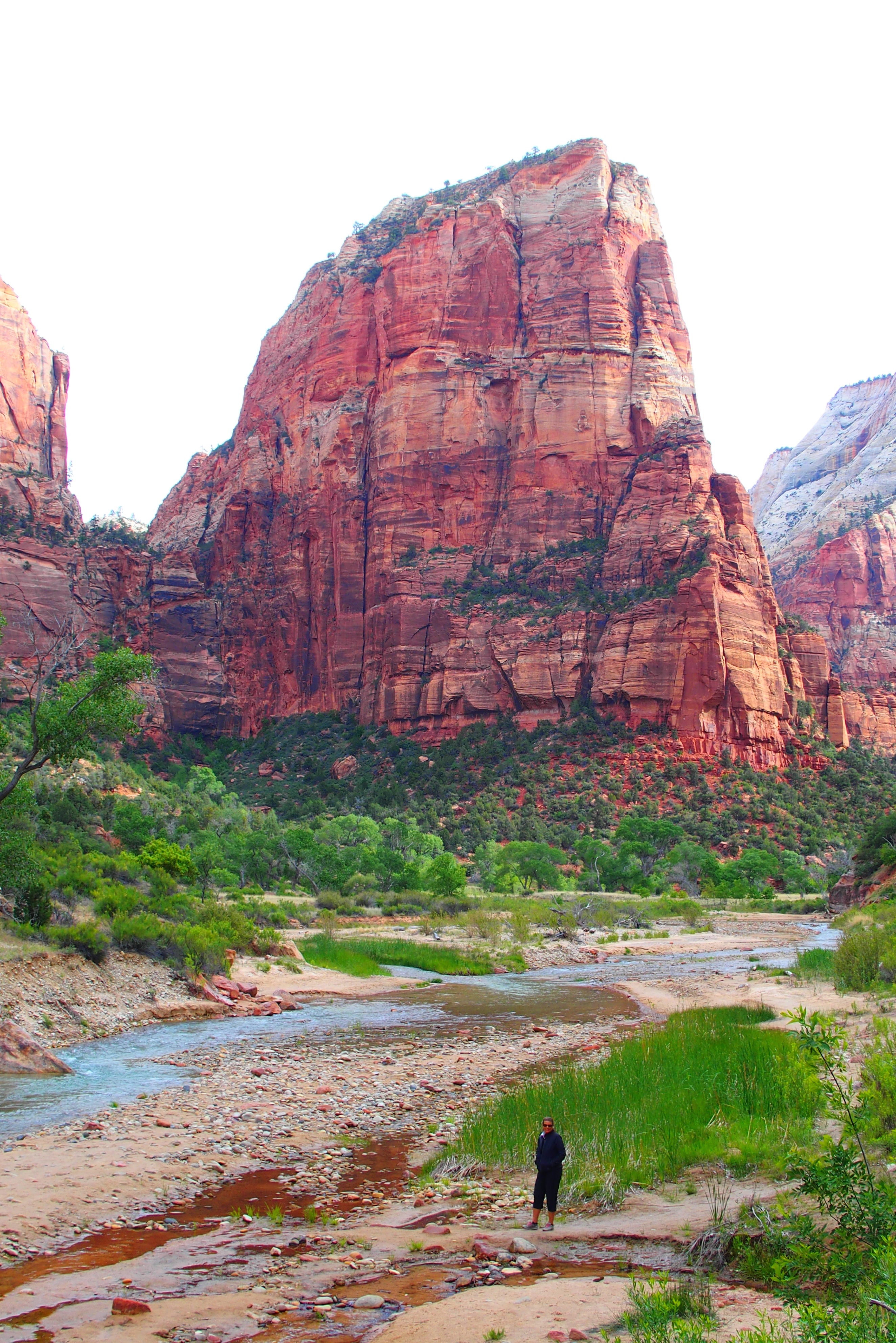
The Virgin River in Zion National Park, with surprisingly low flow during our May visit
Arches National Park has over 2,000 arches, many with interesting names: Delicate Arch, Landscape Arch, Double Arch. Some of them started out as domes. Then erosion over the millennia mysteriously took away rock on all sides and hollowed out middles.
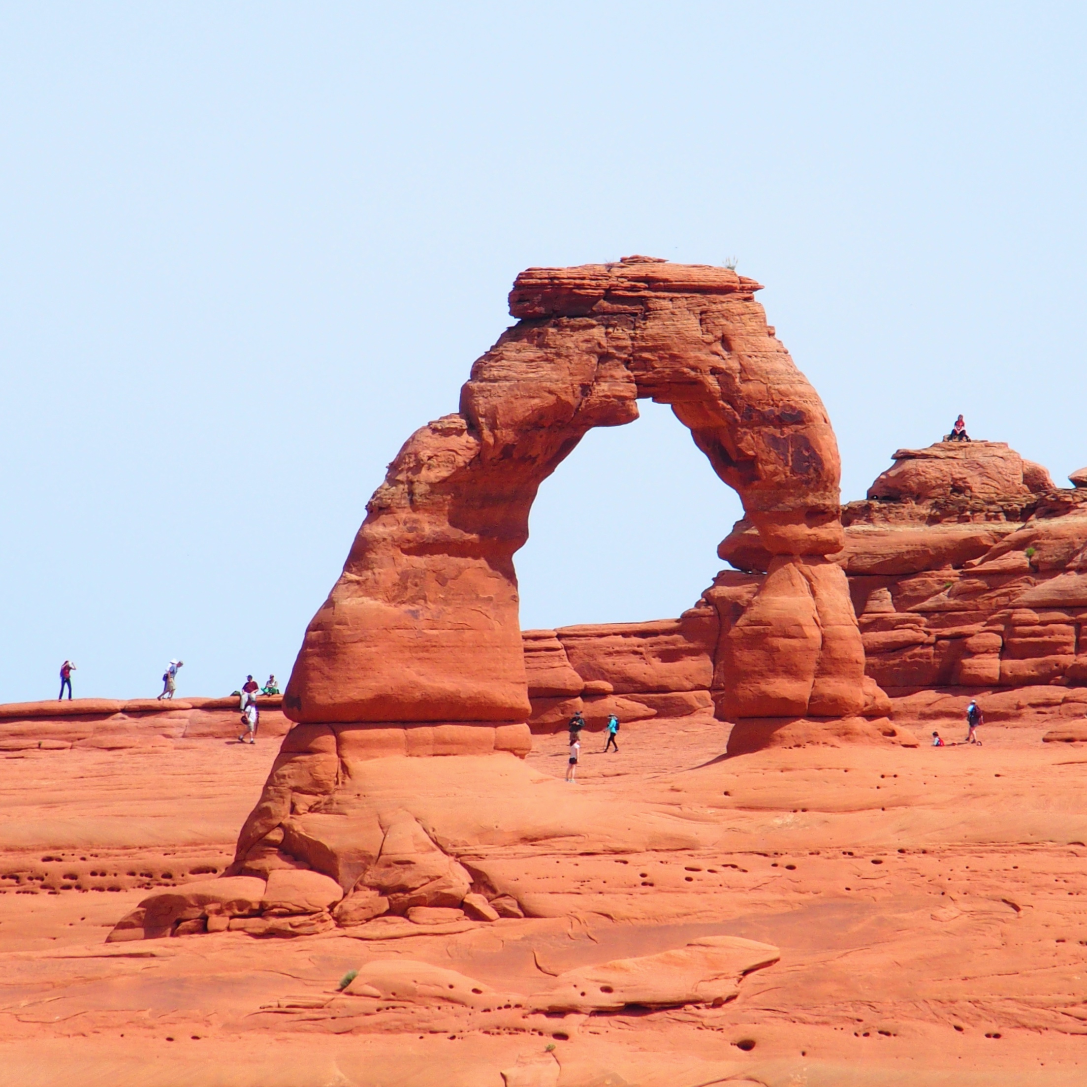
Delicate Arch is actually a very massive rock structure, making the visiting tourists look the size of ants.

In another view from a distance, Delicate Arch (at the very top center) does look delicate compared to the rest of the massive surrounding rock formations.
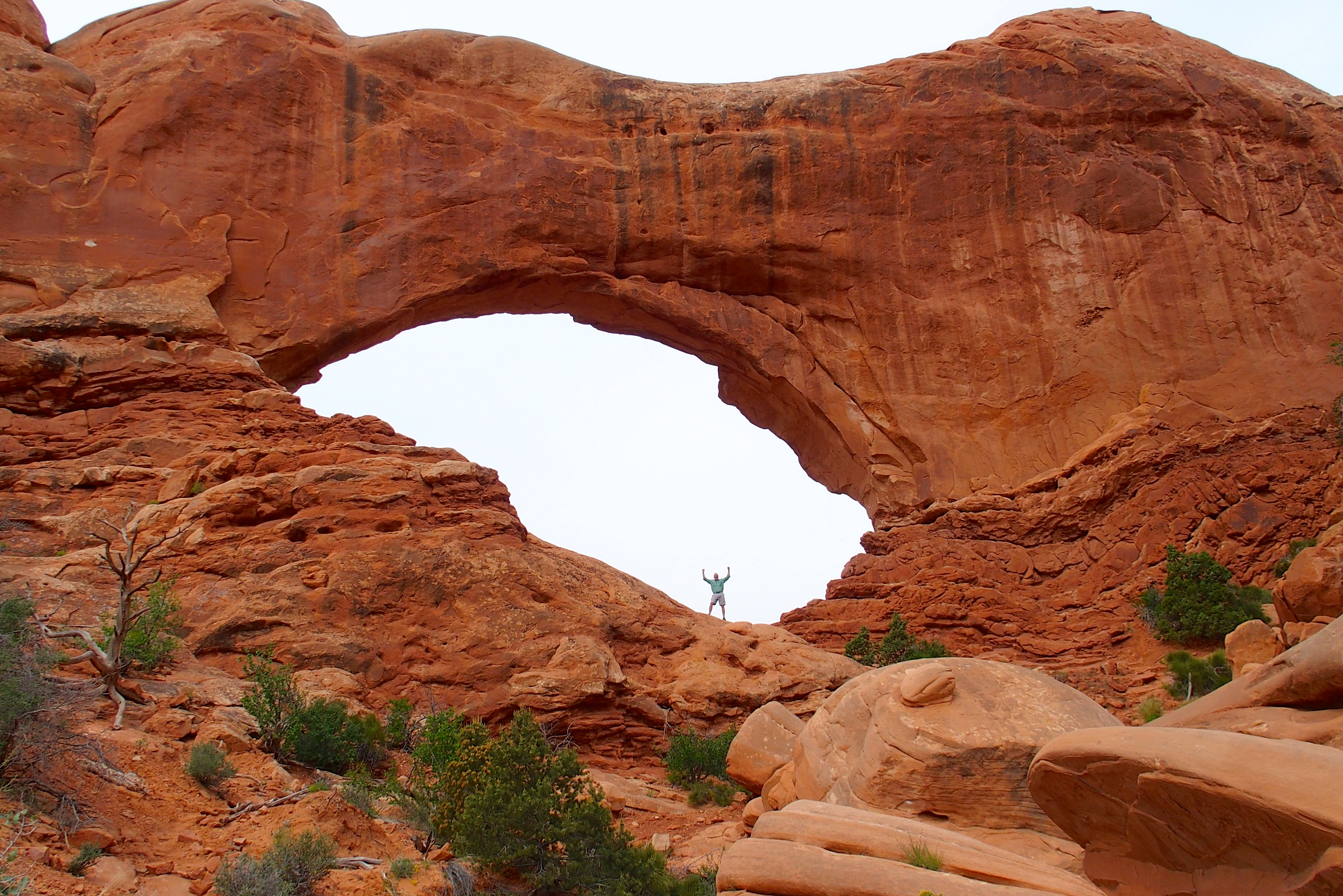
Climbing under these arches is allowed, but not on top.

Double Arch. Maybe this is the inspiration for Ray Kroc’s two golden arches of McDonalds.
Other formations in Arches National Park have names based on what observers saw in their shapes, such as Tower of Babel, Balanced Rock, Three Gossips and Elephant Butte. Identifying these shapes is a bit of a Rorschach test in rock rather than ink.
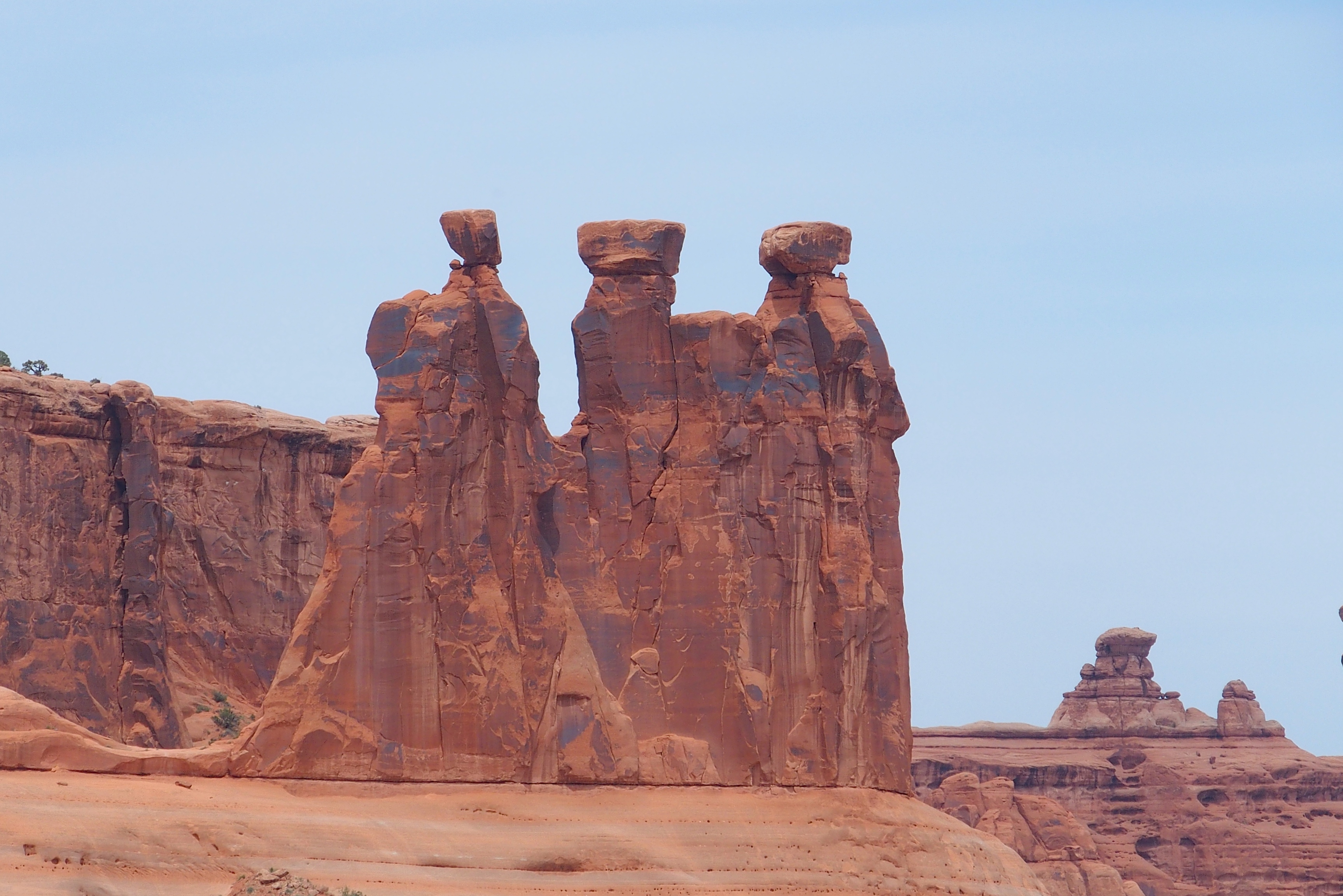
These Three Gossips have been telling their tales for thousands of years.
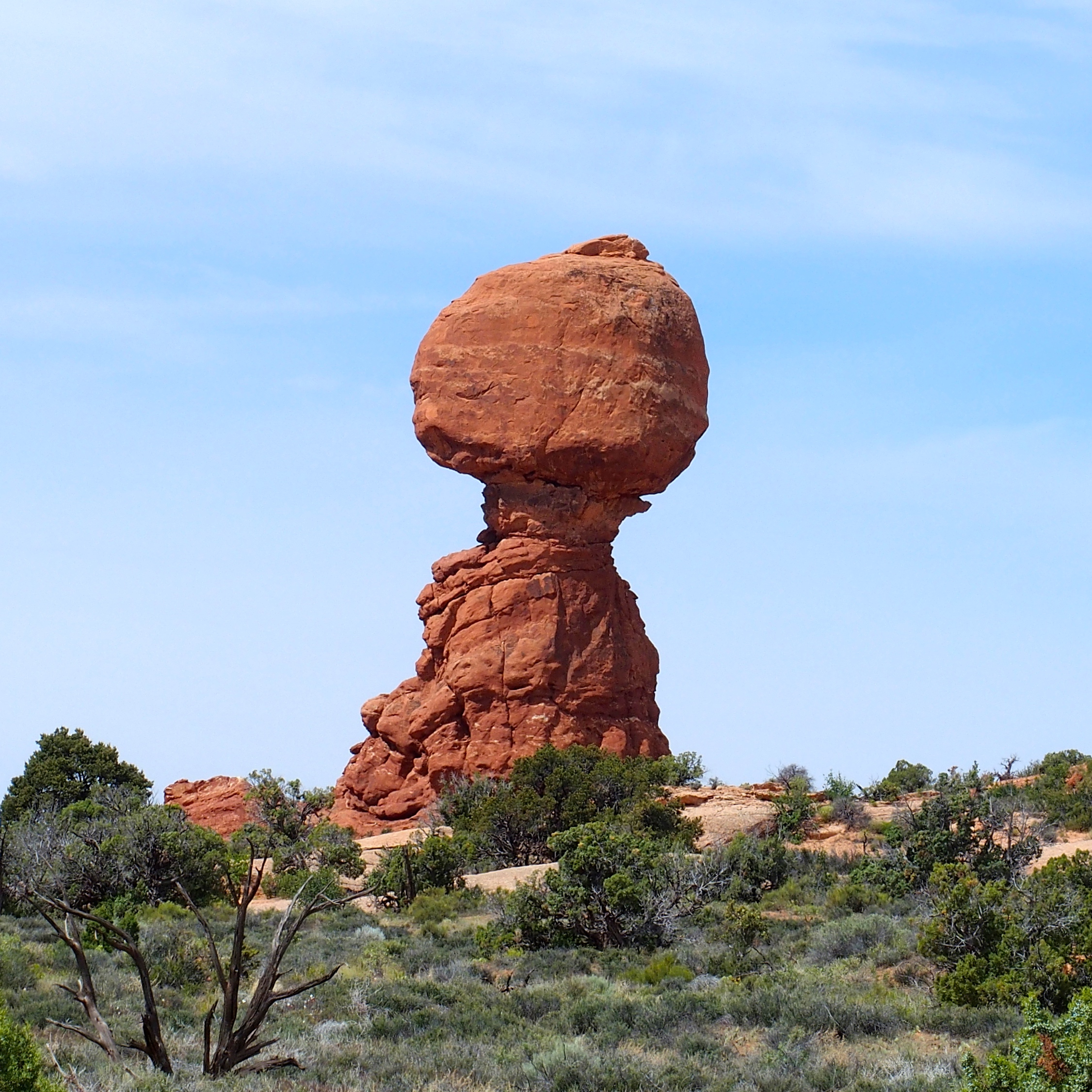
Balanced Rock has been balancing for thousands of years. It seems like one hurricane-force wind might knock it over. (Not likely in Utah)
Bryce Canyon National Park has more white limestone than red sandstone. Both parts of the layered rock are carved away in U-shaped amphitheaters. Here you stand above the erosion rather than below peaks and arches.
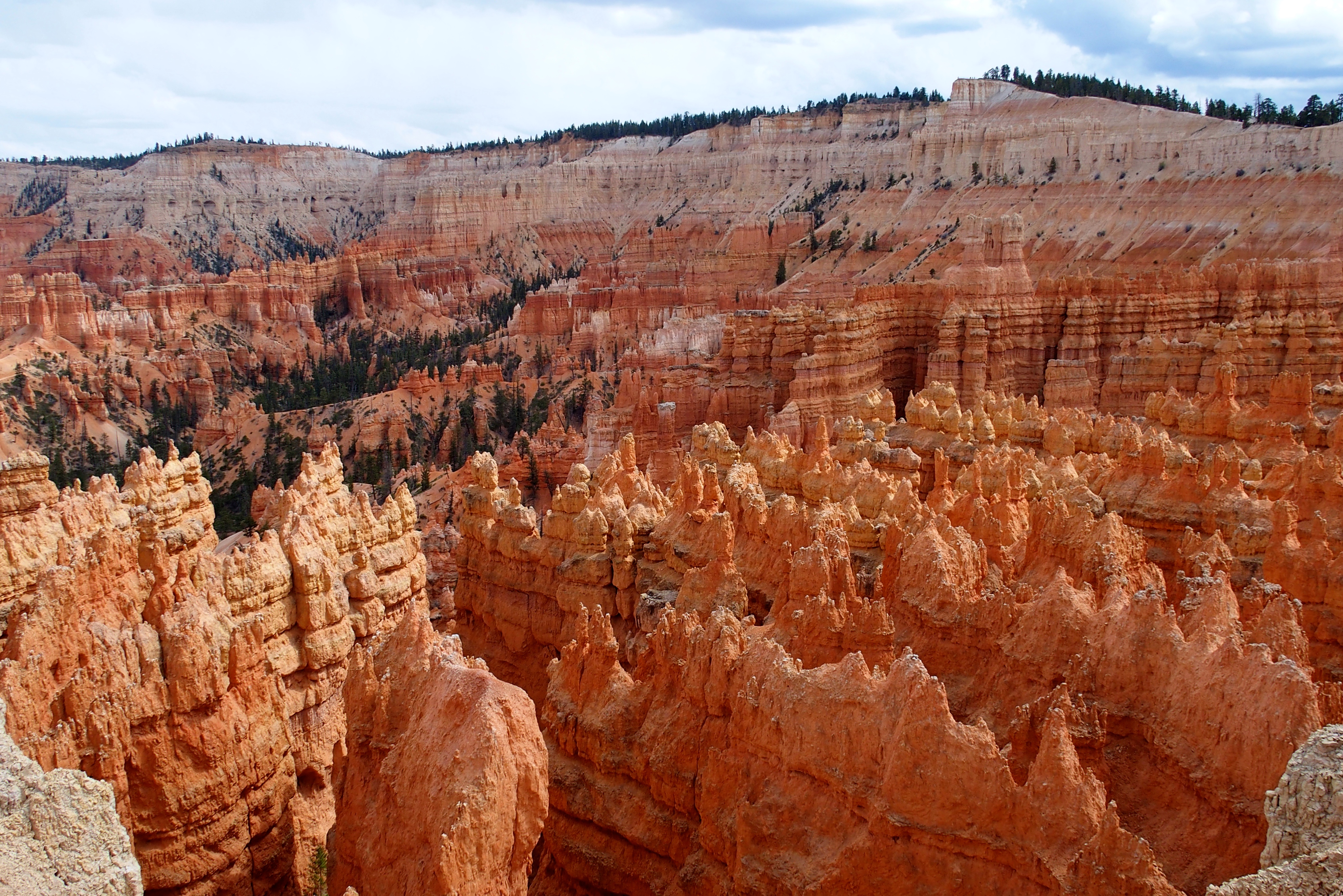
The tall, narrow spires in Bryce’s Canyon are known as hoodoos.
Bryce Canyon’s 15 seconds of family fame: On a long-ago Jardim family trip here, Jesse once saved the life of his brother Jonathan by preventing a fall. That would have been a big drop!
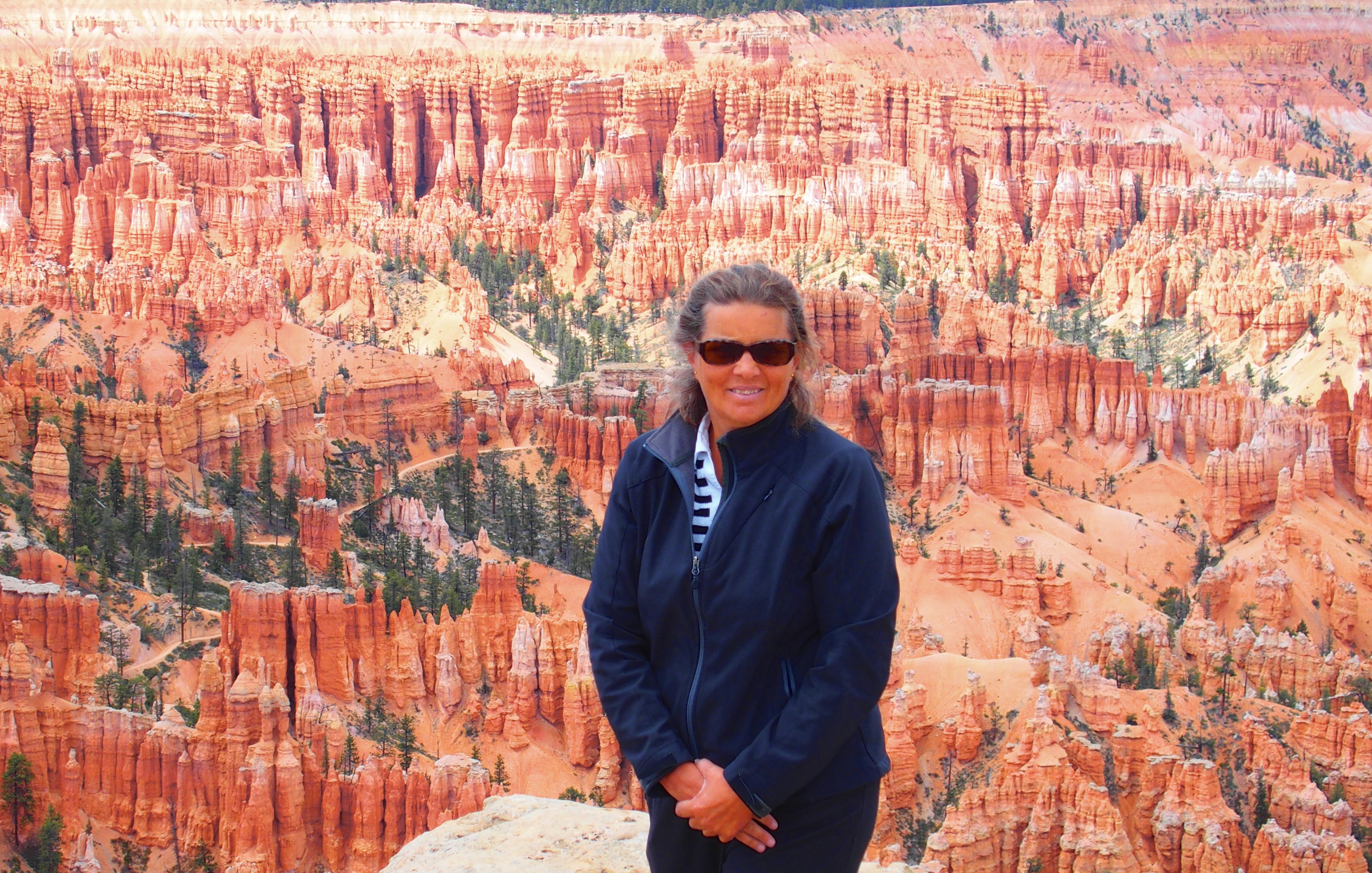
Standing 10 feet from the edge made my knees shake.
This week, driving from Colorado through Utah to Arizona southeast of the parks gave us the opportunity to see more strange formations, a new landscape around every corner. Even outside the national parks, stone arches are fairly common. Near Moab, we saw Wilson Arch before sunset, catching the moon rising beyond the opening.
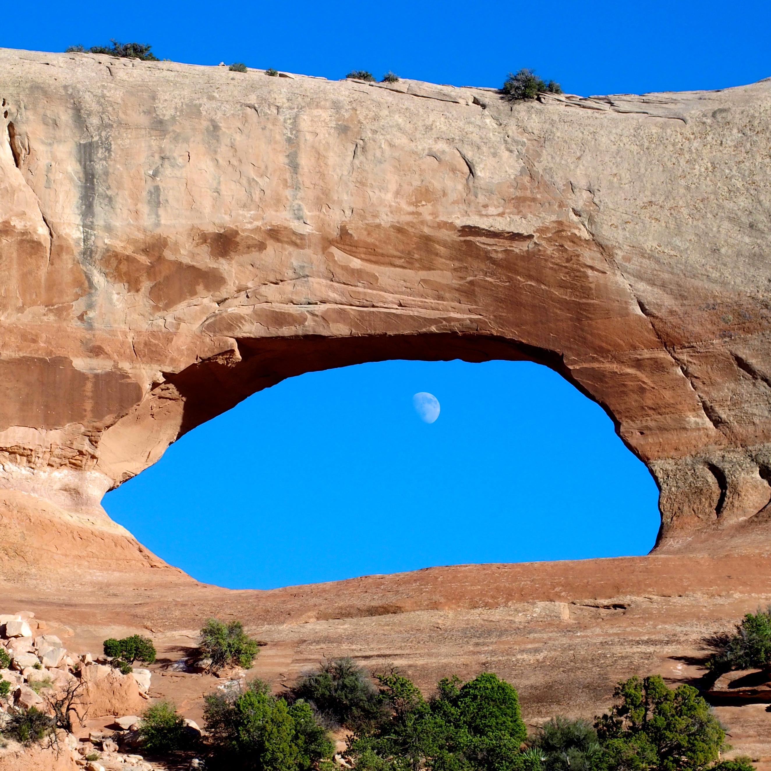
Wilson Arch is right next to the highway. You can see a natural wonder like this for free from the air-conditioned comfort of your car.
We drove on through Monument Valley. This landscape may be familiar from the Forrest Gump film. If you remember, Forrest was the originator of the modern running craze (at least according to Winston Groom. It’s a great book, by the way). Forrest jogged across the country several times in the 1970s. Then one day he just stopped running.
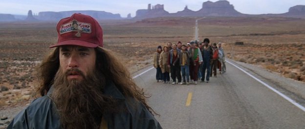
Forrest, no longer running, and his confused followers with the peaks of Monument Valley in the distance.
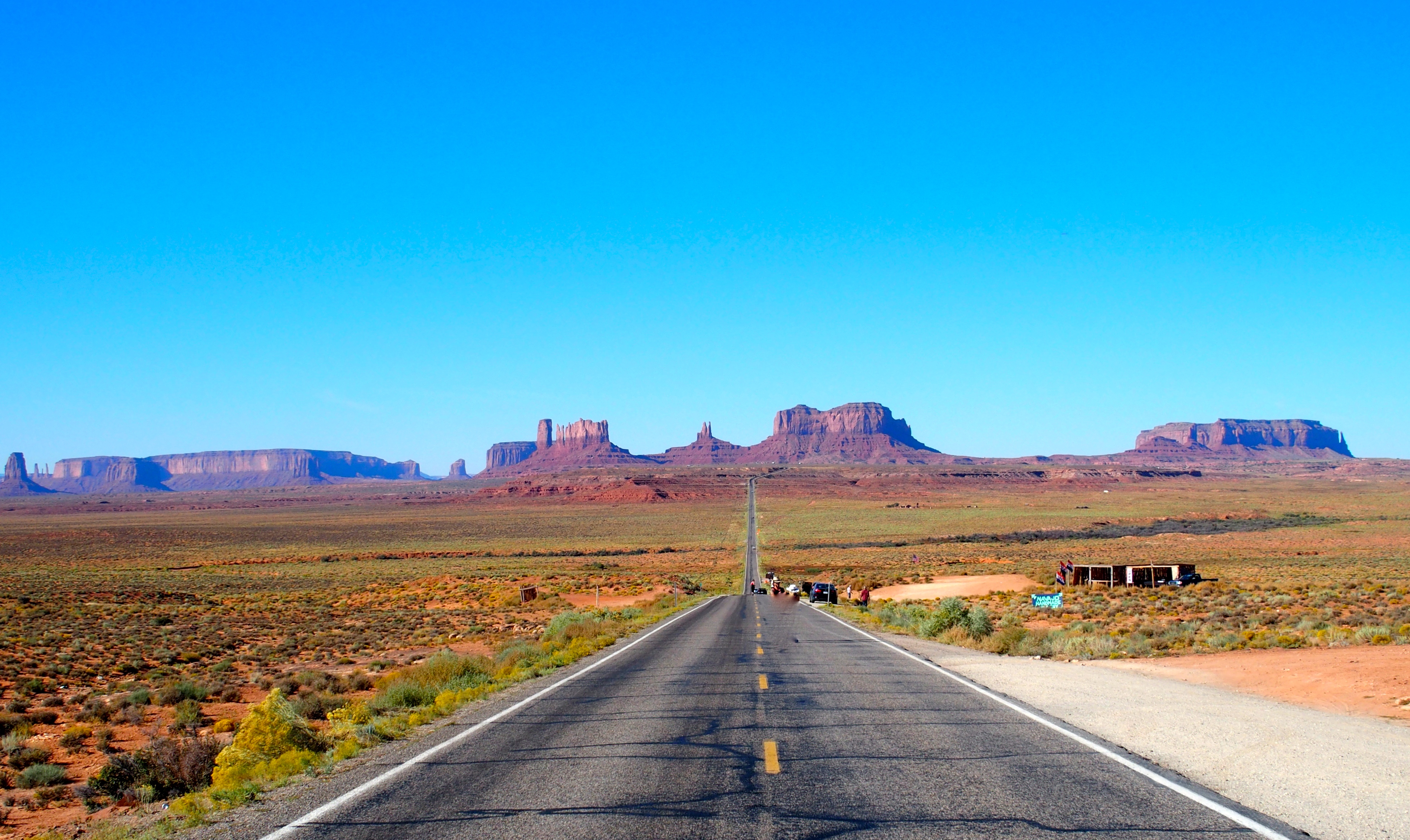
The road is still here and the monuments still stand. The followers have dispersed.
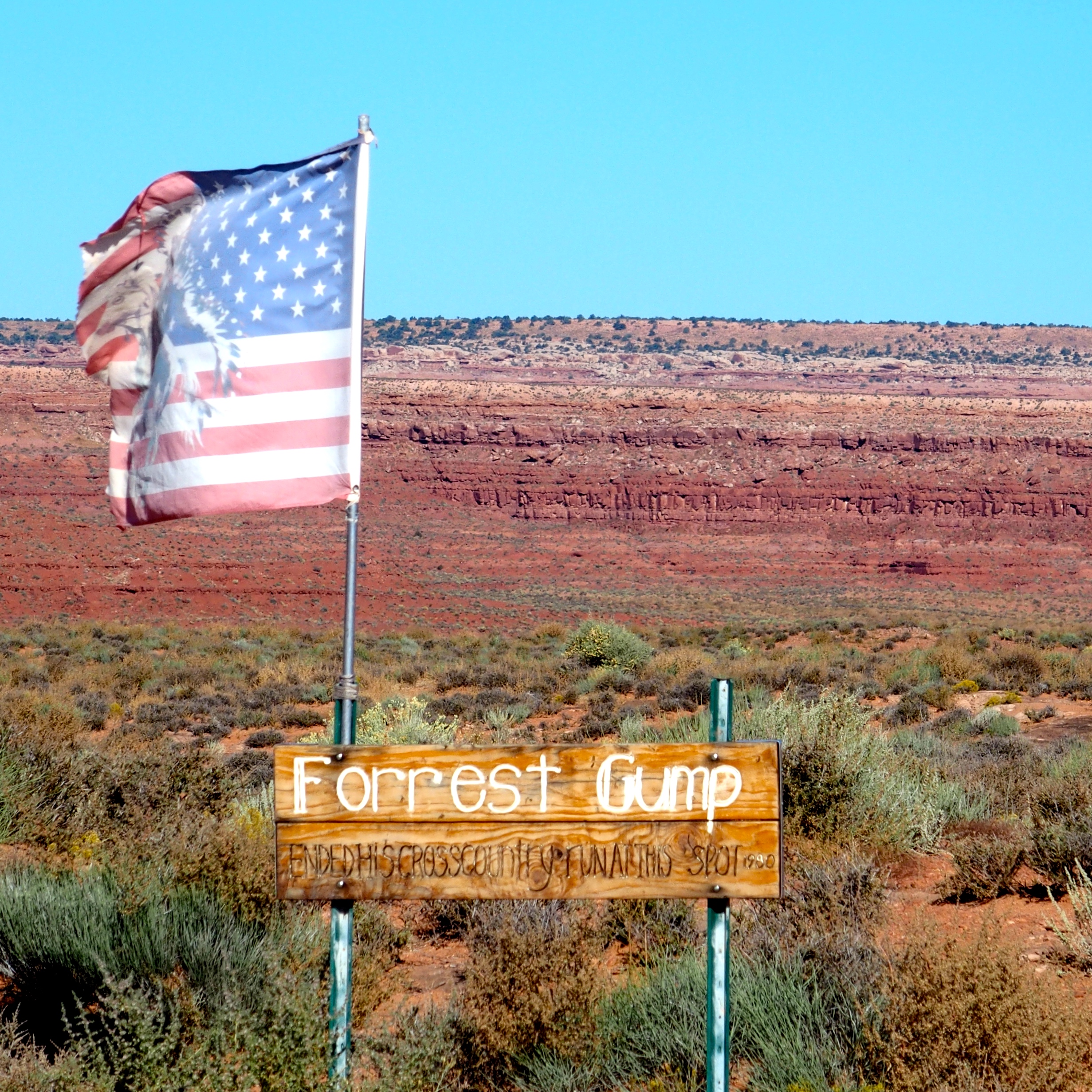
This marker reads “Forrest Gump ended his cross-country run at this spot. 1980”
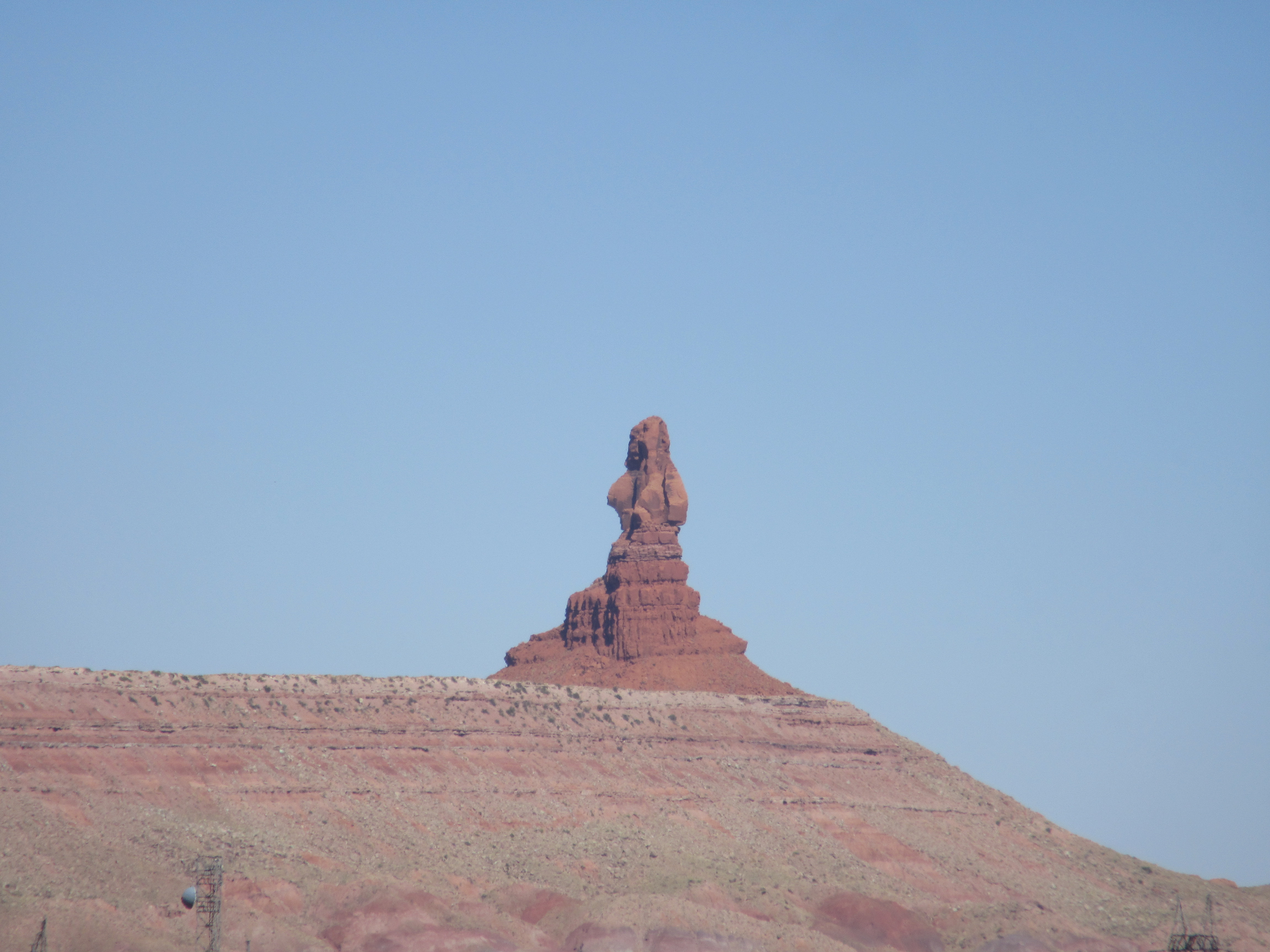
A whole town is named after one formation, Mexican Hat. The lands around this odd formation are like those that showed up in John Wayne westerns, with scrub brush and vultures and no water in sight. It’s easy to imagine a bad guy dressed in black with pistols in his gunbelt riding up on his black horse ready to rob us of our valuables. No gold, silver coins, or bank notes these days, just credit cards, cell phones, cameras, laptops…
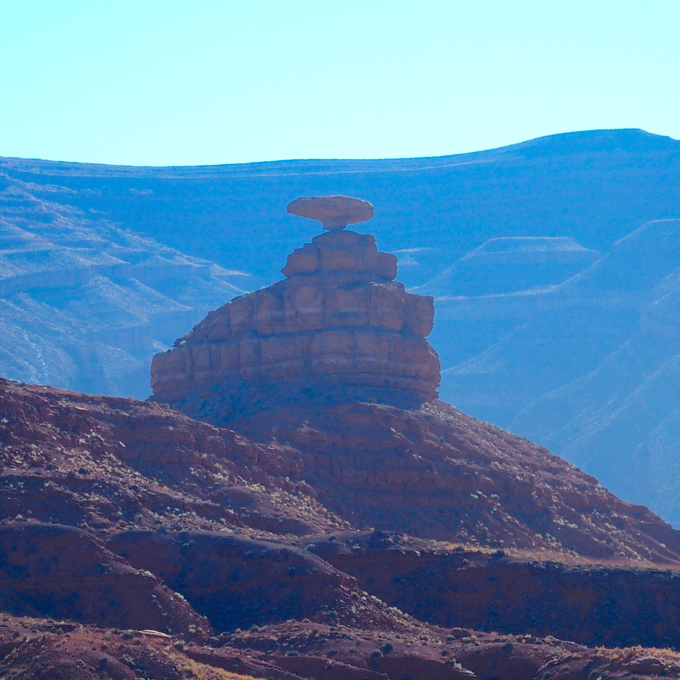
Mexican Hat, another balanced rock.
Elsewhere are buttes, again created by erosion. In this case, it seems that the level of the land has just dropped, leaving tall, often cylindrical pillars hundreds of feet high. This one is Mitchell Butte on the Navajo Nation. You can see a small amount of rock extending around the base, apparently having fallen from the top and sides over many years. But the big question is: Where is all the “stuff” that made up the land that once surrounded the buttes? It’s a lot of missing mountains.
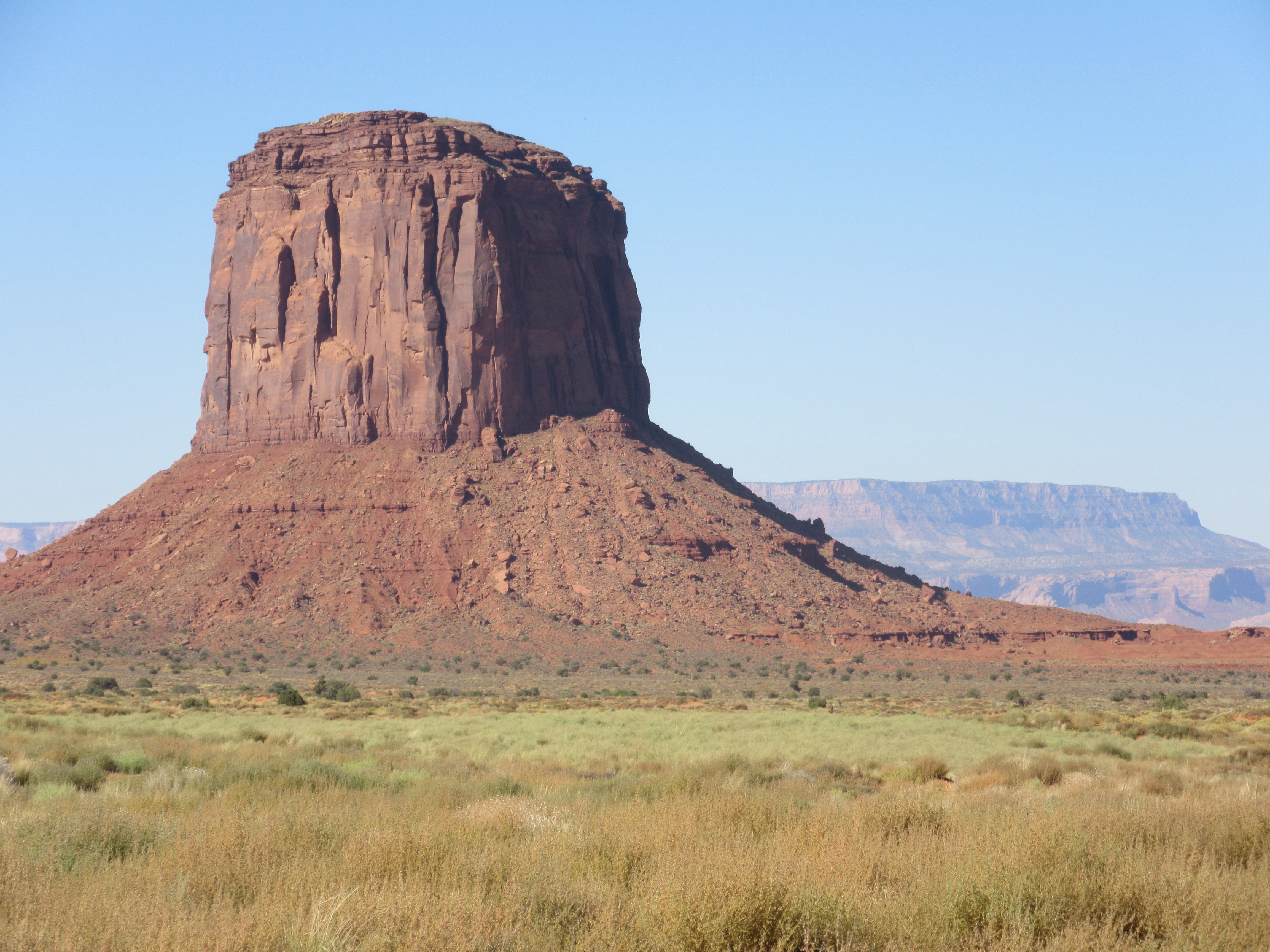
Mitchell Butte. Why does this one giant rock stand hundreds of feet over the rest of the land?
Just beyond Mitchell is Utah’s southwestern border. Almost immediately when we crossed into Arizona, the rocks changed, losing some of the red color, showing more signs of tilt in the sedimentary layers, having more vegetation, and appearing either more smoothed and mounded or sharply pointed.
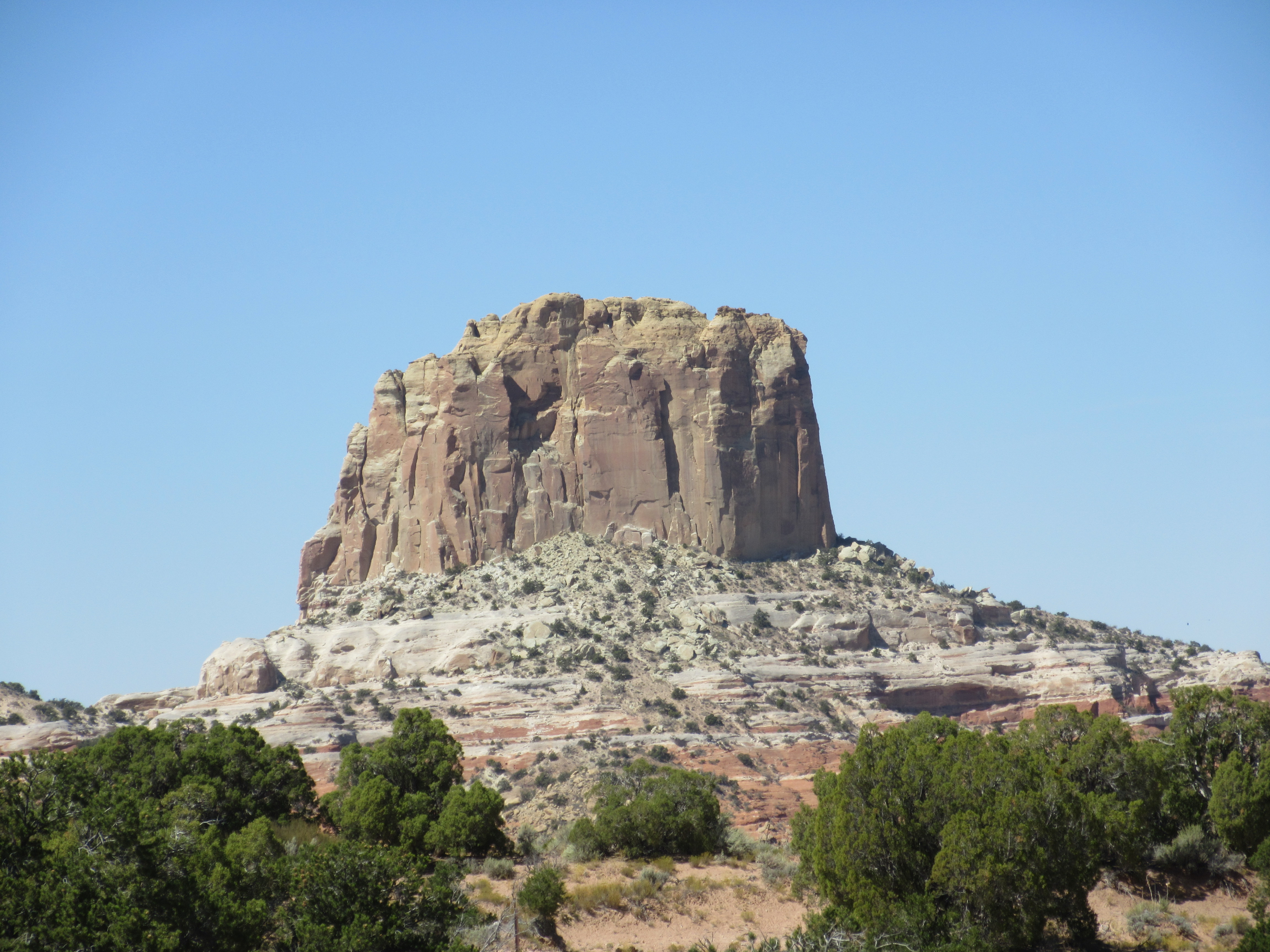
Like Mitchell Butte, but whiter and not as cylindrical. The top is probably about 1,000 feet over the road and there is a canyon below too.
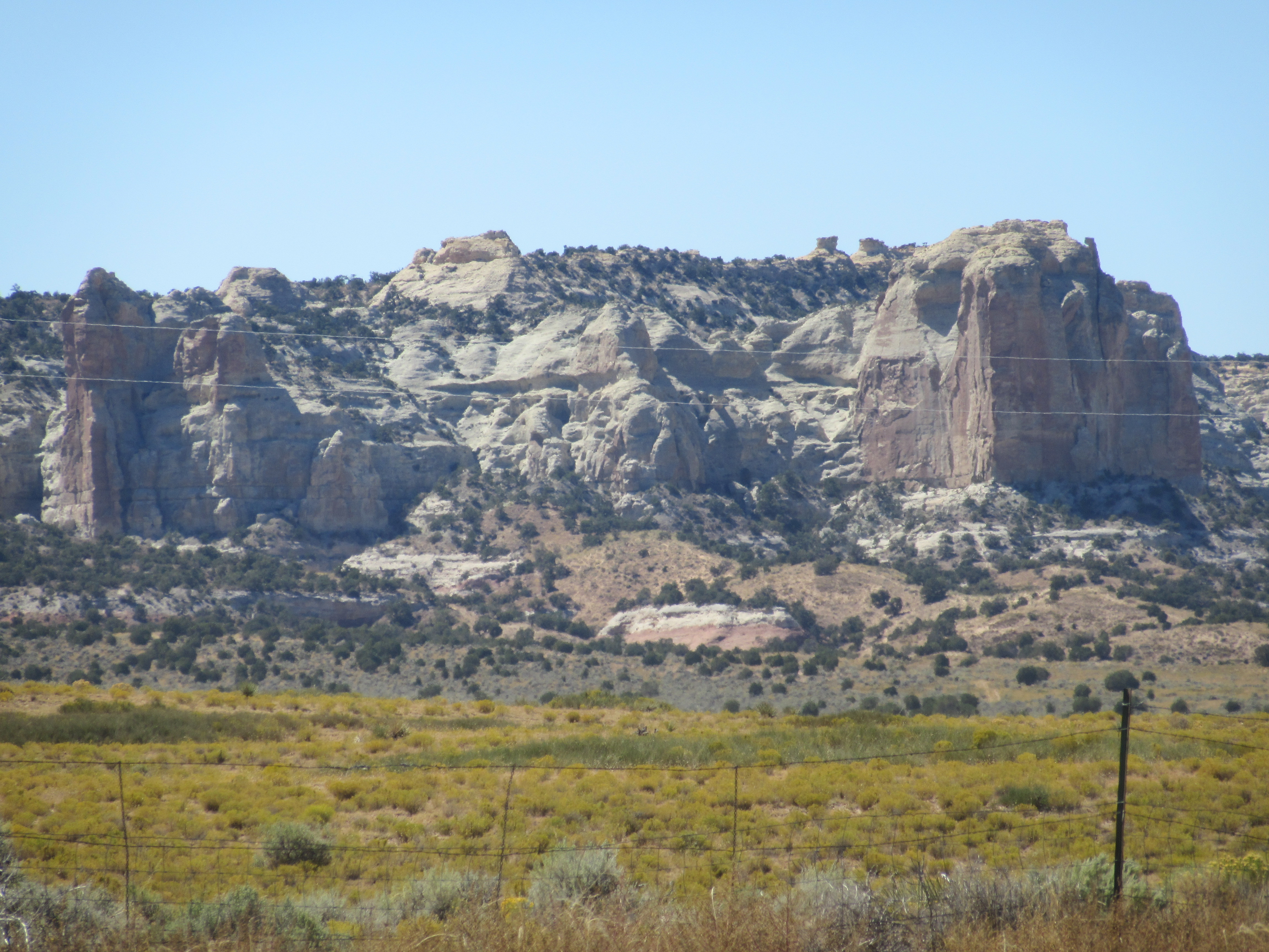
In northern Arizona the sandstone is whiter and not as uniformly eroded.
In fact, the very first Arizonan formation we saw reminded us of a saguaro cactus, the often two-armed “tree” that produces the Arizona state flower.
Not a typical cylindrical butte. See the stubby saguaro arms?
That same formation from a different direction looks like an owl (thinking of Linda)… or a turkey (anticipating Kathy’s Thanksgiving feast!)…or an elephant (remembering a recent conversation with Francene).

Hoot. Hoot. See the very large owl?
One more set of formations reminded us of days on the farm.
They’re like “cow pies” without the odor.
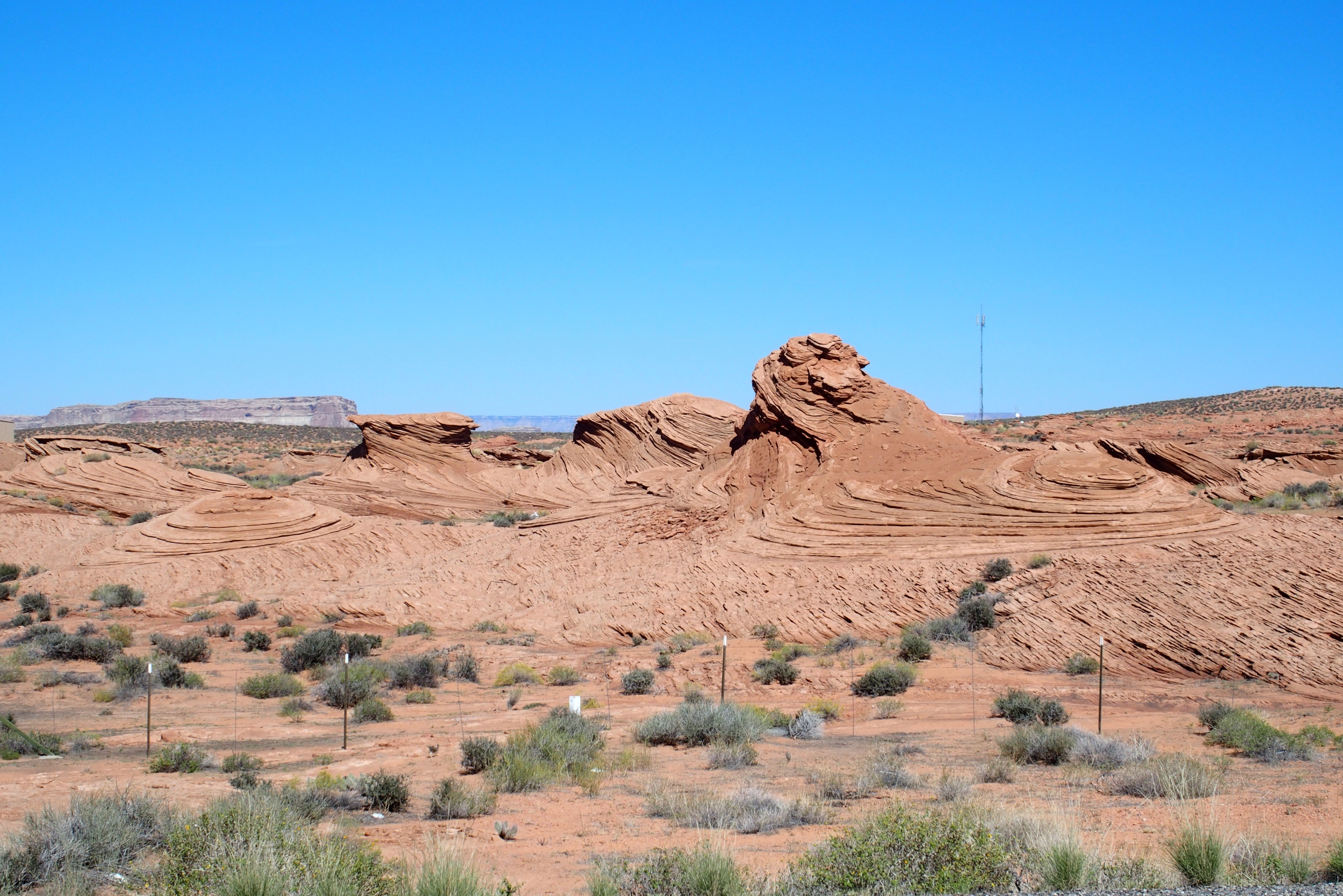
We did find an answer to “Where did all the stuff go?” Across Utah are multiple types of sandstone formations, some that once formed compacted sand dunes and others that were sediment at the bottom of an inland sea as much as a billion years ago. Some of this rock was thrust upward, while other sections remained flat, rather than dramatically tilting like the plates in the Rockies. Then rainwater carved small cracks by dissolving chemicals in the rock and carrying away the softest parts of the sandstone. Water seeped into cracks and broke apart solid rock as it expanded as frost. Wind, blowing viciously and carrying small rock particles, cut into the land like a sandblaster, smoothing surfaces. Over many years, the particles of red dirt blew away or were carried off as silt in the rivers, helping to etch away further depth in the canyons. Much of what was once Utah is probably in the Gulf of California now deposited where the Colorado River once flowed briskly into the sea.
The hard sections of sandstone that remained standing actually became stronger from the weight of the remaining rock creating stress and in a sense compacting the particles. The arches and hoodoos and buttes seem strong and sturdy, for now at least. But by the time our children’s children’s children visit these lands, some of the arches will have fallen and the owl may look like a pussycat.
Utah has the Colorado River too, but that’s a story for another day…
