A year and a half after we originally planned to visit Scandinavia, we have arrived. Well, almost. Our planned trip last April was via a repositioning cruise to the Atlantic coast of Europe, then Netherlands, then Sweden and Norway on our own. But COVID…
Now Norway won’t let us (Americans) in, but Netherlands, Denmark and Sweden are welcoming us with mostly open arms. It helps to have had three COVID vaccinations. So on to our adventures.
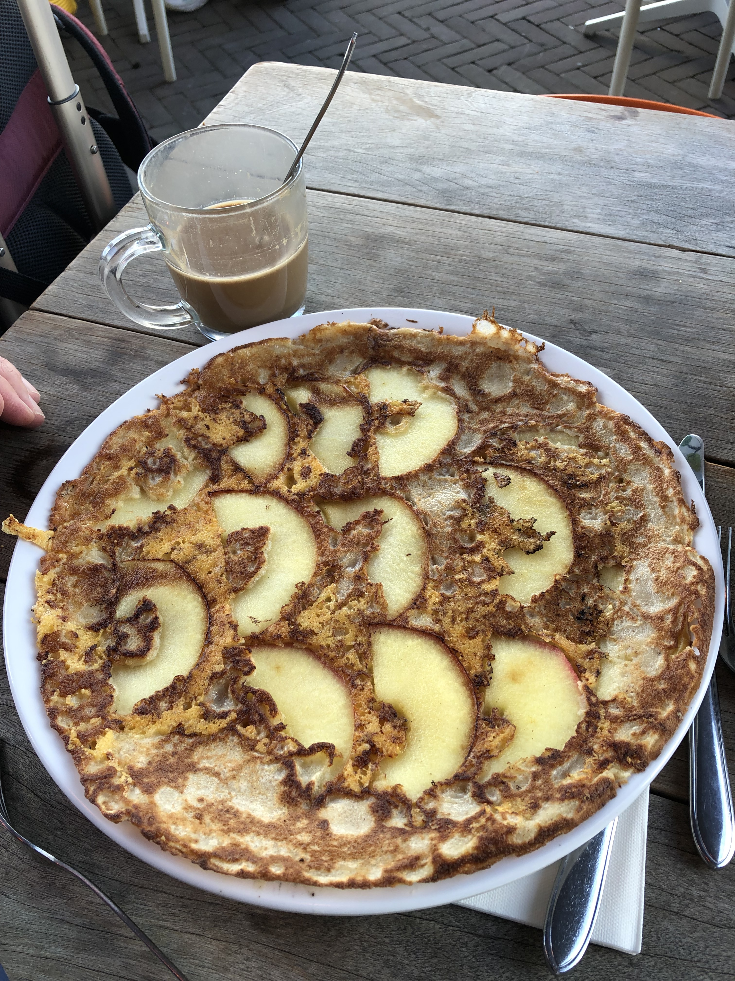
As soon as we got off the plane and train in Amsterdam at 9AM local time, midnight-ish for our bodies, coffee sounded like a great idea. We stopped for a double-caffeine boost and sampled a Dutch pancake. It was really good, a very light crepe, this one with thin-sliced apples and cheese. Other options were not just sweet, but also savory, with ham, pesto, guac, salmon, mushrooms, chili peppers, you name it. We are definitely going to try to recreate on our griddle at home. Maybe we can invent one for the abundant tomatoes and lemons from Kathy’s garden!
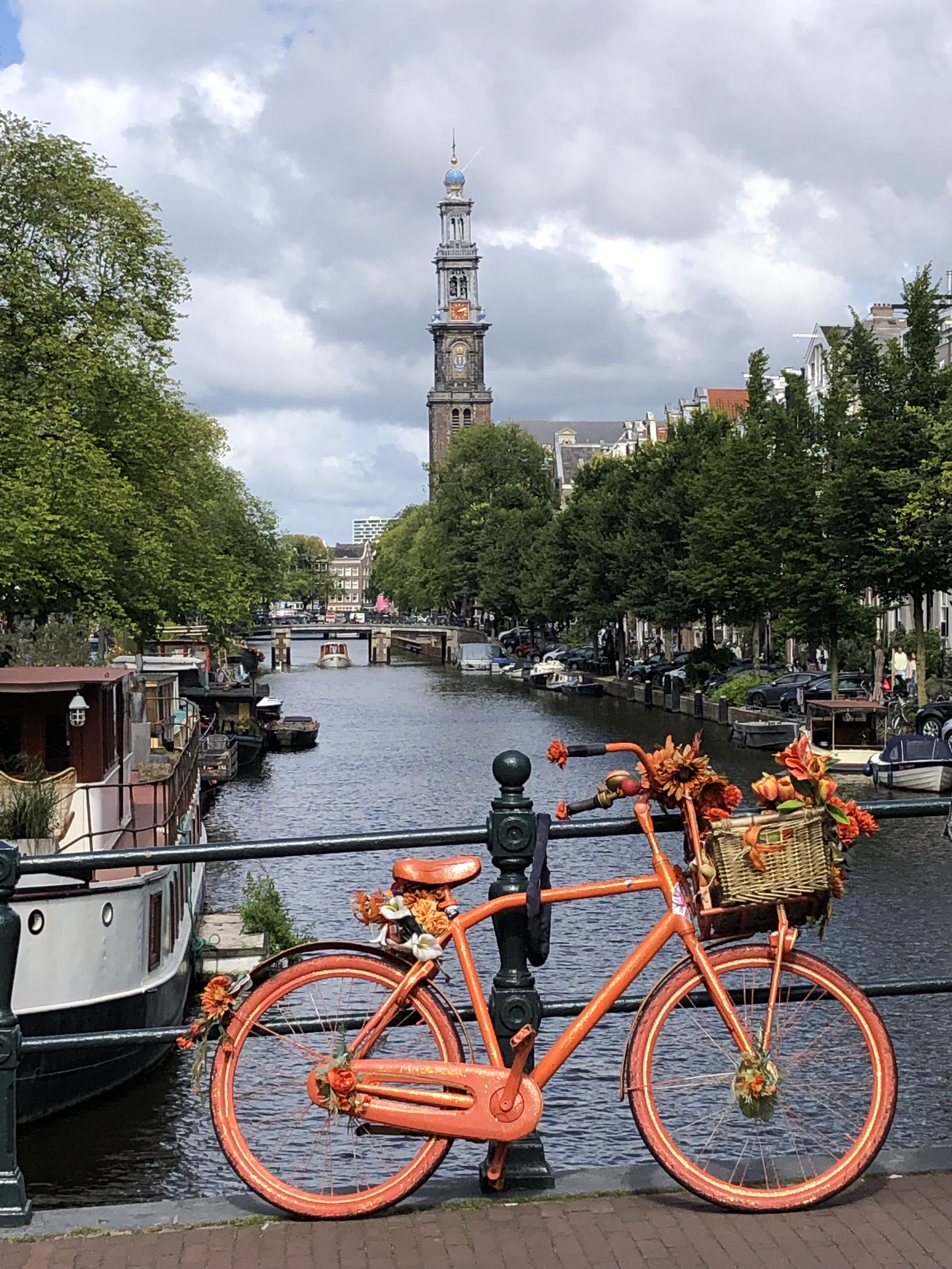
When we could lift our heads to enjoy the views, we found ourselves in the land of canals, bicycles, and flowers. The next image combines all three. The Westerkerk’s tower, with a Rembrandt blue dome, stands above the myriad canals in the Jordaan district, just a few blocks from the Anne Frank house. She heard the church’s bells every day during the two years her family was hidden. If only she could have hopped on a bike to get out of town.
The church’s dome is actually a crown. In 1489, Maximilian I, who would later become emperor, gave Amsterdam the right to use the crown in its coat of arms in return for support the town gave him in his quest for power. In 1578, Amsterdam joined the Prince of Orange and ousted the town’s Roman Catholics, moving to the Reformed religious path. The Westerkerk is now a Lutheran church, quite austere on the inside.
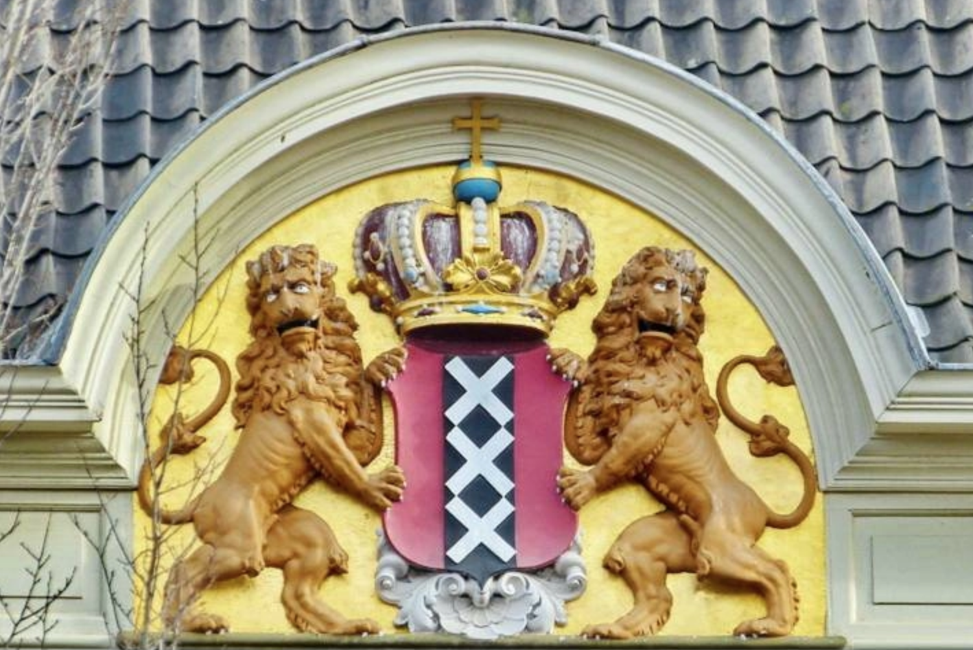
The town coat of arms is everywhere. We’ve explained the crown, but why XXX? First, XXX is not for the famed Red Light District. That would be XXX written horizontally. Instead it is the three Xs in a vertical line. These are St. Andrews’ crosses or saltires. He was one of the apostles and was crucified on a diagonal rather than vertical cross (allowing him to suffer longer). What does that have to do with Amsterdam? It really isn’t known! But the pattern is ubiquitous. Find an Amsterdam t-shirt and you’ll find the triple vertical Xs.
On to the horizontal XXX: Prostitution is legal in De Wallen (the Red Light District). The businesswomen are their own bosses, renting their “offices” (windows bathed in red light and backed by small bedrooms) for 50 to 80 Euros during the day and 100 to 150 Euros in the evening. Theoretically they could make up the cost of the rental in an hour or two because they charge 50 Euros for 15 to 20 minutes. There are between 200 and 400 of these window brothels in three separate areas in the city. (This info is all thanks to Google research, not personal experience.)

When we visited De Wallen, most of the folks on the streets seemed to be tourists like us, enjoying a walk along the canal, not interested in engaging with the ladies. We did observe one gentleman trying to negotiate a deal, but the young lady either didn’t like him or the amount he offered and she sent him away. It’s always good to be your own boss.
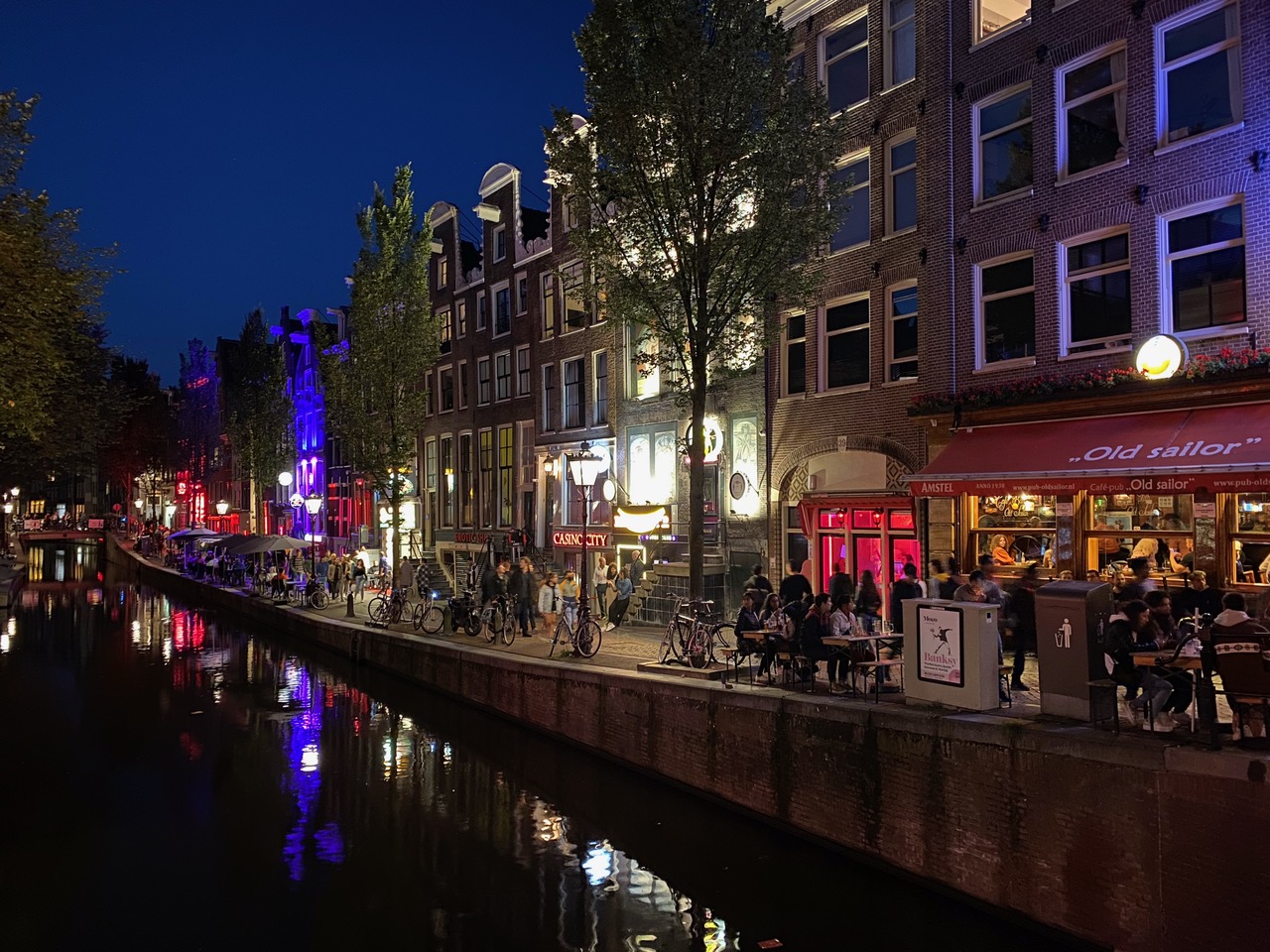
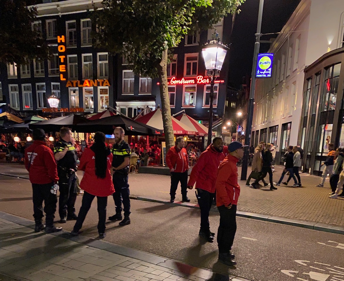
We didn’t see many police in this area even though it was very crowded at times. Instead Amsterdam practices some common sense crowd control. First cars and bikes are not permitted on the streets and pedestrian traffic is one way. The area does not allow drinking outside of bars and restaurants (with a 95 Euro fine if caught), although smoking pot is quite prevalent. Most conspicuous are the red-jacketed ambassadors. These men and women are here to HELP tourists with directions, rules and advice so they don’t get into any trouble in the area. It seems to work.
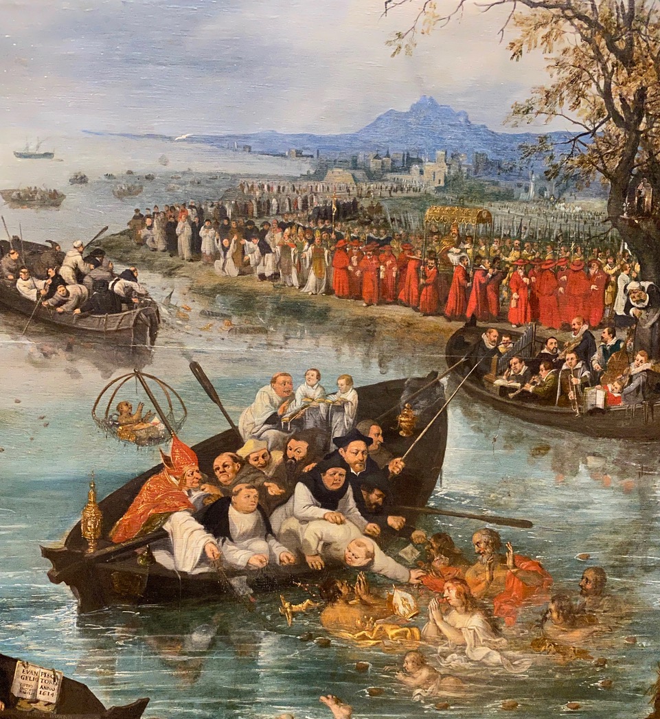
The Netherlands is the home of many of the Dutch masters painters and the Rijksmuseum is the place to go to see their artworks. Among the most famous is Rembrandt’s “Night Watch,” currently undergoing a massive restoration. We were intrigued by “Fishing for Souls,” painted by Adriaen Pietersz van de Venne in 1614, not long after the Catholics got kicked out of town. This interesting painting depicts the conflict between the Protestants and the Catholics. The Protestants, in black on the left, are far more successful in rescuing souls than the less organized Catholics on the right. They seem to know how to keep the boat from sinking, while the Pope-captained boat on the right appears to be floundering. Lots of other artistic allegory going on here such as the brighter light and the trees in leaf on the left (Protestant) side. Even the facial expressions are more clear. We could have used Paul’s help to understand many of the artworks in this museum.

Take a closer look at the pope.
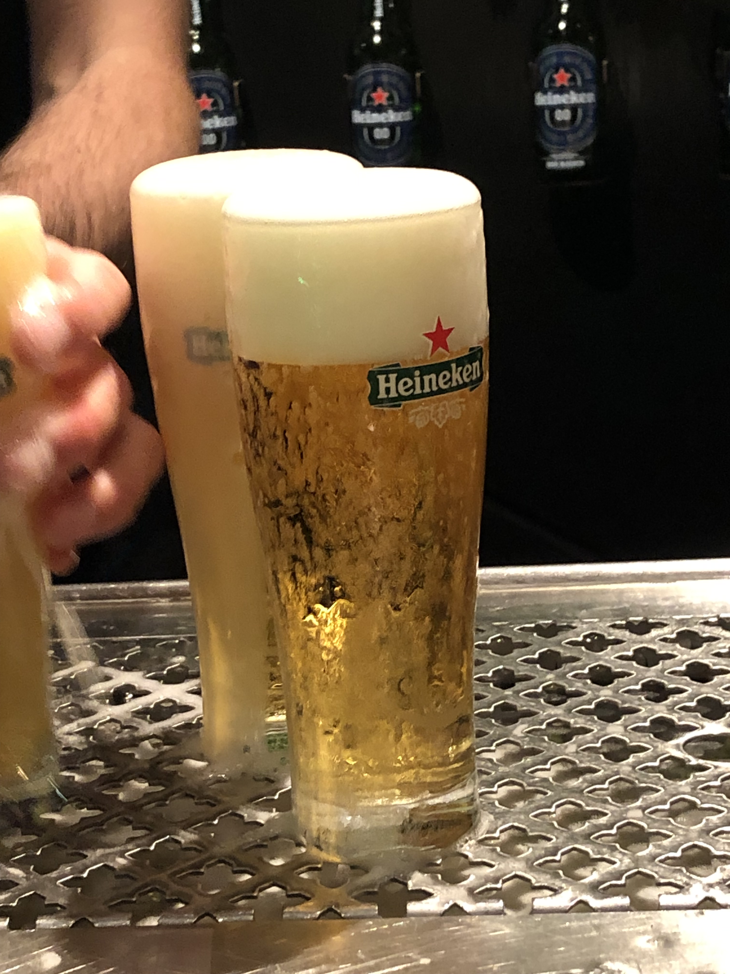
When in Amsterdam, visitors must drink Heineken, the beer first made here in 1864. We stopped at the Heineken Experience in one of the original breweries, unused now since 1988. A key learning was that the beer should be poured so the bottom of the foam lies at the “arms of the star” on a Heineken glass, preventing the bubbles from escaping from the beer and keeping the taste fresher. Be sure to try that at home.
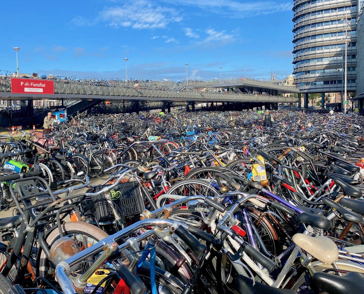
While the orange bike festooned with plastic blooms in the earlier photo appears to be for decoration only, its brethren are everywhere in the neighborhood, so much so that we’re more likely to be hit by a bicycle than a car.
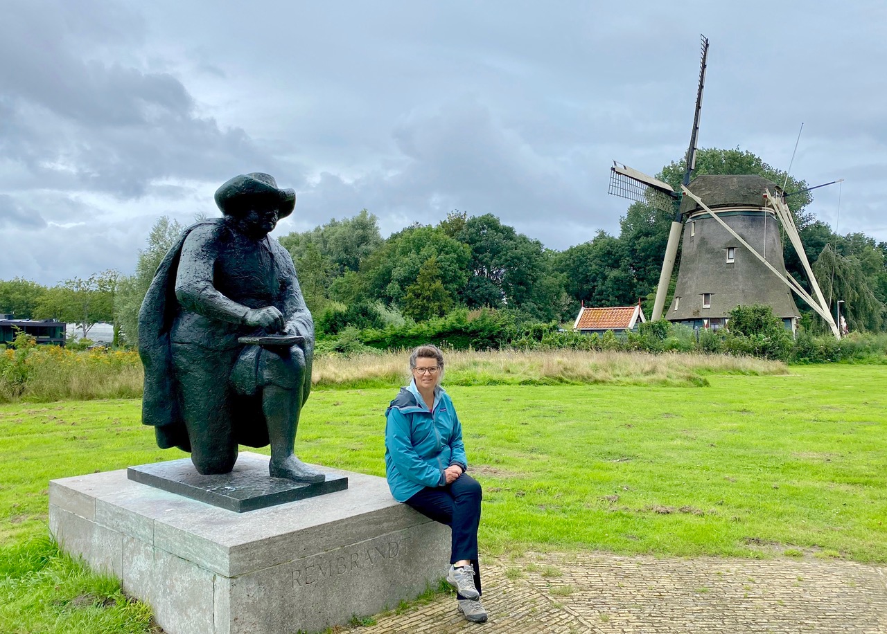
We rented our own bikes to join the locals. Fortunately it was on an overcast Sunday when the bike paths were less crowded. We did some of the Rondehoep, Amsterdam’s most popular Strava route. Apparently Rembrandt sketched up and down this portion of the path along the Amstel River. Two historic windmills are now private homes.
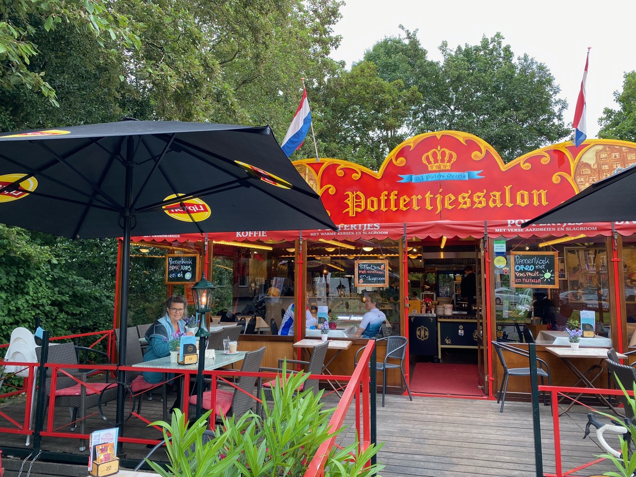
When impending rain made us look for shelter, we found this delightful pancake house, which serves pannenkoek (a large pancake) and poffertjes (little pancakes). After a great meal, we found out it was a cash-only restaurant and we had no Euros or debit cards with us. Fortunately the proprietor rescued us, taking our USD (not the norm) or we’d have been washing pancake plates for a long time. The Pieters-Geeris family sold their food at fairs for decades and opened this seasonal house of pancakes in Ouderkerk in 2013.
So we’re ending our trip to Amsterdam the way we started, with pancakes.